Download

1 / 15
150 likes | 340 Vues
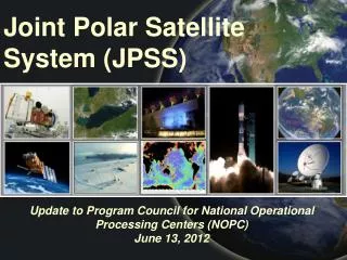
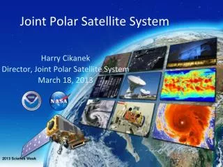
Status of Polar Satellite Systems and NWS Satellite Initiatives. Briefing Outline. Joint Polar Satellite System (NOAA, NASA) Overview Defense Weather Satellite System (DoD) Overview Polar Satellite Continuity NPP Products Polar Data into Operations Initiatives. JPSS Overview.

E N D
Status of Polar Satellite Systems and NWS Satellite Initiatives
Briefing Outline • Joint Polar Satellite System (NOAA, NASA) Overview • Defense Weather Satellite System (DoD) Overview • Polar Satellite Continuity • NPP Products • Polar Data into Operations Initiatives
JPSS Overview JPSS operates in 13:30 (LTAN) orbital plane only Period of development/operations: through FY 2026 Launch Readiness Dates: FY 2014 and FY 2018 (TBC) Maximum data latency of 80 minutes for JPSS-1; and 30 minutes for JPSS-2 International partners provide some space segment components and/or data AMSR data will be provided by JAXA Depends on EUMETSAT providing mid-morning data under current and future agreements Sensitive – For Official Use Only
JPSS Overview Maintain most NPOESS PM observations – VIIRS, ATMS, CrIS, OMPS (Nadir) Replace MIS option with JAXA GCOM Advanced Microwave Sounder (AMSR) data Accommodate sensors from NOAA Climate Sensor Program – TSIS, CERES/ERBS, OMPS Limb Accommodate internationally provided SARSAT, A-DCS Use SEM-N data from DWSS (AM orbit) Continue to depend on EUMETSAT for mid-morning orbit through current and future segment components and/or data Sensitive – For Official Use Only
JPSS Progress To ensure lowest risk of observational gap, first JPSS satellite (JPSS-1) will use NPP clone bus with launch readiness in 2014 Options for second JPSS satellite (JPSS-2), with launch readiness date in 2018, in work with NASA and DoD Due to JPSS-1 (NPP Clone) bus limitations, NOAA is seeking alternate platform, free flyer/rideshare for TSIS, SARSAT and A-DCS NOAA-managed shared ground system being coordinated with DoD to meet both JPSS and DWSS operations, data processing and data latency needs Program will be subject to independent review prior to program baseline Sensitive – For Official Use Only
DMSP Overview • 22 Jun 2010 Acquisition Decision Memo • Immediately begin acquisition efforts to support a 2018 launch for a DMSP successor • Develop a sensor suite consisting of VIIRS, SEM-N, and (TBD) microwave sensing capability for DMSP successor • Transition the NPOESS sensors/elements needed to support JPSS program NLT 31 Dec 2010 • Implement above actions to maximize use of Govt’s investment in NPOESS, and in a manner that offers max opportunities for collaboration w/ JPSS • ADM directed AF to conduct 45-day study and brief DAB early August (costs/schedule/sensor suite) Pre-Decisional/FOUO
GCOM-W1 thru W3 8 2 September 2010 Annual Management Review: FY11 8
JPSS/DWSS Satellite InstrumentsChanges in Red * Seeking free flyer/ride share for JPSS-1 time frame ** May not be same MIS as NPOESS – decision by 10 Aug Sensitive – For Official Use Only
Polar-Orbiting Sensor Continuity AQUA (MODIS) DWSS C2 (AM) NPP NOAA 18 (AVHRR) JPSS-1 NOAA 19 (AVHRR) JPSS-2 AQUA (AIRS/AMSU-A) NPP NOAA 17 (HIRS) JPSS-1 NOAA 18 (AMSU-A) JPSS-2 NOAA 19 (HIRS/AMSU-A) NOAA 17 (SBUV) NPP (nadir and limb) AURA (OMI) JPSS-1 (nadir) NOAA 18 (SBUV) JPSS-2 (nadir) NOAA 19 (SBUV) NPP TERRA (AM) JPSS -1 AQUA JPSS -2 SORCE JPSS Free Flyer GLORY (TIM) JPSS Free Flyer NOAA 16 (SEM) NOAA 17 (SEM) METOP-B NOAA 18 (SEM) DWSS C2 (AM) METOP-A NOAA 19 (SEM) NOAA 17 METOP-B NOAA 18 JPSS Free Flyer METOP-A NOAA 19 JPSS Free Flyer NOAA 16 NOAA 17 METOP-B NOAA 18 JPSS Free Flyer METOP-A NOAA 19 JPSS Free Flyer Key Currently on-orbit JPSS 140 min 28 min 65 min Other planned 10 MIS - DWSS C2 (AM)
NPP Products NPP contractor delivered xDRs Operational: 6 - 18 months after NPP launch JPSS program office controls when xDRs are declared operational Early access to key NOAA user: 1-18 months after NPP launch
NPP Products (Continued) NOAA Unique Products (NUPs): currently in research to operations Operational: 6 - 18 months after launch of NPP Early access to key NOAA users 36+ Products
NPP Products (Continued) FY11 NOAA Unique Products (NUPs) new starts under consideration 8+ Products
Polar Data into Operations Initiatives • NPOESS Data Exploitation team is meeting with AWIPS reps to determine what is needed for effective NPP interface • Product Distribution and Access (PDA) IPT is dealing with polar and geo data • IT Infrastructure Working Group has polar data on its scope • NWS MOBI Branch to focus on ways to blend satellite data with data from other sensors – focus on NWS Strategic Goals • Bonnie Reed is working with JPSS Program on polar-orbiting proving ground initiative • NWS OCWWS is working to ensure training modules are in place
Conclusions • NWS is working with JPSS, DWSS, and MetOp to prepare for operational implementation of future capabilities • NWS has solid initiatives to effectively implement the NWS Strategic Vision • Every NWS organization has a vested interest in participating in this effort • Your input and support is critical