Download
1 / 46
460 likes | 724 Vues
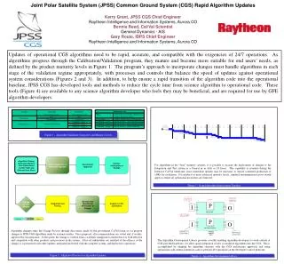
Joint Polar Satellite System (JPSS). Update to Program Council for National Operational Processing Centers (NOPC) June 13, 2012. Outline. Introduction System Description Space Segment Ground Segment Status Requirements Update Data Distribution to DoD Challenges and Way Ahead.

E N D
Joint Polar Satellite System (JPSS) Update to Program Council for National Operational Processing Centers (NOPC) June 13, 2012
Outline • Introduction • System Description • Space Segment • Ground Segment • Status • Requirements Update • Data Distribution to DoD • Challenges and Way Ahead Joint Polar Satellite System
Introduction METOP DMSP DoD Follow-on NPP / JPSS-1/JPSS-2 JAXA GCOM-W Local Equatorial Crossing Time • JPSS Implements: • U.S. civil commitments • Interagency and international agreements • Part of a three-orbit constellation providing global coverage for observations from a low-Earth orbit • GCOM-W from JAXA provides observations to meet Level-1 requirements Joint Polar Satellite System
Introduction • President’s BY2013 Budget Request • Utilize appropriate standards and best practices for cost estimation • Check estimates with parametrics, analogies etc. • Matched Department and NOAA priorities to maintain continuity of weather observations; meet profile and Life-Cycle Cost (LCC) constraints; and meet other NOAA mission needs Joint Polar Satellite System
Introduction End of Program GCOM W-2/3 GCOM W-1 AQUA Launch Date POL 70% NASA L1 - Checkout / Calibration / Validation NPP Potential Gap JPSS-1 (2QFY2017) JPSS-2 (NET 1QFY2022) JPSS-2 LRD 1QFY2022 SORCE TCTE JPSS-2 Budgeted for Launch Readiness Date (through FY28) Free Flyer-1 (4QFY2016) Currently collects TSI data Free Flyer-2 (3QFY2021) NOAA 19 A-DCS and SARSAT (User Services) are manifested MetOp-A A-DCS (User Services) is manifested MetOp-B MetOp-C Joint Polar Satellite System
Outline • Introduction • System Description • Space Segment • Ground Segment • Status • Requirements Update • Data Distribution to DoD • Challenges and Way Ahead Joint Polar Satellite System
System Description Joint Polar Satellite System
System Description Joint Polar Satellite System
System Description(Space Segment) • JPSS space segment comprises two satellites (JPSS-1/2) and Free-Flyers • JPSS-1 similar to NPP satellite - Differences are: a) Increased mission assurance requirements, b) Increase lifetime to seven years, and c) Addition of Ka-band uplink (through TDRSS) and downlink (and L-band downlink on JPSS-2) • Instrument suite for JPSS-1 will include: • Advanced Technology Microwave Sounder (ATMS) • Cross-track Infrared Sounder (CrIS) • Visible/Infrared Imager Radiometer Suite (VIIRS) • Ozone Mapping and Profiler Suite (OMPS) • Cloud and Earth Radiant Energy Suite (CERES) • Free-flyer spacecraft will accommodate: • Total Solar Irradiance Sensor (TSIS), Advanced Data Collection System (A-DCS) and Search and Rescue (SARSAT) instruments Joint Polar Satellite System
System Description(Ground System) • JPSS Ground System comprises: • Command, Control and Communications Segment (C3S) • Includes mission planning, enterprise management, antenna resource scheduling, satellite operations, data relay and spacecraft and instrument engineering • Interface Data Processing Segment (IDPS) • Processing at one NOAA and one DoD sites • Transformation of raw data streams into Environmental Data Records (EDRs) • Provision of data to all DoD operational centers • Field Terminal Segment (FTS) • Local processing of direct broadcast data into EDRs Joint Polar Satellite System
System Description(Ground System) • Dedicated Ground Station assets • Svalbard 13-m S-band transmit; X-,S-,L-Band receive antenna • Svalbard (2) 4-m Ka-Band receive antennas (future) • McMurdo (2) 4-m Ka-, S-Band receive antennas • Fairbanks 4-m Ka-Band receive antenna (future) • Shared Ground System assets • Fairbanks 13-m S-Band transmit; X-, S-Band receive antenna • McMurdo 11-m S-Band transmit; X-, S-Band receive antenna (Metop) • Troll 7-m S-Band transmit; Ka-, X-, S-Band receive antenna (future) • Svalbard 3-m X-Band HRD antenna (future) • Space Network White Sands Complex Joint Polar Satellite System
System Description(Ground System) CLASS NCEP GCOM-W Mission Data NPP/JPSS Svalbard Commands and Telemetry JPSS DMSP JAXA Interface Data Processor (NOAA) Mission Management Center (MMC) METOP NPOESS Data Exploitation (NDE) Interface Data Processor (AFWA) McMurdo NCF (AWIPS) NWSTG TDRSS EUMETSAT Command, Control and Communications Segment (C3S) Interface Data Processing Segment (IDPS) Other Users Environmental Satellite Processing Center White Sands Ground Terminal (NM) JPSS Ground System (NOAA5042) Other Satellites (GOES, POES, Jason) Joint Polar Satellite System
Outline • Introduction • System Description • Space Segment • Ground Segment • Status • Requirements Update • Data Distribution to DoD • Challenges and Way Ahead Joint Polar Satellite System
Status • New Program Office Estimate provided to NOAA, Department of Commerce, OMB and Congress • Confirms cost, content, and schedule for the program • 2012 NOAA Satellite Science Week in Kansas City, MO • Joint JPSS and GOES-R meeting to review work of the GOES-R Algorithm Working Group and JPSS and GOES-R Proving Grounds and Risk Reduction activities • Goal was to promote interchange between product developers and the user community, ensuring a path for the transition of new systems into operations • The Global Change Observation Mission – Water 1 (GCOM-W) was successfully launched in May • Advanced Microwave Scanning Radiometer 2 (AMSR2) antenna successfully deployed • JPSS will provide data acquisition services for GCOM-W and will process the data operationally Joint Polar Satellite System
Status • Program/System Requirements Review conducted May 22-24, 2012 • Reviewed by Standing Review Board (SRB) • Program met all success criteria; but the SRB had some concerns • Program ready to proceed towards Key Decision Point (KDP)-0 • JPSS-1 Flight SRR completed successfully • JPSS-1 instruments 60-95% complete • NESDIS Independent Review Team initiated • Transferred and definitized the Ground System and almost all Instrument contracts • VIIRS to be definitized in June • Suomi-NPP commissioned and operating well • CrIS/ATMS are being used by National Weather Service Joint Polar Satellite System
Status Beta Provisional Validated (Stage 1) Validated (Stage 2) Joint Polar Satellite System
Outline • Introduction • System Description • Space Segment • Ground Segment • Status • Requirements Update • Data Distribution to DoD • Challenges and Way Ahead Joint Polar Satellite System
Requirements Update • The current Level-1 Requirements Document (L1RD) was developed by an interagency working group comprising NOAA, NASA, and DoD • Preliminary version signed by Deputy Under Secretary for Operations (DUS-O) on September 22, 2011 • The current requirements: • Combine high-level functional and performance requirements, and environmental observations (and their parameters) • Observational parameters can be traced to the Consolidated Observational Requirements List (CORL) • Contain implementation details inherited from NPOESS • Level 4 and lower requirements were already on contract for NPOESS scope • Ground system already operating • Instruments well along in their development • Assumed the FY2011 President’s Budget Request • Meet the Administration’s Plan for the restructured polar program Joint Polar Satellite System
Requirements Update • NOAA is in the process of updating the requirements to: • Align with the actual appropriations received in FY2011 and FY2012 and the President’s Budget Request for FY2013 (in terms of the total Life-Cycle Cost and the Budget Profile) • Prioritize the requirements • Response to recommendations from the Office of the Inspector General • Allows program to address future changes in the fiscal environment • Remove implementation details to the extent possible (accepting that some implementation is inherited) • Confirm performance parameters (e.g., latency) for observable requirements Joint Polar Satellite System
Requirements Update • The approach to updating the requirements is to: • Align the requirements with decisions already made by the Agency (e.g., relax latency requirements) • Engage the Low-Earth Orbiting Requirements Working Group (LORWG), NOAA Observing Systems Council (NOSC), NOAA’s Technology, Planning and Integration for Observations (TPIO) office for observation requirements • LORWG comprises NOAA line offices, and NASA/DoD as observers • NOSC coordinates Earth observing activities across NOAA and provides recommendations on Earth observation requirements, architectures and investments • TPIO responsible for documentation, validation, configuration management and assessment of all NOAA observation requirements • Establish priority for functional and performance requirements • Trace requirements to source and document validation methods Joint Polar Satellite System
Requirements Update Joint Polar Satellite System
Requirements Update Joint Polar Satellite System
Outline • Introduction • System Description • Space Segment • Ground Segment • Status • Requirements Update • Data Distribution to DoD • Challenges and Way Ahead Joint Polar Satellite System
Data Distribution to DoD • JPSS Ground Re-architecture will allow for: • System modularity and scalability • Backup mission management and data processing at a consolidated NESDIS backup facility • Situational awareness, data quality and accounting • Different latencies for different products • Part of re-architecture is to identify a way to share data with DoD operational processing centers • JPSS has narrowed options to two • Provide “application packets” to processing centers via a Wide Area Network and rely on DoD purchased equipment to process data • Provide xDRs via the Environmental Satellite Processing Center (ESPC) through an enterprise Product Distribution and Access (PDA) sub-system using a connection through the National Maritime Intelligence Center (NMIC) in Suitland, MD • Final decision will be made based on information assurance requirements of the DoD, cost, ability to meet mission requirements and adherence to enterprise objectives Joint Polar Satellite System 24
Data Distribution to DoD Joint Polar Satellite System 25
Data Distribution to DoD Joint Polar Satellite System 26
Data Distribution to DoD • The JPSS Ground Project has been given the concurrence to proceed down the first option (i.e., distribution of application packets via a Wide Area Network to each processing center) with one caveat: • NOAA will continue to evaluate use of ESPC and NMIC connection to distribute data • Approach allows Ground Project to meet its schedule for August SRR/SDR • NOAA’s Office of Systems Development completing analysis of ESPC option Joint Polar Satellite System 27
Outline • Introduction • System Description • Space Segment • Ground Segment • Status • Requirements Update • Data Distribution to DoD • Challenges and Way Ahead Joint Polar Satellite System
Challenges • Programmatic • Requirements baseline to establish technical, cost and schedule baseline • Calibration/Validation transition from USAF contracts to NASA • Flight • Suomi-NPP VIIRS (cross-talk, day-night band, SBC, degradation) • Ride-shares for Free-Flyers • Ground • Ground SRR/SDR in August 2012 • McMurdo receptor issue • Svalbard link outage • Information assurance Joint Polar Satellite System 29
Way Ahead • JPSS continuing to update requirements – expected to be completed by October 2012 • NWS and other NOAA Line Offices members on the LORWG and NOSC • DoD and NASA participate as observers on the LORWG • JPSS complete analysis and reach final decision on data distribution to DoD processing • DoD participates in Ground Architecture studies and reviews • JPSS continue to provide updates to NOPC/PC on status of program and share plans with the Environmental Satellite Users Group (ESUG) and NOAA Satellite User Conferences Joint Polar Satellite System 30
Questions NOAA Satellites
Backup(Instrument Description) • Visible/Infrared Imager Radiometer Suite (VIIRS) J1 and J2 • An electro-optical imager having multi-band imaging capabilities which collects calibrated visible/infrared radiances to produce data products for cloud and aerosol properties, land surface type, vegetation index, ocean color, land, ice and sea surface temperatures, and low light visible imagery. • Cross-trackInfraredSounder (CrIS) J1 and J2 • A Michelson interferometric sounder capable of sensing upwelling infrared radiances from 3 to 16 µm at very high spectral resolution (~1300 spectral channels) to determine the vertical atmospheric distribution of temperature, moisture, and pressure from the surface to the top of the atmosphere across a swath width of 2200 km. • Advanced Technology Microwave Sounder (ATMS) J1 and J2 • A cross-track high spatial resolution microwave sounder; supports temperature and humidity sounding generation in cloud covered conditions. • Ozone Mapping and Profiler Suite (OMPS) J1 and J2 • Monitors ozone; collect total column and vertical profile ozone data and continue the daily global data produced by the current ozone monitoring systems, the Solar Backscatter Ultraviolet radiometer (SBUV)/2 and Total Ozone Mapping Spectrometer (TOMS). • Cloud and Earth Radiant Energy System (CERES) J1 and J2 • Seeks to develop and improve weather forecast and climate models prediction, to provide measurements of the space and time distribution of the Earth’s Radiation Budget (ERB) components, and to develop a quantitative understanding of the links between the ERB and the properties of the atmosphere and surface that define that budget. NOAA Satellites
Backup(Instrument Description) • Total Solar Irradiance Sensor (TSIS) • Measures variability in the sun's solar output, including total solar irradiance. TSIS consists of two instruments: the Total Irradiance Monitor (TIM) that measures the total light coming from the sun at all wavelengths; and the Spectral Irradiance Monitor (SIM) that will measure how the light from the sun is distributed by wavelength. • Search and Rescue Satellite Aided Tracking (SARSAT) • Receives signals from emergency position indicating radio beacons (EPIRBs) on the international distress frequency activated by aviators, mariners, and land-based users in distress. • Advanced Data Collection System (A-DCS) • Relays meteorological and other data (e.g., temperature, humidity, pressure, velocity, salinity) transmitted from in-situ and ground-based data collection platforms including buoys, free floating balloons, and remote weather stations. NOAA Satellites
System Description(Space Segment) Joint Polar Satellite System
System Description(Space Segment) Joint Polar Satellite System
System Description(Ground System) VIIRS (22 EDRs) EDRs RDRs & SDRs (for each band) TSIS (1) SUSPENDED MATTER VEGETATION INDEX AEROSOL OPTICAL THICKNESS AEROSOL PARTICLE SIZE ACTIVE FIRES IMAGERY SEA ICE CHARACTERIZATION SNOW COVER SEA SURFACE TEMPERATURE LAND SURFACE TEMP SURFACE TYPE ALBEDO (SURFACE) CLOUD BASE HEIGHT CLOUD COVER/LAYERS CLOUD EFFECTIVE PART SIZE CLOUD OPTICAL THICKNESS CLOUD TOP HEIGHT CLOUD TOP PRESSURE CLOUD TOP TEMPERATURE ICE SURFACE TEMPERATURE NET HEAT FLUX OCEAN COLOR/CHLOROPHYLL RDR & SDR SOLAR IRRADIANCE OMPS (2 EDRs) Free-flyer or JPSS Ground System (FF-1) RDR & SDR EDRs ESPC (GCOM-W1) CrIS/ATMS (3 EDRs) GCOM AMSR-2 (11 EDRs) CERES (2 EDRs) (1) O3 TOTAL COLUMN O3 NADIR PROFILE RDR & SDR RDR & SDR EDRs RDR NET SOLAR RADIATION (TOA) OUTGOING LW RADIATION (TOA) EDRs EDRs SDRs ATM VERT MOIST PROFILE ATM VERT TEMP PROFILE PRESSURE (SURFACE/PROFILE) LONG WAVE RADIANCE (TOA) REFLECTED SOLAR RADIANCE (TOA) TOTAL RADIANCE (TOA) A-DCS SARR & SARP PLATFORM REPORTS DISTRESS BEACON REPORTS CLOUD LIQUID WATER PRECIPITATION TYPE/RATE PRECIPITABLE WATER SEA SURFACE WINDS SPEED SOIL MOISTURE SNOW WATER EQUIVALENT IMAGERY SEA ICE CHARACTERIZATION SNOW COVER/DEPTH SEA SURFACE TEMPERATURE SURFACE TYPE KEY EDRs with Key Performance Parameters RDR = Raw Data Record SDR = Sensor Data Record EDR = Environmental Data Record (1) CERES and TSIS Climate Data Record (CDR) production is outside the scope of JPSS JPSS Ground System (NPP, JPSS – ½) Joint Polar Satellite System
System Description(Space Segment) NPPSatellite VIIRS CrIS ATMS OMPS CERES Joint Polar Satellite System
System Description(Space Segment) JPSS-1 Satellite Joint Polar Satellite System
Benefits(NOAA Mission) Climate Adaptation and Mitigation Weather Ready Nation To understand and predict changes in climate, weather, oceans, and coasts. To share that knowledge and information with others, and To conserve and manage coastal marine ecosystems and resources Resilient Coastal Communities and Economies Healthy Oceans Joint Polar Satellite System 39
Benefits(Impact on Forecasting) Forecast error reduction contribution (%) Joint Polar Satellite System 40
Benefits(Impact on Forecasting) Forecast Period: 5 Feb (am) – 6 Feb (am) 15-18” Forecast 15-22” Actual 7-10” Forecast w/o PM Data • In DC and Mid-Atlantic coast models without NOAA polar-orbiting data did not forecast this paralyzing event and under forecast snow by at least 10 inches • Aircraft and airline passengers would have been stranded, ground commerce would have been halted with no mitigation plans, population would have been unprepared for paralyzing snow-depth Joint Polar Satellite System 41
Benefits(Improvements) VIIRS Image – November 21, 2011 Joint Polar Satellite System
Benefits(Improvements) NOAA-19 AVHRR 11-24-11 2000Z • VIIRS ( with ocean color) significant improvement over AVHRR • AVHRR prone to large errors in: • Discriminating clouds from snow / fog • Poor navigation and sensitivity for adequate fire location • Poor spatial resolution at edge of scan • AVHRR in mid-morning orbit suffers from insufficient solar illumination for accurate measurements Joint Polar Satellite System 43 NPP VIIRS 11-24-11 1845Z
Benefits(Improvements) First Global ATMS Image – November 8, 2011 Joint Polar Satellite System
Benefits(Improvements) • CrIS (AIRS as proxy) provides significant improvements in temperature and moisture soundings over older generation instruments • Vertical resolution has improved from 3-5 km to 1-2 km • Improves accuracy of forecasts Joint Polar Satellite System 45
Benefits(Summary) • Maintains continuity of critical environmental data for weather forecasting, climate analysis and environmental monitoring • Improvement in data latency • Increases timeliness and accuracy of severe weather event forecasts • VIIRS will provide advanced imaging will improve weather and oceanographic support, fire and volcano analysis, and surface oil monitoring • CrIS and ATMS will provide advanced atmospheric temperature, moisture and pressure profiles for support of improved NWP forecasts Joint Polar Satellite System 46