Project Context
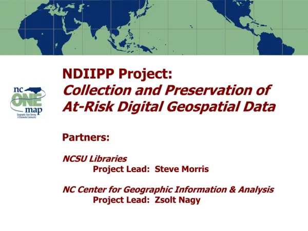
Long-Term Preservation of At-Risk Digital Geospatial Data: A Cooperative Agreement with Library of Congress Steve Morris NCSU Libraries Zsolt Nagy NC Center for Geographic Information & Analysis. Project Context.


Project Context
E N D
Presentation Transcript
Long-Term Preservation of At-Risk Digital Geospatial Data: A Cooperative Agreement with Library of CongressSteve MorrisNCSU LibrariesZsolt NagyNC Center for Geographic Information & Analysis
Project Context • Partnership between NCSU Libraries and NC Center for Geographic Information & Analysis • $520,000 funding • Focus on state and local geospatial content in North Carolina (statedemonstration) • Address NC OneMap objective: “Historic and temporal data will be maintained and available.” • One of eight projects in the first NDIIPP funding round: “Building a Network of Partners” Note: Percentages based on the actual number of respondents to each question
Targeted Content • Resource Types • GIS “vector” (point/line/polygon) data • Digital orthophotography • Digital maps • Tabular data (e.g. assessment data) • Content Producers • Mostly state, local, regional agencies • Some university, not-for-profit, commercial • Selected local federal projects Note: Percentages based on the actual number of respondents to each question
Risks to Digital Geospatial Data .shp .mif .gml .e00 .dwg .dgn .bsb .bil .sid Note: Percentages based on the actual number of respondents to each question
Risks to Digital Geospatial Data • Producer focus on current data • Archiving data does not guarantee “permanent access” • Future support of data formats in question • Need to migrate formats or allow for emulation • Data failure • “Bit rot”, media failure • Preservation metadata requirements • Descriptive, administrative, technical, DRM • Shift to “streaming data” for access Note: Percentages based on the actual number of respondents to each question
Time series – vector data Parcel Boundary Changes 2001-2004, North Raleigh, NC Note: Percentages based on the actual number of respondents to each question
Time series – Ortho imagery Vicinity of Raleigh-Durham International Airport 1993-2002 Note: Percentages based on the actual number of respondents to each question
Tabular data (combined with vector data) Note: Percentages based on the actual number of respondents to each question
Today’s geospatial data as tomorrow’s cultural heritage Note: Percentages based on the actual number of respondents to each question
Earlier NCSU Acquisition Efforts • NCSU University Extension project 2000-2001 • Target: County/city data in eastern NC • “Digital rescue” not “digital preservation” • Project learning outcomes • Confirmed concerns about long term access • Need for efficient inventory/acquisition • Wide range in rights/licensing • Need to work within statewide infrastructure • Acquired experience; unanticipated collaboration Note: Percentages based on the actual number of respondents to each question
Exploring Approaches to Sharing Data County and City GIS Directories Note: Percentages based on the actual number of respondents to each question
Content Identification and Selection • Work from NC OneMap Data Inventory • Combine with inventory information from various state agencies and from previous NCSU efforts • Develop methodology for selecting from among “early,” “middle,” and “late” stage products • Develop criteria for time series development • Investigate use of emerging Open Geospatial Consortium technologies in data identification Note: Percentages based on the actual number of respondents to each question
Content Acquisition • Work from NC OneMap Data Sharing Agreements as a starting point (the “blanket”) • Secure individual agreements (the “quilt”) • Investigate use of OGC technologies in capture • Use METS (Metadata Encoding and Transfer Standard) as a metadata wrapper • Bundle data files, metadata, ancillary documentation • Supplement FGDC metadata with additional administrative, technical, and descriptive metadata • Encode rights (Digital Rights Management – DRM) • Links to services Note: Percentages based on the actual number of respondents to each question
Partnership Building • Work within context of the NC OneMap initiative • Explore state, local, federal partnerships • Defined characteristic: “Historic and temporal data will be maintained and available” • Advisory Committee drawn from the NC Geographic Information Coordinating Council subcommittees • Seek external partners • National States Geographic Information Council • FGDC Historical Data Committee • … more Note: Percentages based on the actual number of respondents to each question
Content Retention and Transfer • Ingest into Dspace open source digital repository software • Look more generically at the issue of putting geospatial content into digital repositories • Investigate re-ingest into a second platform • Start to define format migration paths • Special problem: geodatabases • Purse long term solution • Roles of data producing agencies, state agencies; NC OneMap; NCSU Note: Percentages based on the actual number of respondents to each question
End of Project Outcomes • Components which become part of state geospatial data infrastructure • NC OneMap objectives for long term access • Start a dialog about digital preservation; create stories about digital preservation that can be told in geospatial industry venues • Components which NCSU Libraries continues for its own business reasons • High user demand for local data, historical versions • Components which are not sustainable Note: Percentages based on the actual number of respondents to each question
Areas for Collaboration and Partnership • Identifying data for inclusion in the repository • Sharing inventories of data holdings • Discussing data format strategies • Sharing ideas about archiving approaches and architectures • Discussing strategies for preservation of geodatabase contents • Sharing and identifying concerns about rights issues, liability, etc. Note: Percentages based on the actual number of respondents to each question
Questions? Contact: Steve Morris Head of Digital Library Initiatives NCSU Libraries Steven_Morris@ncsu.edu Phone: (919) 515-1361 Note: Percentages based on the actual number of respondents to each question