
Uploaded by
adolph
17 SLIDES
275 VUES
180LIKES
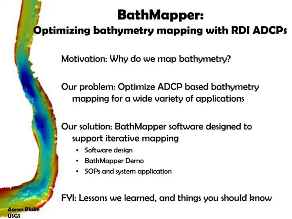
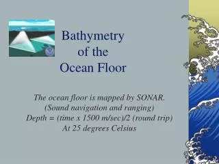
BathMapper: Improving Bathymetry Mapping for Diverse Applications
DESCRIPTION
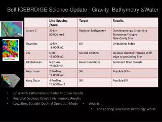
BathMapper utilizes RDI ADCPs for optimized bathymetry mapping, benefiting navigation assessments, studying bed-form processes, sediment transport, model inputs, habitat assessment, and monitoring levee conditions. Developed by Aaron Blake from USGS to cater to diverse bathymetry needs.
Download
1 / 17
Télécharger la présentation 
BathMapper: Improving Bathymetry Mapping for Diverse Applications
An Image/Link below is provided (as is) to download presentation
Download Policy: Content on the Website is provided to you AS IS for your information and personal use and may not be sold / licensed / shared on other websites without getting consent from its author.
Content is provided to you AS IS for your information and personal use only.
Download presentation by click this link.
While downloading, if for some reason you are not able to download a presentation, the publisher may have deleted the file from their server.
During download, if you can't get a presentation, the file might be deleted by the publisher.
E N D
Presentation Transcript


More Related