Download
1 / 29
290 likes | 379 Vues
This study explores a nonlinear regression approach to assimilate SAR data into models for marine wind retrieval, considering SAR errors, error quantification, and model improvements. The Radarsat-1 SAR data are validated using ship and buoy winds, with conclusions on error estimates.

E N D
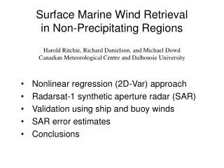
Surface Marine Wind Retrievalin Non-Precipitating Regions • Nonlinear regression (2D-Var) approach • Radarsat-1 synthetic aperture radar (SAR) • Validation using ship and buoy winds • SAR error estimates • Conclusions Harold Ritchie, Richard Danielson, and Michael Dowd Canadian Meteorological Centre and Dalhousie University
wind gusts (darker) Regression Approach • The assimilation of SAR data • into models depends partly on • whether errors in SAR-wind • information can be quantified • the identification of conditions • for which SAR data improve • marine wind forecasts. • Errors can be explicitly quantified using nonlinear regression. • These may be related to physical processes (e.g., wave tilt, • precipitation impact) or satellite characteristics (e.g., beam • mode, incidence angle).
Regression Approach SAR backscatter cross section SAR errors Numerical Model winds Model errors
Regression Approach Hersbach (2003), Vachon and Dobson (2000) SAR backscatter cross section SAR errors Numerical Model winds Model errors Radarsat-1 incidence angle bias correction
Regression Approach • CMOD is first used to remove the incidence angle • dependence of the SAR obs ( ). This allows R to • be positive definite. • J is generally a function of the estimated winds (x) • and the unknown error covariances (R and B). • Here, error covariances are assumed to decay • exponentially with a length scale of 150 km and B • error variances are fixed at 1 m2/s2 (only R varies).
Radarsat-1 SAR • Polar orbiting every 100 minutes at ~800 km • C-band SAR (5-cm wavelength; horizontally polarized) • First ScanSAR to use multiple beam modes to obtain • ~50-m resolution over swaths of ~400 km • We employ 609 acquisitions from June 2004 to • July 2005 at 6.4-km resolution
400-m SAR Acquisition • (Koch 2004 smoothing) • masking over land Backscatter (dB)
400-m SAR Acquisition • (Koch 2004 smoothing) • masking over land • along beam seams Backscatter (dB)
400-m SAR Acquisition • (Koch 2004 smoothing) • masking over land • along beam seams • over sea ice Backscatter (dB)
400-m SAR Acquisition • (Koch 2004 smoothing) • masking over land • along beam seams • over sea ice • where retrieved wind speed • would be less than 3 m/s or • greater than 33 m/s Backscatter (dB)
800-m SAR Acquisition • (Koch 2004 smoothing) • masking over land • along beam seams • over sea ice • where retrieved wind speed • would be less than 3 m/s or • greater than 33 m/s Backscatter (dB)
1.6-km SAR Acquisition • (Koch 2004 smoothing) • masking over land • along beam seams • over sea ice • where retrieved wind speed • would be less than 3 m/s or • greater than 33 m/s Backscatter (dB)
3.2-km SAR Acquisition • (Koch 2004 smoothing) • masking over land • along beam seams • over sea ice • where retrieved wind speed • would be less than 3 m/s or • greater than 33 m/s Backscatter (dB)
6.4-km SAR Acquisition • (Koch 2004 smoothing) • masking over land • along beam seams • over sea ice • where retrieved wind speed • would be less than 3 m/s or • greater than 33 m/s Backscatter (dB)
Ship and Buoy Validation GTS ship/buoy obs (CDC web archive)
Ship and Buoy Validation • GTS ship/buoy obs • (CDC web archive) • vertical adjustment to • 10-m using Walmsley • (1988) or logarithmic • profile requires obs • heights (WMO Pub 47)
Ship and Buoy Validation • GTS ship/buoy obs • (CDC web archive) • vertical adjustment to • 10-m using Walmsley • (1988) or logarithmic • profile requires obs • heights (WMO Pub 47) • taken within 90 min of • an acquisition
Ship and Buoy Validation • GTS ship/buoy obs • (CDC web archive) • vertical adjustment to • 10-m using Walmsley • (1988) or logarithmic • profile requires obs • heights (WMO Pub 47) • taken within 90 min of • an acquisition • valid within a radius of • 5-50 km, depending on • proximity to land
Retrieval Example SAR Backscatter (dB) Precipitation Region
Retrieval Example SAR Backscatter (dB) Normalized by CMOD Precipitation Region
Retrieval Example 15-km Hourly Model Winds Normalized by CMOD xb and CMOD(xb)
and CMOD() Retrieval Example 15-km Hourly Model Winds Retrieval xb and CMOD(xb)
Error Estimates SAR error variance is reduced (as expected) Errors appear Gaussian
Error Estimates Wind speed (and direction) errors are unchanged Errors appear Gaussian
Error Estimates • Precip regions have higher error standard deviation • (with slightly stronger wind speeds) • Low incidence angle regions (with no precip) have • higher error standard deviation
Conclusions • If errors in ship and buoy obs can be • neglected, then the regression approach • permits a distinction between errors with • and without precipitation and at high and • low incidence angles. • A more sophisticated approach considers • ship and buoy errors (which may be larger • than corresponding SAR or model errors). • The B and R error covariance matrices can • also be improved.
Retrieved wind speeds can be biased at near and • far range (Monaldo et al. 2001) • We obtain wind speeds that are more consistent with • numerical model winds by multiplying SAR data by • = 1 + 0.005 (Incidence Angle – 30) Radarsat-1 Incidence Angle Bias
Spatial Error Correlation relative to ship and buoy wind speed and backscatter (using CMOD)
CMOD (C-band model) empirically relates wind and Bragg scattering from waves.