Geostationary surface albedo retrieval error estimation
240 likes | 276 Vues
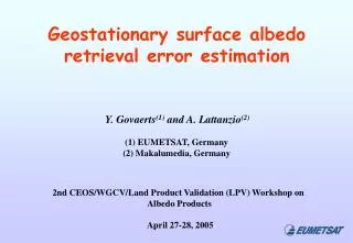
Geostationary surface albedo retrieval error estimation. Y. Govaerts (1) and A. Lattanzio (2). (1) EUMETSAT, Germany (2) Makalumedia, Germany. 2nd CEOS/WGCV/Land Product Validation (LPV) Workshop on Albedo Products April 27-28, 2005. METEOSAT MISSIONS STATUS. 6 bits data. 8 bits data.

Geostationary surface albedo retrieval error estimation
E N D
Presentation Transcript
Geostationary surface albedo retrieval error estimation Y. Govaerts(1) and A. Lattanzio(2) (1) EUMETSAT, Germany (2) Makalumedia, Germany 2nd CEOS/WGCV/Land Product Validation (LPV) Workshop on Albedo Products April 27-28, 2005
METEOSAT MISSIONS STATUS 6 bits data 8 bits data The Meteosat mission has been conceived in the early seventies. The primary objective of VIS band data was the near real-time qualitative observation of meteorological systems (i.e., to take picture). Pre-operational VIS 6 bits Operational VIS 8 bits 24 years of archive Need to be consistently calibrated and navigated
METEOSAT MISSIONS STATUS Govaerts, Y.M., Clerici, M., and Clerbaux, N. (2004) Operational Calibration of the Meteosat Radiometer VIS Band, IEEE TGARS, 42, 1900-1914. • Majors drawbacks concerning the quantitative use of the VIS band concern: • The unreliable SSR characterization Development of a SSR model to characterize the error
METEOSAT MISSIONS STATUS • Majors drawbacks concerning the quantitative use of the VIS band concern: • The unreliable SSR characterization • The width of the VIS band (surface changes, WV absorption, …) Surface reflectance Aerosol transmittance (τ=0.4) Gaseous transmittance
METEOSAT MISSIONS STATUS • Majors drawbacks concerning the quantitative use of the VIS band concern: • The unreliable SSR characterization • The width of the VIS band (surface changes, WV absorption, …) • Navigation problem in the eighties. The Meteosat system has not been design to fulfil any climate monitoring requirements The proposed approach relies on a reliable estimation of the retrieved surface albedo retrieval error that explicitly accounts for the observation system uncertainties.
METEOSAT-7 VIS Band Calibration Estimated calibration error Target characterisation error : 4.1% SSR error contribution : 3.8% Random error : 1.6% Total calibration error : 6% The SSR error should increase in time The loss of transmittance depends on the wavelength Desert Sea Govaerts, Y.M. Clerici, M. Clerbaux, N., 2004, Operational calibration of the Meteosat radiometer VIS band, IEEE TGARS, 42, 1900- 1914
Surface Albedo from Geostationary Obs. The Reciprocity Principle is applicable at a spatial scale of a few km • Assumptions • Atmosphere is composed of one absorbing gas layer and one scattering layer • US76 atmospheric profile • Continental aerosol type • Atmospheric and surface scattering properties are constant along the day • Surface scattering properties can be represented by the RPV BRF model Absorbing atmosphere State variables • Model : • ozone (TOMS) • Total column water vapour (ECMWF) Scattering atmosphere • Retrieved : • aerosol optical thickness (1) • surface reflectance level (1) • surface anisotropy (2) Pinty, B., Roveda, F., Verstraete, M.M., Gobron, N., Govaerts, Y., Martonchik, J.V., Diner, D.J., and Kahn, R.A. (2000) Surface albedo retrieval from Meteosat: Part 1: Theory, Journal of Geophysical Research, 105, 18099-18112.
Absorbing atmosphere Scattering atmosphere GEOSTATIONARY SURFACE ALBEDO INVERSION Inversion of the forward model
GEOSTATIONARY SURFACE ALBEDO INVERSION : Nile delta (winter) τ = 0.1, DHR = 0.17
GEOSTATIONARY SURFACE ALBEDO INVERSION : Nile delta (summer) τ = 0.4, DHR = 0.21
Meteosat -2/7 Albedo Comparison Meteosat-2 Launch date : 1981 Sub-satellite point : 0o Repeat cycle (archive) : 30/60 min Digitalisation : 6 bits Calibration accuracy : 15% Daily Rad. Noise : 12% Meteosat-7 Launch date : 1997 Sub-satellite point : 0o Repeat cycle (archive) : 30 min Digitalisation : 8 bits Calibration accuracy : 6% Daily Rad. Noise : 7-9% Calibration error budget
Meteosat -2/7 Albedo Comparison Met-7: 1-10 May 2004 Met-2: 1-10 May 1984
5.0% 6.8% MET-2 has more high values SURFACE ALBEDO COMPARISON OVER STABE DESERT Min prob.: 90% Max albedo rel. error: 10%
DETECTION OF SIGNIFICANT CHANGES • Remove the pixels with a QI (probability of the goodness of the fit) lower than 90%
SOLUTION PROBABILITY Met-2 Met-7
DETECTION OF SIGNIFICANT CHANGES • Remove the pixels with a QI (probability of the goodness of the fit) lower than 90% • Analyse the albedo difference with respect to the retrieval error
RADIOMETRIC RELATIVE ERROR Met-2 Met-7
SURFACE ALBEDO RELATIVE ERROR Met-2 Met-7
DETECTION OF SIGNIFICANT CHANGES • Remove the pixels with a QI (probability of the goodness of the fit) lower than 90% • Analyse the albedo difference with respect to the retrieval error • Keep only differences larger than the respective error (including calibration error):
DETECTION OF SIGNIFICANT CHANGES A2 : 1-10 May 1984 A7 : 1-10 May 2004 (A2-A7)/A7 -75%< <+75%
CONCLUSION • Geostationary observations offer a decisive advantage to retrieve surface albedo climate data set thanks to the frequent daily sampling used to estimate the surface anisotropy and to the duration of the archive (+20 years). • Met-2 and Met-7 agrees within 6% over desert area. It should be possible to detect significant (15%) temporal surface albedo changes from the Meteosat archive. • Uncertainty in the SSR characterization is the major limiting factor.
GLOBAL SURFACE ALBEDO Broadband (0.3 – 3.0µm) surface albedo derived from GOES-8/10, MET-5/7 and GMS-5 in 1-10 May 2001