Download
1 / 36
370 likes | 707 Vues
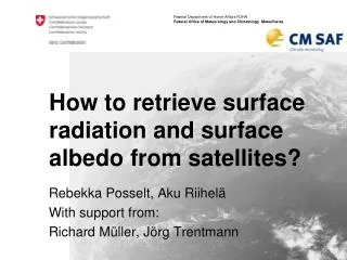
How to retrieve surface radiation and surface albedo from satellites ?. Rebekka Posselt , Aku Riihelä With support from: Richard Müller, Jörg Trentmann. Outline. PART I Solar radiation (SIS, SID) MagicSol – Retrieval for historical radiation datasets LookUpTable radiation retrieval

E N D
How to retrieve surface radiation and surface albedo from satellites? RebekkaPosselt, Aku Riihelä With support from: Richard Müller, Jörg Trentmann
Outline PART I Solar radiation (SIS, SID) • MagicSol – Retrieval for historical radiation datasets • LookUpTable radiation retrieval Longwave radiation (SDL) • AVHRR-CLARA (GAC) algorithm (very short) PART II Surface albedo (SAL) CM SAF Event Week, Surface radiation retrieval
Retrieval Overview Satellite- orbit Satellite- orbit Variables Algorithm Sensor Satellite Satellite Sensor Algorithm Variables Atmospheric Watervapour & temperature AMSU + HIRS (ATOVS) Cloud Albedo MVIRI MAGIC IAPP Solar Surf. Rad. R E T R I E V A L S SAF-NWC/ PPS NOAA Cloud Macro- physics MFG METOP Cloud Micro- physics Solar & Thermal Surf. Rad AVHRR CPP G2R Geo- stat. Solar & Thermal Surf. Rad.; Cloudforcing Polar SAF- NWC/ MSG P2R Cloud Macro- physics SEVIRI Cloud Micro- physics CPP MSG DMSP Water- & Energy- Fluxes Over ocean Solar & Thermal Rad. at Top -of-atm. SSM/I HOAPS GERB ToA-Rad CM SAF Event Week, Surface radiation retrieval
Part ISurface radiation retrievals Rebekka Posselt (MeteoSwiss) Contact me at: rebekka.posselt@meteoswiss.ch
Outline PART I Solar radiation (SIS, SID) • MagicSol – Retrieval for historical radiation datasets • LookUpTable radiation retrieval Longwave radiation (SDL) • AVHRR-CLARA (GAC) algorithm(very short) PART II Surface albedo (SAL) CM SAF Event Week, Surface radiation retrieval
MagicSolRetrieval for historical radiation datasets • Historical = Meteosat 2 – 7 (1983 – 2005) = MVIRI instrument • Benefits: • 23 years of high resolution data climatology • Challenges: • Only three available channels (VIS, IR, WV) • Satellite operations not designed for climate studies • Different satellites (inhomogeneities) • Poorly documented (M2-4 missing calibration) CM SAF Event Week, Surface radiation retrieval
MagicSolRetrieval for historical radiation datasets • Historical = Meteosat 2 – 7 (1983 – 2005) = MVIRI instrument • Benefits: • 23 years of high resolution data climatology • Challenges: • Only three available channels (VIS, IR, WV) • Satellite operations not designed for climate studies • Different satellites (inhomogeneities) • Poorly documented (M2-4 missing calibration) Self-calibration CM SAF Event Week, Surface radiation retrieval
MagicSolRetrieval for historical radiation datasets • Retrieval scheme • Get cloud information • “Effective Cloud Albedo” (CAL) • From satellite • Get clear sky information • “Clear Sky Radiation” (Radcs) • From LookUpTables • Combine 1. & 2. Rad = SIS or SID CM SAF Event Week, Surface radiation retrieval
MagicSolRetrieval for historical radiation datasets • Get cloud information • Get clear sky = cloud free = surface only image from a series of original images (usually the darkest pixel in the series) Original image (clouds and surface) = ρ Clear sky image (clouds removed, only surface) = ρmin Cloud image (surface removed, only clouds) CM SAF Event Week, Surface radiation retrieval
MagicSolRetrieval for historical radiation datasets • Get cloud information • Get Selfcalibration via ρmax = 95% percentile of all counts in target region (South Atlantic) Original image CM SAF Event Week, Surface radiation retrieval
MagicSolRetrieval for historical radiation datasets • Get cloud information • All information together give the “effective cloud albedo” (CAL, a.k.a. cloud index) Heliosat method Cloud image ~ Maximum range of pixel brightnesses CM SAF Event Week, Surface radiation retrieval
MagicSolRetrieval for historical radiation datasets • Get cloud information • All information together give the “effective cloud albedo” (CAL, a.k.a. cloud index) Heliosat method • Overcast CAL= ? • Clear-sky CAL = ? • Fresh snow CAL < 0, 0<CAL<1, CAL>1 Cloud image ~ Maximum range of pixel brightnesses CM SAF Event Week, Surface radiation retrieval
MagicSolRetrieval for historical radiation datasets • Get clear sky radiation (gnu-magic) • LookUpTables • Fast Obtained from a Radiative Transfer Model Atmospheric State • Aerosols (climatology) • Water vapour(reanalysis) • Ozone Surface Albedo • Climatology LookUpTable Radcs Interpolation Müller et al. (2009) http://sourceforge.net/projects/gnu-magic CM SAF Event Week, Surface radiation retrieval
MagicSolRetrieval for historical radiation datasets • Retrieval scheme • Get cloud information • “Effective Cloud Albedo” (CAL) • From satellite • Get clear sky information • “Clear Sky Radiation” (Radcs) • From LookUpTables • Combine 1. & 2. Rad = SIS or SID CM SAF Event Week, Surface radiation retrieval
Outline PART I Solar radiation (SIS, SID) • MagicSol – Retrieval for historical radiation datasets • LookUpTable radiation retrieval Longwave radiation (SDL) • GAC algorithm(very short) PART II Surface albedo (SAL) CM SAF Event Week, Surface radiation retrieval
LookUpTableradiation retrieval • Used for • Operational (= regularly updated) radiation products • AVHRR-CLARA (GAC) radiation dataset • Benefits: • Physical approach • Applicable to geostationary and polar orbiting satellites • Challenges: • Multispectral information required for cloud detection • Auxiliary data required (e.g., surface albedo) CM SAF Event Week, Surface radiation retrieval
LookUpTableradiation retrieval • Retrieval scheme • Cloud detection • Cloud free:use clear-sky gnu-magic (see MAGICSOL) CM SAF Event Week, Surface radiation retrieval
LookUpTableradiation retrieval • Retrieval scheme • Cloud detection • Cloudy: Get atmospheric trans-missivityτ from LUT • Use satellite and model data as input • Calculate Rad E0= solar constant = 1362 Wm-2 Θz = sun-zenith angle τ = atmospheric transmissivity CM SAF Event Week, Surface radiation retrieval
LookUpTableradiation retrieval • Retrieval scheme • Cloud detection • Cloudy: Get atmospheric trans-missivityτ from LUT • Use satellite and model data as input • Calculate Rad E0= solar constant = 1362 Wm-2 Θz = sun-zenith angle τ = atmospheric transmissivity • known • known • use cloud-magic CM SAF Event Week, Surface radiation retrieval
LookUpTableradiation retrieval • Get atmospheric transmissivityτ (cloud-magic) TOA albedo • GERB (CM SAF RMIB) orGERB-like-SEVIRI • AVHRR-CLARA (GAC) broadband albedo Atmospheric State • Aerosols (climatology) • Water vapour(NWP DWD) • Ozone • Cloud fraction (SAFNWC) LookUpTable Surface Albedo • Climatology Atmospheric Transmissivityτ Interpolation Müller et al. (2009) http://sourceforge.net/projects/gnu-magic CM SAF Event Week, Surface radiation retrieval
LookUpTableradiation retrieval • Retrieval scheme • Cloud detection • Cloudy: Get atmospheric trans-missivityτ from LUT • Use satellite and model data as input • Calculate Rad E0= solar constant = 1362 Wm-2 Θz = sun-zenith angle τ = atmospheric transmissivity Cloud free:use clear-sky gnu-magic (see MAGICSOL) CM SAF Event Week, Surface radiation retrieval
Outline PART I Solar radiation (SIS, SID) • MagicSol – Retrieval for historical radiation datasets • LookUpTable radiation retrieval Longwave radiation (SDL) • AVHRR-CLARA (GAC) algorithm (very short) PART II Surface albedo (SAL) • Arctic-SAL CM SAF Event Week, Surface radiation retrieval
AVHRR-CLARA (GAC) SDL retrieval -very short • GAC = “global area coverage” = AVHRR instrument (1982-present), polar orbiting • SDL mainly determined by Temperature and humidity close to the earth’s surface • Cannot be observed by satellites • all SDL products from satellites need additional data (e.g., reanalysis, NWP) • CM SAF GAC SDL uses ERA Interim SDL as basis • Cloud information of GAC are used to refine ERA SDL CM SAF Event Week, Surface radiation retrieval
Outline PART I Solar radiation (SIS, SID) • MagicSol – Retrieval for historical radiation datasets • LookUpTable radiation retrieval Longwave radiation (SDL) • GAC algorithm(very short) PART II Surface albedo (SAL) CM SAF Event Week, Surface radiation retrieval
PART IISAL retrieval algorithm Aku Riihelä FMI
Surface albedo Radiation budget at surface: Enet = SW↓ – α * SW↓ + LW ↓ - LW↑ The resulting net energy is available for surface heating, snow melt, heat fluxes etc. SW↓ - α* SW↓ + LW ↓ - LW ↑ CM SAF Event Week, Surface radiation retrieval
The SAL algorithm • A shortwave black-sky surface albedo product • Black-sky = direct solar flux only, all atmospheric effects removed • A radiometric and geolocation correction for topography effects on AVHRR images • Dedicated algorithms for vegetated surfaces, snow/ice, and water • Atmospheric correction with SMAC • BRDF correction over vegetated surfaces CM SAF Event Week, Surface radiation retrieval
0. Topography correction In the first part, we correct the geolocation of the AVHRR pixels for the true terrain height effects using a global DEM In the second part, we correct the observed reflectances for effects caused by the various slopes and shadowed areas in an AVHRR pixel CM SAF Event Week, Surface radiation retrieval
1. Atmospheric correction • Atmospheric effects need to be removed from the observed TOA reflectances • We use the Simplified Model for Atmospheric Correction (SMAC) [Rahman & Dedieu, 1994]. • Required Inputs • Visible + near IR TOA reflectances • Aerosol Optical Depth (AOD) content of the atmosphere(set constant to 0.1) • Total ozone column (O3) (constant at 0.35 (atm cm)) • Total column water vapour and surface pressure (taken from atmospheric model, ECMWF / DWD (g/cm^2)) CM SAF Event Week, Surface radiation retrieval 29
2. BRDF correction • Applied the model of Roujean (1992) with an update by Wu et al. (1995). • The model considers the bidirectional reflectance of a surface to consist of three ”kernels”: CM SAF Event Week, Surface radiation retrieval
2. BRDF correction • Applied the model of Roujean (1992) with an update by Wu et al. (1995). • The model considers the bidirectional reflectance of a surface to consist of three ”kernels”: • k terms describe the reflectance contributions from: • nadir-viewing & overhead Sun situation (k0), • geometric and volume scattering terms k1 and k2. • The f terms describe the dependency of the model from the viewing/illumination geometry of the scene. Generic vegetation canopy! CM SAF Event Week, Surface radiation retrieval
2.5. Anisotropy sampling of snow • The reflectance anisotropy properties of snow vary widely with snow type! • Very difficult to model universally without universal data on snow physical characteristics • Our solution: sample the anisotropy directly and consider the mean of the samples to represent the albedo. • The strategy works if we have enough samples of the BRDF…which fortunately is the case when using AVHRR in the high latitudes (where snow exists)! Reflectance sampling distribution at Summit Camp, Greenland Ice Sheet, summer 2005 CM SAF Event Week, Surface radiation retrieval
3. Narrow-to-broadband conversion Satellite imagers cover only a part of the solar spectrum – algorithms needed to convert observed (spectral) albedo to full broadband albedo! NTBC algorithms separated by instrument (SEVIRI / AVHRR) and land cover (vegetation, snow, water) Vegetation-AVHRR: Liang (2000) Vegetation-SEVIRI: Van Leeuwen & Roujean (2002) Snow: Xiong et al. (2002) Water (LUT-based): Jin et al. (2004) AVHRR channels 1 & 2 CM SAF Event Week, Surface radiation retrieval
When all is said and done… • We have retrieved a broadband black-sky surface albedo for a satellite image* • The instantaneous images are then projected into a common map grid and averaged over a pentad/week/month to create the product we distribute to You, the user. * Multiple images required for a robust snow albedo retrieval CM SAF Event Week, Surface radiation retrieval
Limitations of the algorithm • Sun Zenith Angle of the scene has to be less than 70 degrees and the Viewing Zenith Angle (of the satellite) less than 60 degrees • Retrievals would be unreliable outside these bounds • Cloud masking errors do occur sporadically • Cloud reflectance propagates into an albedo ”retrieval” • Aerosols and O3 concentrations currently constant in retrievals • Increased uncertainty over areas where AOD is high (see figure below) • O3 effect is much smaller than the aerosol effect • Coarse resolution (15 km2, 0.25 degrees, 25 km2) may not allow for accurate small-scale studies Problems using SAL? You can contact me at aku.riihela@fmi.fi CM SAF Event Week, Surface radiation retrieval
Thanks for tuning in! CM SAF Event Week, Surface radiation retrieval