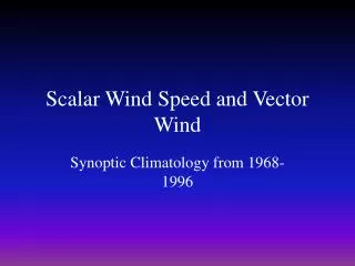
Ocean Surface Vector Wind Constellation
This report details the collaboration among space agencies to enhance the use of scatterometer-derived surface vector winds (SVW) and altimeter-derived significant wave heights (SWH) in marine forecasts. Emerged from discussions at the 23rd CEOS Plenary in Phuket, Thailand, this initiative aims to address challenges in accessing and utilizing ocean surface meteorological data. The plan includes user engagement, training workshops, and a focus on improving data accessibility to protect lives and property at sea through better operational forecasting.

Ocean Surface Vector Wind Constellation
E N D
Presentation Transcript
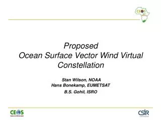
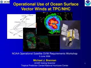
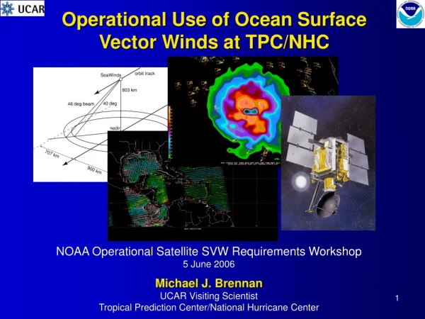
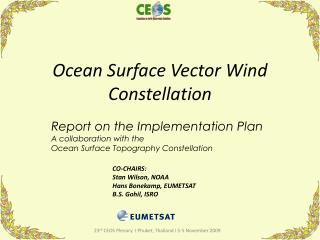
Ocean Surface Vector Wind Constellation Report on the Implementation Plan A collaboration with the Ocean Surface Topography Constellation CO-CHAIRS: Stan Wilson, NOAA Hans Bonekamp, EUMETSAT B.S. Gohil, ISRO 1 23rd CEOS Plenary I Phuket, Thailand I 3-5 November 2009
OSVW & OST Constellation Collaboration GOAL – Promote the widespread use of scatterometer-derived surface vector winds (SVW) and altimeter-derived significant wave heights (SWH) in operational marine analyses and forecasts worldwide, as a contribution to the protection of life and property at sea. WMO Executive Council in June 2008 – Requested that efforts be made…to ensure that… ocean surface meteorological observations be routinely collected and disseminated… Requested…participation of space agencies... 23rd CEOS Plenary I Phuket, Thailand I 3-5 November 2009
User Community Engagement As stated at SIT-23: • Focus initially on operational marine forecasting for Southern Hemisphere via provision of OSVW & SWH • Assess whether GMDSS high-seas forecast centers have timely access to, and a capability to use, these products • Depending on what is learned, proceed accordingly…
We have been observing SVW and SWH for well over a decade…Why such low operational use? • Unaware of the capabilities 5 different satellites • Unable to access the GTS • Unable to decode BUFR files on GTS & each is different • Must sort through files on the GTS that have little correspondence to areas of interest • Must write a proposal to get ftp access • Must go to 5 different ftp sites, each with different format • Don’t know when products become available on each • Difficult to integrate OSVW & SWH products into analyses • Forecasters don’t know how to use the products
For the space agencies – Facilitate data access • Single point of access for a given product • KNMI provides ftp site for access to SVW from both QuikSCAT and ASCAT • We are looking at options for a similar site for SWH • In parallel, ensure SVW and SWH access via the GTS • Policy for timely data access • ESA/ENVISAT/NOAA– discussions here in Darmstadt • ISRO – • Oceansat-2 – separate negotiations with EUMETSAT & NOAA • SARAL – collaboration with CNES • SOA/CNSA – proposed collaboration with CNES; separate interactions with ESA, EUMETSAT, NASA, NOAA…
For the users – Training & capacity building • “Use of Satellite Wind & Wave Products for Marine Forecasting” – An initial training workshop being organized by NOAA & EUMETSAT, in collaboration with IOC Project Office for IODE in Oostend, Belgium • December 14-18, 2009 • For information on the course as it develops, go to: http://hosting1.iode.org/moodle/mod/resource/view.php?id=565 • IOC is paying travel costs for a dozen students from Argentina, Brazil, Chile, Fiji, Mauritius & South Africa • Trainers from NOAA, KNMI, EUMETSAT, Met Service NZ & ISRO
Series of Training Workshops • Initial workshop • To organize the course, based on direct and immediate feedback from operational users • To include – for each country – an operational forecaster and (where possible) a research user of SVW and SWH • Subsequent workshops • To be in close collaboration with WMO, IOC and the operational forecast services • To be in the developing countries where student participation can be maximized • To evolve in response to growing forecaster familiarity with operational use of SVW and SWH products • Financial support will be an issue to be addressed
Initial Performance Metrics – How will we measure success? All Southern Hemisphere centers with responsibility for operational forecasts for GMDSS MetAreas will routinely utilize SVW from all current scatterometers and SWH from all current altimeters in marine analyses and forecasts – i.e., all boxes in the table on slide 4 will be colored green. 23rd CEOS Plenary I Phuket, Thailand I 3-5 November 2009