Proposed Ocean Surface Vector Wind Virtual Constellation
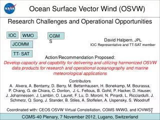
Proposed Ocean Surface Vector Wind Virtual Constellation. Stan Wilson, NOAA Hans Bonekamp, EUMETSAT B.S. Gohil, ISRO. Ocean Surface Vector Wind Constellation. Goal

Proposed Ocean Surface Vector Wind Virtual Constellation
E N D
Presentation Transcript
Proposed Ocean Surface Vector Wind Virtual Constellation Stan Wilson, NOAA Hans Bonekamp, EUMETSAT B.S. Gohil, ISRO
Ocean Surface Vector Wind Constellation • Goal • Improve operational marine warnings and forecasts through the use of ocean surface vector winds (OSVW) from satellite scatterometry – together with significant wave height (SWH) from the OST Constellation • Characterize the OSVW field for use in climate-quality data records • Facilitate research related to the influence of wind forcing on the circulation of the oceans • Benefits • Common products and formats • Available in time for operational use • Share experience in using those products • Optimize global coverage in space and time
User Community EngagementResearchers have mechanisms to engage, but it is challenging for operational users • Focus initially on operational forecasting for Southern Hemisphere via provision of OSVW & SWH • Assess whether GMDSS high-seas forecast centers have timely access to, and capability to use, products • Existing GMDSS links will deliver forecasts to end users • Resolve issues encountered in point 2 before proceeding further • Extend to Northern Hemisphere & resolve issues • Extend to WMO tropical cyclone forecast centers & … • Consider additional products… • Consider other applications…
Measures of Success • Timely data access • ISRO/EUM/NOAA discussions re: Oceansat-2 SVW • SOA not yet discussing HY-2 SVW and SWH • One-stop shopping • NOAA to consider putting QuikSCAT SVW onto GTS • ESA to consider putting ENVISAT SWH onto GTS • Operational utilization • NOAA/EUM/ISRO to consider organizing operational workshop • Improved on-orbit capabilities • NOAA and EUM considering follow-ons to QuikSCAT and ASCAT
Recommended Actions • CEOS/SIT – encourage establishment of OSVW Constellation • CEOS/SIT – invite SOA to participate in CEOS and engage in discussions regarding timely data access • ISRO/EUM/NOAA/SOA – consider joint discussions on common products and formats • NOAA – consider putting QuikSCAT SVW onto GTS just as EUM has done for ASCAT • ESA – consider putting ENVISAT SWH onto GTS just as MétéoFrance has done for Jason • NOAA/EUM/ISRO – consider organizing joint workshop for operational users • NOAA and EUM – consider follow-on options to improve performance and maximize coverage
Statements of Support • WMO Executive Council (June 2008) • …requested that…ocean surface met…obs…be routinely collected and disseminated via the GTS…to further improve wave models………requested…participation of space agencies in that scheme • …recognized that severe coastal inundation…from extreme sea state conditions occurred in many parts of the world…where coastal and ocean surface met…observations were still limited or absent………requested JCOMM…to address this…as a matter of priority • Peter Dexter, Australian BoM, Co-President, JCOMM • …scatterometer and altimeter products should be available on the GTS • Jean-Michel Lefèvre, Météo-France, JCOMM & GLOBWAVE • Interest in…satellite data for wave application is growing…very few in situ data are available in open oceans
Timely sharing of data enables a significant reduction in revisit time 6-hour goal