Download
1 / 83
830 likes | 1.05k Vues
On the road to the McKinstry Creek project, a complete stream realignment and constructed floodplain.

E N D
On the road to the McKinstry Creek project, a complete stream realignment and constructed floodplain
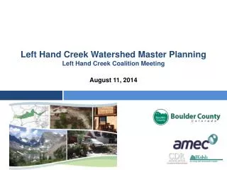
McKinstry Creek, Delevan, NYThis was a complete stream and floodway realignment. Constructed June-July 2005. The stream had been straightened prior to 1939 (probably to accommodate the construction of Gooseneck Road)
McKinstry Creek near Delevan, NY, 5-18-2006, flow left to right Existing planform (red line)
In the 1939 aerial photos the stream had already been straightened & was parallel with the road. Where had it been?? How long was it?? Existing planform (red line)
The stream needs to be longer and/or rougher but we are hemmed in by the road & the hill. Green line is toe of hill Gooseneck Road McKinstry Road We will have to increase the amplitude of the vertical sine wave (extreme verticality)!
Attack Angles, Thalweg Profile, and cross-sections. Important Note: There is a sine wave for both stream planform, and the vertical thalweg profile!
HOW STREAMS NATURALLY DISSIPATE ENERGY !! Purloined from Brad Humber, The Nature Conservancy Longitudinal Profile
McKinstry Creek near Delevan, NY, 5-18-2006, flow left to right New channel planform (blue line)
Looking US, US of the US bridge, (not in our project area) but typical pre-project conditions, straightened, wide, shallow runs, very few pools.
Looking DS at the straightened stretch next to the road (with boilerplate wall), this old channel will be abandoned.
Photo: Deb Freeman, June 29, 2005 Pre-project. The news is not good!
Analysis started the year before construction, June 23, 2004
LET’S STOP FOR A MOMENTThis is a simple “move the stream away from the road” exercise, but we will build as much habitat & energy dissipation into this project as possible!!
Looking DS at a pool and the crest stones for the DS rocked riffle
Let’s dig a pool (the Locked Log pool), McKinstry Creek, Delevan, NY Aquatic habitat techniques include Locked Logs, Bed Diversity Stones, Leaner Stones, & appropriate vegetation
Looking DS, pilot channel cut for the realigned stream, bottom is at invert elevation. The right bank will be lowered for floodway.
Looking DS, pre-dig & overdig those pools! All pools dug 3 ft deeper than invert of DS rocked riffle June 27, 2005-from derrick
Adding Locked Logs June 28, 2005-from derrick
Adding appropriate vegetation June 29, 2005-from derrick
Add some stone & more Locked Logs June 29, 2005 – from Derrick
Locked Logs & Bed Diversity Stones on McKinstry Creek Aug 29, 2005, less than 7 weeks after seeding, Riverbank Wildrye and Creeping Bentgrass mix
Pix by derrick Looking DS @ the same pool, flowing almost at bankfull stage with Hurricane Katrina’s rain, Sept 1, 2005
We need 9 Engineered Rocked Riffle Grade Control structures, so let’s build one.This one is at the DS end of the project.
AN ENGINEERED ROCKED RIFFLE FLOW 4 15 to 20 1 1 Largest stones are placed at crest and on downstream face, upstream face is in compression (due to water flow)
AN ENGINEERED ROCKED RIFFLE Newbury says the backwater should be 1/3 the total height of the structure to dissipate energy and pass sediment through the system. FLOW Largest stones are placed at crest and on downstream face. Upstream face is in compression (due to water flow).
Looking DS, setting the crest stones June 28, 2005
Looking DS In a small stream the two center stones are the most critical for low-flow fish passage
Looking DS, setting the invert of the GC. Log used when the trackhoe pushes down on the stone Stuff in the way!!
Moving a tree out of the way so that we can get the invert elevation shot
“Styling” members of the Catt County stream team chinking stones
How it looks on March 28, 2006 after 3 bankfull flows & one really big flow
The “Shadow Wall” Pool with Locked Logs and a large transplanted multi-trunk Alder for shade
Half-Dense Riprap with Shadow Wall Toe The toe stone is designed to cast a shadow into the deepest section of the channel Stone with Vertical face
Half-Dense Riprap with Shadow Wall Toe Stone with Vertical face Shadow area
All aquatic habitat features are designed to be submerged during base flow conditions
Looking US at pre-dug pool with Shadow Wall & Locked Logs (everyone’s fav pool)
Transplanting a giant multi-trunk alder ALDER BOB Photo: Deb Freeman
THIS CONTRACTOR HAD NO STREAM CONSTRUCTION EXPERIENCE!!
Transplanted alder Looking DS at pool & Alder during Katrina’s rains, Sept 1, 2005