GPS Receivers, Map Software, and Bicycling
250 likes | 418 Vues
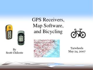
GPS Receivers, Map Software, and Bicycling. Tarwheels May 24, 2007. By Scott Chilcote. Why Mess Up a Ride with this Stuff?. Well, for example, we can. Find out where we are on a ride, what's nearby Give our exact location for emergency response Find out how much climbing we've done

GPS Receivers, Map Software, and Bicycling
E N D
Presentation Transcript
GPS Receivers, Map Software, and Bicycling Tarwheels May 24, 2007 By Scott Chilcote
Why Mess Up a Ride with this Stuff? Well, for example, we can... • Find out where we are on a ride, what's nearby • Give our exact location for emergency response • Find out how much climbing we've done • Conveniently create new routes and print cue sheets
What is GPS? • “Global Positioning System” • Made Possible by Satellites • The Receiver determines its position by measuring its distance from four satellites • GPS Receivers use the principle of over-lapping spheres to figure out where they are • These receivers need to be outdoors, and in relatively open areas for the most accuracy
GPS Jargon! • Waypoint – A place on a map that we want to mark, in order to find it again. Can be numbered or labeled using the GPS controls • Route – A group of waypoints and the sequence we want to navigate them • Track – How a GPS Receiver records where we have been – a series of stored points • Track Point – Stored to create a track. Has Latitude, longitude, elevation and time • Bearing – The direction to a specific waypoint
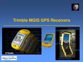
What Makes a GPS Unit Good for Bicycling? • The Good News: There are many good choices. • Not so Good: There are a LOT of good choices! • Recommended: A handheld model in the $100-$300 price range, that has a handlebar mount • Popular Manufacturers: Garmin, Magellan, Lowrance • Some Bicycle Computers with GPS Capabilities are available now, e.g. Garmin Edge Series
Other Useful Features • A Computer Interface (Serial or USB) – essential • Memory for Downloaded Maps • Ability to Store & Display Waypoints (common) • Ability to Store & Display Tracks (common) • Ability to Navigate to Waypoint • Readable map display, visible in sunlight • Readouts for speed and distance traveled • Shock Resistant
More Features Worth Considering • Electronic Compass • Barometric Altimeter • Color Display • Stored Routes • Ability to do Turn by Turn Navigation • Display of Track Profile • WAAS Support • Highly Sensitive Receiver (e.g. SIRFstar III)
Preparing the GPS Receiver for a Ride • 1. Find and Install a Handlebar Mounting Kit* • 2. Update the firmware in the Unit* • 3. Download the appropriate Maps into the Unit's Memory* • 4. If the planned Route is available in advance, we have the option of downloading it to the unit* • 5. Save the Unit's Track Log* • 6. Before starting, zero the Unit's Trip Mileage • 7. For round trips, set a Waypoint at Start/Finish (* If supported)
What a GPS Receiver Can Help Find • Named Roads, Cities, Intersections, Highway Exits, Gas Stations, Stores, Addresses • Requires that Recent Map Data has been Stored • In Rural Areas, the Data may be Incomplete • Previously Set Waypoints (e.g. Start/Finish) • If the display is “zoomed in” close enough, Points of Interest will appear on the unit's Map Display • Nearby Points of Interest can be listed, and located using the unit's POI List
GPS Receiver Hints & Tips • Be Battery Conscious • 8-12 hour battery life is typical • Some GPS Units have a Power Saver mode • During rest stops, it helps to turn it off • Having spare batteries along helps (e.g. rechargables) • Turn off Satellite Tracking when using it indoors • If the Unit has a Track Log, save it between trips • Use the “Pan Map” Feature to broaden the view • Don't rely very much on displayed altitude values
Why Do I Need Mapping Software? • Build Route Maps and Cue Sheets for Rides • Download Local Map Data into the GPS Unit (the base maps are not very useful on some models) • Provide Accurate Elevation Data for a Route or previous ride • Identify Local Places of Interest for a Ride – Stores, Landmarks, Parks, Ice Cream shops • Build Route Elevation Profiles to print, frame, hang on our walls
Online Mapping Tools • www.gpsvisualizer.com - Creates Maps and Elevation Profiles from GPS Data (GPX), Street Addresses, or Simple Coordinates
Online Mapping Tools, cont. • www.routebuilder.org - Build a Route using Google Maps, Print out the Total Mileage
Online Mapping Tools, Cont. • www.bikely.com - Allows bicyclists to share detailed bicycle routes • Uses google maps to display routes uploaded in GPX format • Gives “tour” of bike route on map, including tips along the way • Displays an elevation profile of the route • Currently the selection of routes is limited, but has great potential
Online Mapping Tools, cont. • Google Earth – Part Downloaded Software, part Huge Server Farm • Requires broadband & fairly powerful computer to work well • Can read and display Tracks from GPX files
More Online Bike Route Tools • www.sanoodi.com - Many of the same features as bikely.com, allows route sharing • www.routeslip.com - Also similar to Bikely.com, but has a printable Cue Sheet option • www.mapmyride.com - Bikely-like, search for rides, advertising, fewer features than some • www.veloroutes.org - Bikely-like, fewer routes, shows weather data for some route areas • www.mapitpronto.com - Another ride sharer
Useful Mapping Software Features • Sufficient Detail – 1:24,000 Scale Minimum • Compatibility with your GPS Unit • Saves, Loads Track Data in GPX Format • For building Cue Sheets, look for the ability to print Turn-by-Turn Directions • Elevation Profiling • For Topographic Map Programs, make sure it's Road & Street Savvy • Manageable User Interface – Some are Complex!
Commercial Map Software Choices • DeLorme Street Atlas USA – Very good for Bike Route Planning • Builds & Prints turn-by-turn Cue Sheets, with Distance, Total Distance, and Time Estimates • Is Biased towards Highways & Major Roads, takes a little work to overcome • Prints Custom Route Maps in Color • Displays our recorded GPS Tracks • Does not display Elevation or Elevation Profiles
Commercial Map Software, cont. • Garmin MapSource – A must for Garmin GPS Owners – the one Source for downloadable maps • Included with some GPS Models • Can be used to Build Routes to Download into Garmin GPS Units • Available for Land/Sea/Air use, with International Map offerings • Recent Updates have very good Track Manipulation Tools, Elevation Profiles, GPX
Commercial Map Software, cont. • National Geographic TOPO! State Series • Bitmapped Topographical Maps with 6 Levels of Detail, plus Magnification • Nice Track Manipulation tools, Elevation Profiles, new 3D Overview mode • No knowledge of Roads – only Routes “point-to-point”... No Cue Sheet capability • Maps are showing their age, current product may have newer ones • Highest Price per Area covered
Commercial Map Software, cont. • Delorme Topo USA 6.0 – Very good combination of features for bicycling, at a reasonable price • User Interface & Tools can be intimidating • Help is built-in, and at http://forum.delorme.com • Requires a fairly powerful, recent computer • Provides 3D Topographic display, route profiles, plots GPS Tracks, and supports aerial imagery • Can be used to build bike routes, print maps and cue sheets • All that, and more...