Download
1 / 23
320 likes | 844 Vues
GIS and Transportation. Keivan Khoshons GEOG 516 Feb 10, 2004. Outline. Introduction: What is GIS-T? Differences between GIS and other Systems Unique Properties of Geographic Information GIS Models Used in Transportation Challenges for GIS-T Conclusions. What is GIS-T?.

E N D
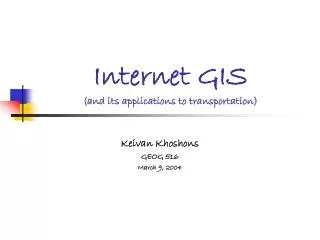
GIS and Transportation Keivan Khoshons GEOG 516 Feb 10, 2004
Outline • Introduction: What is GIS-T? • Differences between GIS and other Systems • Unique Properties of Geographic Information • GIS Models Used in Transportation • Challenges for GIS-T • Conclusions
What is GIS-T? • Geographic information systems for transportation (GIS-T) are interconnected hardware, software, data, people, organizations, and institutional arrangements for collecting, storing, analyzing, and communicating particular types of information about the Earth. “Fletcher, 2000” • These particular types of information are transportation systemsand geographic regions. • GIS-T can be viewed as the product of the interaction between improved concepts of both geographic information system (GIS) and transportation information system (TIS) “Vonderhoe et al., 1993”
What is GIS-T?(cont’d) • GIS-T as the merger of an enhanced GIS and enhanced transportation information system (TIS) (Reference:Vonderhoe et al., 1993) GIS TIS GIS-T
What is GIS-T?(cont’d) • Some applications: • infrastructure planning, design and management • traffic safety analysis • transportation impact analysis • public transit planning and operations • intelligent transportation systems (ITS) • Advanced Traveller Information Systems (ATIS) • Commercial Vehicle Operations (CVO) • Incident Detection Management
Differences between GIS and other Systems • Multi-functionality • Geo-visualization capability • makes GIS different from a usual database management engine; • Analytical capability • makes GIS different from an automated mapping application; • Database management features • enables GIS to capture spatial and topological relationship between geo-referenced entities if these relationships were not pre-defined.
Differences between GIS and other Systems (cont’d) • The major difference between GIS and other database management systems (DBMS) is mainly in the way information is referenced rather than the nature of information handled • both systems may contain exactly the same information!
Differences between GIS and other Systems (cont’d) An Example • If we consider total number of accidents occurring in downtown Vancouver, a DBMS references accidents by some unique index or combination of indices (e.g., the date of occurrence, the vehicle make, or the weather conditions). On the other hand, GIS record each accident as a geographical event with a unique location defined in a given referencing framework (global, national or local datum). The spatial referencing of objects enables users to define topology of data and consequently, different spatial query operations of objects and set of objects. Therefore, it is very easy to determine all accidents occurred within 100 metres of a specific intersection (e.g., Granville and Robson) on the study area, due to the spatial indexing of all accidents and roadway link objects in the GIS database.
Differences between GIS and other Systems (cont’d) • GIS can produce a spatial representation, or model, of the data used to describe a portion of the earth
Unique Properties of Geographic Information • Spatial dependency • The tendency for things closer in geographic space to be more related • i.e., it is meaningful to record, organize and analyze data by geographic location. • Spatial heterogeneity • The tendency of each location in geographic space to show some degree of uniqueness • i.e., it is valuable to consider local geographic context rather than just global generalities
Unique Properties of Geographic Information (cont’d) • Analytical models and statistical estimation techniques that do not consider spatial dependencies in geographic data ignore valuable information and might give misleading results. • With regard to spatial heterogeneity most boundaries are nothing but misrepresentations of the geographic reality. • Geographic processes such as land-use/ transportation systems and intelligent transportation systems have properties that non-spatial analysis techniques do not capture.
GIS Models Used in Transportation • Field models of the continuous variation of a phenomenon over space (e.g., land elevation) • Discrete models, depending on which discrete entities (points, lines or polygons) populate space (e.g., toll barriers, urbanized areas) • Network models to represent topologically-connected linear entities (e.g., roads, rail lines) that are fixed in the continuous reference surface
GIS Models Used in Transportation (cont’d) • All of these three models are useful in transportation • The network model built around the concept of arc and node plays the key role in this application domain because single- and multi-modal infrastructure networks are vital in enabling and supporting passenger and freight movement. • In fact, many transportation applications only require a network model to represent data.
GIS Models Used in Transportation (cont’d) • However, it is worth noting that advanced transportation applications, particularly disaggregate travel demand modelling approaches and intelligent transportation systems (ITS), require representation of complex transportation features that are not well-supported by the node-arc data model.
GIS Models Used in Transportation (cont’d) • Goodchild (1998) recognized three meaningful extensions to overcome these kinds of deficiencies: • Planner versus non-planner model • with different representations for topology versus cartography, by not forcing nodes at cartographic intersections • Turn tables • for including properties of turning movements • Properties can be binary (allowed, disallowed), or cardinal measurements (e.g., expected delay through an intersection) • Links are objects formed of traffic lanes • A structure that allows for an object-oriented view of the infrastructure to define topology between lanes • It may store attributes for individual lanes
GIS Models Used in Transportation (cont’d) • The need for these and other extensions to the base network model is not universal and is dependent to the type of the project. • There are several data modelling, data manipulation, and data analysis that were not supported by conventional GIS and currently are fulfilled by GIS-T software.
Challenges for GIS-T Legacy data management system • Transportation agencies keep comprehensive inventories of the transportation infrastructure, and its condition and usage by the public. • Each TIS handles a single type of information (e.g., highway planning network, pavement management system) with its own data and its own hardware and software platform. • Shortcomings • Data integration, i.e. to transfer disparate data into a unified data management system. • Some of the options available • generic relational data models, new dynamic segmentation data standards, and object-oriented data models.
Challenges for GIS-T (cont’d) Data interoperability • Transportation data are maintained by different agencies and private data providers • Each data source has its own data model • Accuracy across data sets is varied • Typical errors • Data position, topology, naming and attributing • Shortcomings • Algorithms for map matching • Models of error and error spread in transportation data • Data quality standards and data exchange standards • Typical applications • Commercial Vehicle Operations (CVO) • Advanced Traveller Information Systems (ATIS)
Challenges for GIS-T (cont’d) Real-time GIS-T • Real-time traffic data is currently available in many areas • It can be a primary input of world-wide-web applications • However, it does not meet the needs of society when it comes to geo-referenced data • Shortcomings • Quicker access data models • More powerful spatial data combination techniques • More powerful dynamic routing algorithms
Challenges for GIS-T (cont’d) Large data sets • Transportation problems are complex due to • Large amounts of geo-referenced data • Large networks • The complexity combines with difficulty to visualize information on the single dimension of a network • Shortcomings • pioneering system designs in order to optimizing • speed and accuracy of the display of information • the run time of algorithms and analytical tools of network analysis
Challenges for GIS-T (cont’d) Distributed computing • Advances in Internet technology have made computing mobile, distributed and widespread. • Internet GIS applications are currently accessible and common • Real-time transit route and schedule information • Traffic information • Shortcomings • More powerful analytical tools to fit • the limited distributed computing resources, and • limited bandwidth on communication networks • Novel design of system architectures to make efficient use of local and remote computing resources • Geo-referencing of remote service users and real-time tracking of their movements
Conclusions • GIS-T provides the core technology for planning, deploying, operating, and optimizing transportation systems. • It has opened up new horizons in transportation planning and engineering. • It has developed an essential tool for the most effective use of spatial data. • It provides a means of communication for an interactive understanding between the public and transportation professionals. • Still, this technology is facing a lot of challenges to adjust itself with the complexity of transportation data analyses.