Download
1 / 3
30 likes | 149 Vues
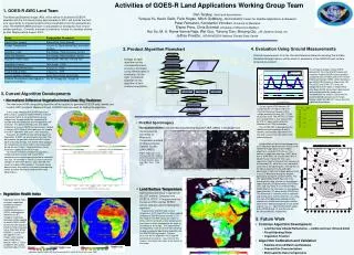
This paper discusses the utilization of GOES-R satellite data to derive land surface characteristics, including land surface temperature and surface insolation, which have been generated since 1995 for the NCEP LDAS. Current products have a resolution of 50 km over CONUS, with future developments offering up to 12 km resolution. The Eta surface model is also evolving, aiming for 4 km resolution in five years, while GOES-R may achieve 1 km resolution. Furthermore, the assimilation of radiative surface fluxes is discussed, emphasizing the need for hydrologic parameters with improved spatial and temporal resolutions.

E N D
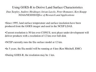
Using GOES-R to Derive Land Surface Characteristics Dan Tarpley, Andrew Heidinger, Istvan Laszlo, Peter Romanov, Ken Knapp NOAA/NESDIS/Office of Research and Applications • Since 1995, land surface temperature and surface insolation have been produced from the GOES imager and used in the NCEP LDAS. • Current resolution is 50 km over CONUS, next phase under development will deliver products with a resolution of 12 km over full-disk • NCEP currently runs the Eta surface model at 12 km. • In 5 years, the Eta model will be running at 4 km (Ken Mitchell, EMC) • During GOES-R, the resolution may be 1 km.
Currently, GOES imager data provides needed information to land data assimilation systems on the radiative surface fluxes such as surface temperature and insolation (shown below) During GOES-R, this data will likely be used in coupled and uncoupled atmospheric and surface assimilation schemes.
GOES-R will likely need to provide hydrologic parameters with increasing spatial and temporal resolution. Shown below is a GOES-8 derived daily snow map with surface snow reports over-laid. Hourly snow cover and precipitation information may be needed.