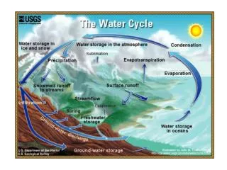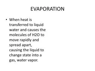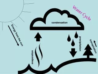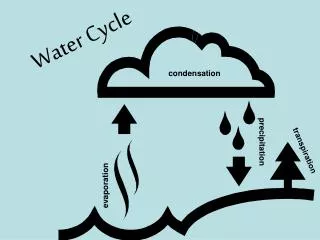
Land Surface Evaporation
Explore key research questions on evapotranspiration (ET) across landscapes for managing water, productivity, climate, and carbon. Learn from OASIS studies on flux variations and remote sensing methods with aircraft, towers, and satellites. Discover how data from different sources and models help quantify ET at varying scales.


Land Surface Evaporation
E N D
Presentation Transcript
Land Surface Evaporation 1. Key research issues 2. What we learnt from OASIS 3. Land surface evaporation using remote sensing 4. Data requirements Helen Cleugh and Ray Leuning CSIRO Atmospheric Research
Key Research Issues(a) Why ET? Quantify evaporation (ET) at landscape (ecosystems, catchments, regions) scales: • Water limits productivity in Australian ecosystems • Managing landscapes for food & fibre • Managing landscapes for carbon • ET is the largest output in the water balance and is the only part that can be “managed” (except for irrigation): • Managing landscapes for water - soil moisture and runoff are the small difference • Surface energy balance important for weather & climate
The challenge …. We can’t cover everythingall of the time … • in-situ observations:(lysimeters, flux towers) cover almost nothing but most of the time cover almost everything but hardly ever • aircraft observations:(fluxes, concentrations) • satellite observations:(AVHRR, MODIS … ) cover everythingall of the time but not what we want! • modelling:(leaf …. region) only pretends to cover everything all of the time Modified from Dr HP Schmid, Indiana University
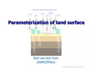
Key Research Issues(b) Methods to quantify ET • Multiple space and time scales: • Local, regional, continental; • Spatially distributed or lumped • Sub-diurnal, daily or seasonal • Monitoring - combining in situ + remotely sensed observations + land surface model • Remote sensing algorithms • Data assimilation approaches • Modelling - prognostic and diagnostic: • Initialisation, parameterisation and testing – especially for Australian ecosystems
Flux variation and coherence along OASIS transect From Leuning et al (2004)
2. Spatially-averaged evaporation – combining aircraft and flux towers (Isaac et al, 2004) • Aircraft data rich in space, sparse in time Tower data sparse in space, rich in time • Combine aircraft and tower measurements • Aircraft: measure spatially varying properties (diurnally invariant): • <gsmax> • Surface properties (Lai) • Evaporative fraction (ae) • Flux tower: measure diurnal variation at fixed points in space: • Near surface meteorology (S, A, D, U, T) • Spatial and temporal evaporation fields using Penman Monteith equation with appropriate forcing
Evaporation – Penman Monteith with a simple conductance model gsx and evaporative fraction (ae) constant during daylight hours
Spatial variability at local scale - contours of evaporation ratio, max. surface conductance
Evaporation – performance of a simple model combining aircraft and tower data From Isaac (2004)
Regional evaporation at OASIS • 10 12 14 16 18 20 22 24 26 28 • October, 1995
3. Land surface evaporation using remote sensing A new approach using Penman-Monteith model with a linear expression for the surface conductance: and MODIS estimates of LAI
Tumbarumba Measured MODIS Virginia Park
4. Data requirements to address research questions • Aircraft provides spatially resolved: • Surface conditions (diurnally invariant) - soil moisture, LST, NDVI, LAI, albedo, gsmax (derived) • Surface fluxes (x, z and t, but not continuous) • Concentration fields (x, z and t, but not continuous) • Ground-based, sparse sites to capture time variation: • Surface meteorology and fluxes (CO2 and water) • Calibration data (soil moisture, LAI, NDVI, LST, albedo) • Land surface model requirements: • ABL profiles, met. forcing, physiological parameters • Vegetation description • Antecedent data (rainfall, soil moisture, fluxes….)