Download
1 / 43
460 likes | 627 Vues
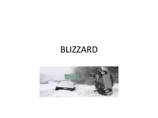
Blizzard Climatology - Red River Valley Dave Kellenbenz - NWS Grand Forks. Methodology and Motivation. Looked at blizzard events in the FGF CWA from the 1974-75 winter season through 2011-2012 winter season

E N D
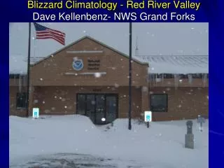
Blizzard Climatology - Red River ValleyDave Kellenbenz- NWS Grand Forks
Methodology and Motivation • Looked at blizzard events in the FGF CWA from the 1974-75 winter season through 2011-2012 winter season • Took all blizzard events from Storm Data and broke them into different synoptic categories • Colorado Low, Alberta Clipper, Arctic Front, Hybrid and valley wind event • Then used NCAR/NCEP reanalysis page to produce composite mean charts • Also computed average wind values and mixed layer wind values for all events
Area of study Grand Forks NWS County Warning Area (CWA)
Blizzards in FGF CWA • 85 blizzards in the FGF CWA since 1974-75 winter or 38 winter seasons (through 2011-2012 winter season) • 2.2 blizzards per year on average • Most blizzards were in 1996-97 winter with 10! • 4 winters with no blizzards 2011-2012, 90-91, 86-87 and 78-79 - about 1 out of every 10 years no blizzard (11%) • Big gap from 90-91 to 11-12 season, 21 years!
No blizzards 2011-2012 winter, first year since 1990-91 season, 21 years!
Colorado Lows (CL) • 30 total - most common • Most occur in March (9) • 4 out of 6 total blizzards in November, so if a blizzard in Nov, most likely a CL • All 5 blizzards in April are Col. Lows
500mb 1 Day before CL 1 days before CL
500mb Day of CL Day of CL
SLP 1 day before CL 1 day before CL
SLP Day of CL Day of colorodo lows slp
SLP 1 Day after CL 1 day after CL SLP
Hybrid Blizzards (21) • Classified into Montana, Wyoming, Central Plains, inverted trough and Dakota’s low • Most hybrids in Jan (7) • All 3 blizzards in October are Hybrids
500mb 1 day before Hybrid 1 day before
500mb day of Hybrid Day of Hybrid blizzards
500mb 1 day after Hybrid 1 day after
SLP 1 day before hybrid Slp day before hybrid
SLP day of hybrid SLP day of hybrid • Sfc low deepens
SLP day after hybrid Slp day after
Alberta Clipper (19) • Most occur in Jan (7) • 17 of 19 occur in Dec, Jan and Feb • Produce less snow but enough with winds behind cold fronts to produce blizzard conditions
500mb 1 day before clipper Day before clipper
500mb day of clipper Day of clipper 500mb
500mb 1 day after clipper Day after clipper 500 mb
SLP day of clipper SLP day of clipper
SLP 1 day after clipper 1 day after clipper slp
Arctic Front (AF) • 12 events, most occur in Jan (4) and Feb (4) • Usually low precipitation (ground blizzard) conditions with T-3 inches of snow • Strong low level CAA and pressure rise maximum
500mb day of AF 500mb Arctic fronts day of
500mb 1 day after AF Day after AF 500mb
925 mb day of AF 925mb temp day of AF
925 mb 1 day after AF Day after AF 925mb
SLP day of AF Day of AF SLP
SLP 1 day after AF Day after AF slp high building in from nw
Valley Wind Events (3) • 2 occurred in Dec and 1 in Jan • Characterized by strong press gradient with southerly or northerly winds • Must have snow on ground though
Average Wind Values for Blizzards For all blizzard event types (85) (Colorado Lows, Hybrids, Alberta Clippers, Arctic Fronts and Valley Wind Events. Looked at RAOBs from BIS/ABR/MPX and INL and sfc reports from GFK for each event. • 925mb = 38kt • 850mb = 44kt • 700mb = 42kt • Mixed Layer 888 mb with 43kt in mixed layer • Average Max surface gust at GFK 39kt • Average surface wind direction 343 degrees
Conclusions • 26 out of 30 blizzards occurring in Oct, Nov, March or April are Colorado Lows or Hybrids. • All blizzards in Oct are hybrids and CL in April • Most blizzards occur from Dec-Mar. - 84% • Each blizzard event is different, and not all are the same
References • Becky Kern (Griffis) research on blizzards • Brad Bramer for providing many cases and insight • Storm Data Thank you David.Kellenbenz@noaa.gov