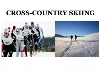
Beginning Cross Country
380 likes | 410 Vues
This presentation covers the basics of cross country soaring, including speed-to-fly, off-field landings, farmer relations, instrumentation, navigation, weather, crewing, official observers, retrieving, checklists, FAI rules, tasks, ABC/Bronze badges, final glide calculations, GPS/cameras, thermalling techniques, and accident prevention. It provides a plan of action to develop the necessary knowledge and skills for successful cross country flights.

Beginning Cross Country
E N D
Presentation Transcript
Beginning Cross Country Thomas Knauff Ridge Soaring Gliderport Julian, Pa 16844 www.eglider.org
Things you need to know. • Speed To Fly. • Off Field Landings. • Farmer Relations. • Assembly/Disassembly. • Instrumentation. • Navigation. • Chart Reading. • Weather. • Crewing. • Official Observers.
Things you need to know 2. • Retrieving. • Checklists. • FAI Rules. • Tasks.. • ABC/Bronze Badges. • Final Glide Calculations. • GPS / Cameras. • Thermalling Techniques. • Accident Prevention.
Reading Time Total Required Reading Time = 7 hours +.
This presentation will cover the simple basics & give you a plan of action.
Develop A Plan Of Action • Gain the Knowledge. • (What do I need to know?) • Develop Skills. • A Workable Flight Plan.
Where To Get The Info • Subject • Thermalling. • Final Glide. • Off Field Landings. • Farmer Relations. Textbook • After Solo. • Transition To Gliders. • New Soaring Pilot. • Cross Country Soaring. • Soaring Cross Country.
You will need a small library of text books. These are my favorites, although there are others. Each author has their own style and each book has unique information. The more information you have, the more efficient and safe you will be. More book suggestions follow:
Where To Get The Info • Subject • Navigation. • Instrumentation. • ABC/Bronze. • Weather. • Decision Making. Textbook • Understanding The Sky. • Badge & Record Book. • Accident Prevention Manual.
Where To Get The Info Subject • Aeronautical Charts. • Regulations. • Textbook • Airspace For Glider Pilots CDROM. • FAR’s For Glider Pilots. • Aeronautical Chart User’s Guide. • Pilot’s Handbook of Aeronautical Knowledge.
Some of the suggested material is specific to USA airspace and regulations.
Armed With Knowledge You Are Ready For The Next Step. • Develop Skills.
Developing Skills • Earn the ABC & Bronze badges. • Fly a single place glider. • Prove you can stay up with several sustained flights of more than 2 hours. • Prove you can accurately land in a restricted area with no reference to the altimeter.
Earn Your Badges • A Badge = Solo Skills. • B Badge = Soaring. • C Badge = Cross Country Knowledge. • Bronze Badge = Off Field Landing Skills.
The USA Bronze Badge requirements are different from other countries. Specifically, the USA Bronze Badge targets off field landing skills.
Before Cross Country Flights Assumptions • You have learned to identify, enter and climb in thermals. • You can enter landing patterns from various directions. • You have completed the “Accident Prevention Manual” workbook. • You will choose a good soaring day.
The “Glider Pilot Accident Prevention Manual” is an important judgment training concept developed by several agencies and colleges. It helps all pilots fly safer by emphasizing important decision making concepts. It is a workbook all pilots should be familiar with.
Fly A Local Task Plan a 50 km triangle with equal legs with the gliderport in the center of the triangle. 17 km 17 km X 17 km
You can use a camera or GPS data logger for flight analysis.
Fly Local Task You are never more than 10 km (6 Miles) from the gliderport. 17 km 17 km X Little, or no wind! 17 km
Local Task Assuming a 30:1 glider (Schweizer 1-34.) 5280 = 176 ft per mile X 6 = 1,056 feet. 30 1,056 feet, plus pattern altitude (1,000 feet) plus safety margin (1,000 feet) = 3,056 feet.
Flying A Local Task If you are a reasonable person, you would not consider flying cross country if you could not maintain a minimum height of 3,056 feet AGL. As you fly the task, if you lose altitude to 3,100 feet, return to the gliderport!
If There Is Wind You must do the computation. However, would you reasonably fly in a strong wind? No!
10 kt wind computation GAG = GAA Airspeed +/- wind Airspeed GAG = 30 50 – 10 = 24 50 5280= 220 feet per mile 24 6 X 220 = 1,320 feet. 264 feet higher during the task.
GAG = Glide Angle over the Ground. GAA = Glide Angle in the Air.
LOCAL TASKWith 10 Knot Wind Assuming a 30:1 glider (Schweizer 1-34.) 220 ft per mile X 6 = 1,320 feet. 1,320 feet plus pattern altitude (1,000 feet) plus safety margin (1,000 feet) = 3,320 feet minimum.
Task setting. Entering Thermals. Thermalling. Speed To Fly. Cloud Reading. Confidence. Navigation. Turnpoint Photos. GPS Logger Use. Cockpit management. Judgment! What You Will Learn
Get Help • Ask flight instructor to help with task area. • Fly over friendly terrain. • Have “What if,” plans of action.
“What If” Plans of Action. • Abandon attempt. • Return to gliderport. • Go to other nearby airport. • Go to known good landing field.
Next Task • Larger Triangles. • A 100 km equilateral triangle has the apex some 17 miles away. • Using the same formula with a 10 knot wind, you would have to maintain a minimum altitude of 5,740 Ft AGL.
It Can Be Easy! • At many soaring sites, a 6,000 ft cloud base is common on good soaring days. • If there are other airports along the route, the minimum altitude required may not be so high as long as you are willing to commit to a landing at another airport.
100 Km Triangle 33km X 17km radius X X X X = Airport
Look At This! • If you can get to 6,000 feet, and the winds are ten knots or less . . . • You need 5,740 feet to travel 17 miles into a 10 knot headwind. • S O O O O. . . .
Silver DistanceOn A 6,000 Ft Day. 17 miles 17 miles X 34 miles 34 miles = More than Silver Distance!
Silver distance (50 km) can be straight out, out & return, or the long leg of a triangle as shown.
Be Reasonable • Few people care if you have your badges or fly cross country. • It’s only important to you.
However • Should you have an accident because of foolish, immature behavior, you will lose respect of others.