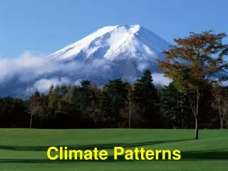
Climate Patterns Lab
Climate Patterns Lab. Earth Science Climate Modified by Mrs. Costanza. Climate vs Weather. Climate – overall view of a region’s weather conditions over long periods of time Weather – short term conditions of the atmosphere. Climate. 2. A regions average temperatures and precipitation.

Climate Patterns Lab
E N D
Presentation Transcript
Climate Patterns Lab Earth Science Climate Modified by Mrs. Costanza
Climate vs Weather • Climate – overall view of a region’s weather conditions over long periods of time • Weather – short term conditions of the atmosphere
Climate • 2. A regions average temperatures and precipitation
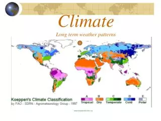
What are factors that influence climate type? • Latitude • Elevation • Mountain Barriers • Ocean Currents • Prevailing Winds • Large Bodies of Water
7-9. Average Annual World Temperatures What is the relationship between Latitude and Average Annual Temperature?
10-11. Altitude and Temperature Which area of New York State is coolest? Why?
Orographic Uplift and Rain Shadows On your mountain diagram draw an arrow showing wind direction. Label wet, dry, windward, leeward, adiabatic cooling, adiabatic heating.
Average Precipitation in the Western United States Humid & Cool Arid • Please draw/mark the following on your map: • Cascade and Sierra Nevada Mountains in black • Humid Area in Blue • Dry Area in Brown
Ocean Temperatures of the Atlantic 60o North America 30o Africa 17. Is there warm water or cool water coming of the East coast of the North America? 0o South America
18. What are three things that determine ocean current direction? • A. Surface winds • B. Density differences • C. Rotation of the earth