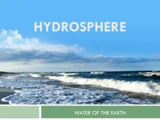
Hydrosphere
Hydrosphere. Surface Water and the Water Cycle. Goals for This Unit. Explain the structure and processes within the hydrosphere Explain how water is an energy agent (currents and heat transfer) understand the role of water in weather and atmospheric change

Hydrosphere
E N D
Presentation Transcript
Hydrosphere Surface Water and the Water Cycle
Goals for This Unit Explain the structure and processes within the hydrosphere • Explain how water is an energy agent (currents and heat transfer) • understand the role of water in weather and atmospheric change • use concepts of fluid density to describe global water movement and ocean currents and their effect in distributing heat around the globe • Explain how ground water and surface water interact • understand the concepts and dynamics of river systems with emphasis and examples drawn from NC river systems • list and describe common methods used to conserve both water quantity and quality
The Water Cycle • A never-ending natural circulation of water through Earth’s systems powered by the Sun
Steps of the Water Cycle • Precipitation – rain, snow, hail, sleet • Runoff or ground seep • Reservoir – living things, snowfields, glaciers, lakes, oceans • Evaporation – from land or bodies of water • Transpiration • Condensation
Runoff V/S Ground Seep • Vegetation • more vegetation = more ground seep • less vegetation = more runoff • Rate of Precipitation • lighter rainfall = more ground seep • harder rainfall = more runoff • Soil composition • high humus, coarse particles = more ground seep • low humus, fine particles = more runoff • Slope • flatter slope = more ground seep • steep slope = more runoff
Stream Systems • Some runoff flows into brooks, creeks, streams and rivers that eventually empty into lakes and oceans • Watershed – all the land area whose water drains into a stream system • Stream load – all the materials (living and non-living) that the water in a stream carries • Carried in three ways – solution, suspension, bed load
Solution • When material has dissolved in a stream’s water • Dependent upon the material a stream has passed through • High amounts of calcium carbonate and magnesium • Groundwater provides most of the dissolved load to streams • Expressed in parts per million (ppm)
Suspension • Particles small enough to be held up by the turbulence of a stream’s moving water • Dependent upon volume and velocity of the stream • Faster moving water = larger particles
Bed Load • Sediments too large or heavy to be held up by turbulent water • Consists of sand, pebbles, cobbles that are rolled and pushed along the stream bed • Abrasion – particles rubbing and scraping against one another as they tumble in the water • Erodes not only sediments in water but also sides and bottom of stream itself
Stream Carrying Capacity • Amount of material a stream can transport • Depends upon velocity and amount of water moving in the stream • Affected by channel slope, depth and width • Discharge – measure of the volume of stream water that flows over a particular area within a given period of time • Discharge(m3/s) = width(m) X depth(m) X velocity(m/s) • As discharge increases carrying capacity increases • Impacted by heavy rain, flooding, rapid melting of snow
Floods • Floodplain – broad, flat area extending out from a stream’s bank that is covered by excess water during times of flooding • As flood water recedes it deposits sediments in the floodplain that develop highly fertile soil • Upstream flooding – local • Downstream flooding - widespread • Monitoring of streams is provided by the National Weather Service, weather satellites and the US Geological Survey (USGS)
Water Cycle Project • Please draw the water cycle • Criteria • Must be accurate • Must be neat • Must be on plain paper • Must be colored • DUE Tuesday 25 September
Hydrosphere Stream Development
A Stream is Born • Precipitation provides the water for the beginnings of stream formation • Headwater – region where water first accumulates to supply a stream • Stream channel – narrow pathway carved into sediment or rock by stream waters • Stream capture – when a stream erodes the area separating two drainage basins, joins another stream and then draws away its water
Stream Valleys • V-shaped channels caused by erosion from streams • Grand Canyon, Colorado River • Streams continue to erode until they reach their base level, the point where they enter another stream or body of water • Lowest possible base level is the ocean • Eventually v-shaped valleys erode into broader valleys with gentle slopes
Meandering Streams • Meander – bend or curve in a stream channel • Velocity differences • Straight stream: fastest in the center, slower on the sides and bottom • Meander: fastest along the outside of a curve, deposition occurs on inside of curve where water slows • Over time meanders become more accentuated • Mouth – area of a stream that empties into another body of water
Sediment Deposition • Occurs as streams slow (lose velocity) • Alluvial fan – occur when mountain streams flow into broad, flat valleys • Usually found in dry, mountainous regions • Usually composed mostly of sand and gravel • Delta – occur when streams join larger bodies of quiet water • Usually form a triangle shaped deposit • Usually composed of silt and clay particles
Stream Rejuvenation • Downcutting – wearing away of a streambed • Stops when a stream reaches its base level • Rejuvenation – occurs when downcutting resumes due to land uplift of the stream bed or lowering of the base level • Creates v-shaped valleys • In meanders, creates deep sided canyons
Hydrosphere Lakes and Freshwater Wetlands
Lakes • Form from many sources • Streams, runoff, local precipitation, springs, etc • Created two ways • Man Made • Ponds – livestock, fish supplies, attract wildlife • Reservoirs – stores water for human use • Naturally Formed • Oxbow • Landslides • Remnants of prehistoric lakes • Glaciers • Dissolved limestone
Glacier Lakes • Moraine-dammed • Form when glacial moraines dam some depressions and restrict outward flow of water • Cirque • Form when cirques that are carved out by high valley glaciers fill with water • Kettle • Form when water fills depressions left by blocks of ice from melting glaciers
Changing Lakes • Exist for long periods of time as long as the supply of water is more than what is removed by evaporation and human use • Some only exist during times of heavy rains • Over time (100,000+ years) will eventually fill with sediment and become part of the landscape
Eutrophication • Process by which lakes become rich in nutrients from the surrounding watershed, which results in a change in the kinds of organisms in the lake • Photosynthesis (plants) add oxygen and waste products to the lake • Animals in the lake use the oxygen and add their waste to the lake • Decay of dead animals and plants also uses dissolved oxygen supplies • Amount of dissolved oxygen helps determine the health of a lake and if it can support life
Rates of Eutrophication • Increases with addition of nutrients • Nitrogen and phosphorus from fertilizer • Animal wastes • Phosphate detergents • Release of toxins from industry and untreated sewage • Additional nutrients causes excessive algae to grow • Causes organisms that eat the algae to multiply • Overpopulation and decay of large numbers of plant and animals consumes the oxygen supply • The lake eventually dies
Freshwater Wetlands • Land area covered with water most of the year • Include bogs, marshes, swamps • Have certain soil types that support specific plant species
Bogs • Receive water only from precipitation • Soil is waterlogged • Rich in sphagnum (peat moss) • Peat moss breakdown produces acid • Acidic soil supports unusual plant species • Pitcher plants • Sundew • Venus flytrap
Marshes • Common along the mouths of streams and in areas with large deltas • Constant supply of water • Shallow roots of marsh grasses allow for capture of silt and mud that slows water flow and expands the marsh • Diverse wildlifeand plants • Birds, fish, reeds, grasses, sedges and rushes
Swamps • Low-lying areas often near streams • May develop from marshes as they fill-in • Support the growth of larger plants such as trees and bushes • Because of increased shade, marsh grasses begin to die • Present day coal reserves were once swamps 250 million years ago
Importance of Wetlands • Help improve water quality • Trap pollutants, sediments, pathogenic bacteria • Provide vital habitat for migratory water birds and other wildlife • Between 1700 to 1985 the US lost 50% of its wetlands • Wetlands are often filled-in to make space for people • New York City (Queens, Brooklyn) • New Oreleans • Washington, DC