Download
1 / 5
50 likes | 184 Vues
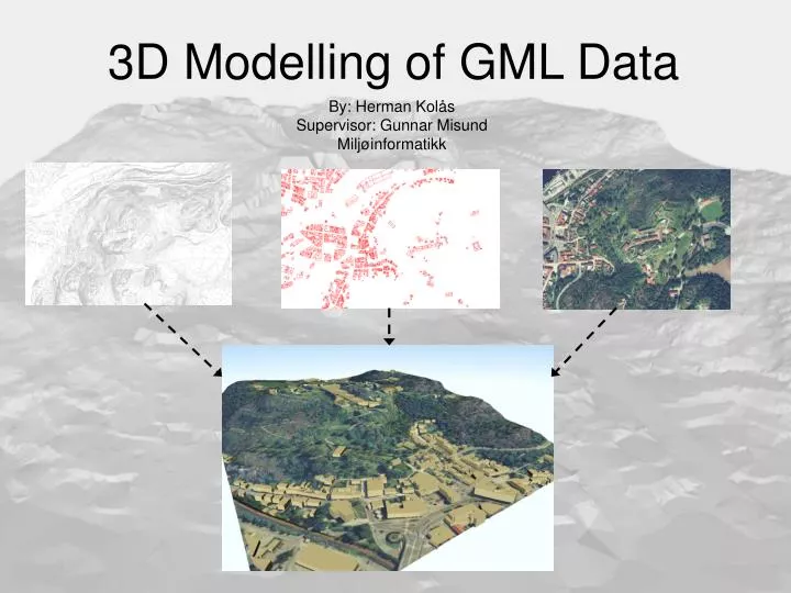
3D Modelling of GML Data. By: Herman Kolås Supervisor: Gunnar Misund Miljøinformatikk. Making Visualization 1. Import of SOSI Data The original data for the terrain are stored on SOSI format and must be imported. Triangulization

E N D
3D Modelling of GML Data By: Herman Kolås Supervisor: Gunnar Misund Miljøinformatikk
Making Visualization 1 Import of SOSI Data The original data for the terrain are stored on SOSI format and must be imported. Triangulization The next Step in the process is to make triangulization from those data to be able to make the elevationgrid.
Making Visualization 2 Elevation Grid From the triangulization the elevation grid is approximated. Texture from Orthographic Photo The elevation grid allow the use of orthographic photo as texture.
Making Visualization 3 Apply LOD to Terrain The final step for the terrain is to split the grid into smaller bits, to make the model lighter. Add Buildings From SOSI When the terrain is done, the data for the buildings are imported into the model.
Final Result Model of Fredriksten Fortress with buildings, texture and LOD.