Download
1 / 6
60 likes | 183 Vues
Seismic Noise Tests: Bayou Corne , LA, USA Juan M. Lorenzo Louisiana State University. Bayou Corne and environs. Site 2. Site 1. Preliminary summary-analysis of seismic noise tests at Bayou Corne , LA; conducted: 9-22-12 to 9-23-12.

E N D
Seismic Noise Tests: Bayou Corne, LA, USAJuan M. LorenzoLouisiana State University
Bayou Corne and environs Site 2 Site 1
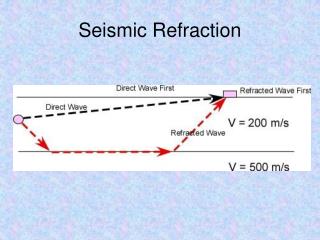
Preliminary summary-analysis of seismic noise tests at Bayou Corne, LA; conducted:9-22-12 to 9-23-12 • Goal: To locate aquifer sands, which could be charged with free gas. • What we know: Shear-wave data indicate the tops of two prominent reflector bodies (A and B). The shallower body (“top A”) lies at 7-10 m below the surface and the deeper body (“top B”) at ~40-50 m below the land surface. • What we do not know: gas content at the two sites. • What we think we know: Reflector B corresponds to the top of aquifer sands and lies at a shallower depth (~42 m) east of Bayou Corne than west of Bayou Corne ( ~47 m). • Recommendations: S-wave surveys (not sound-waves) will be more successful than P-wave (sound) surveys at imaging the shallow sand bodies in the area. Seismic results should be cross-checked with available geological and geotechnical information. • Warning (s): Buried sand bodies are likely to change their thickness and depth considerably across the area so that the two “seismic borings” shown here should not be linearly interpolated with complete confidence.
Representative shear wave (not sound wave) dataSite 2- (DugasLe Blanc-1 property) Distance between source and geophones (m) Reflector A ~10 m depth Reflector B ~43 m depth Technical note: Field data are displayed with a constant rms amplitude and using an “all-pass” filter. Maximum source-receiver offset is 192 m. Refracted SH Love TWTT (s)
Velocity-versus-depth profiles at Site 1, S of route 70 and W of Bayou Corne (Triche-1 property) Technical notes: Velocity values, derived using semblance velocity analysis (dashed line) help confirm best-matched forward ray-trace models (continuous bold line). WT marks the interpreted top of the water table.
Velocity-versus-depth profiles at Site 2N of route 70 (Dugas-Le Blanc-1 property) Technical note: Velocity values, derived using semblance velocity analysis (dashed line) help confirm best-matched forward ray-trace models (continuous bold line). WT marks the interpreted top of the water table.