Download
1 / 24
240 likes | 357 Vues
This study explores the factors influencing residential land values in Garfield County, evaluating how rural industrialization affects property values. It presents a three-phase study: data collection, statistical analysis, and evaluation of solutions and mitigation strategies. Using hedonic regression analysis, 20+ property variables were tested to understand their impact on property value, including land, structural, and locational characteristics. Results show significant influences on value variation, providing a basis for understanding the economic impacts of gas drilling and other industrial activities.

E N D
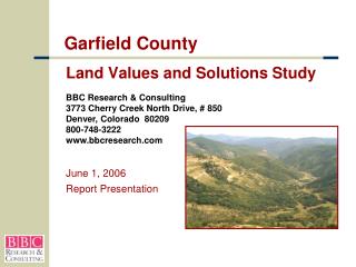
Garfield County Land Values and Solutions Study BBC Research & Consulting3773 Cherry Creek North Drive, # 850Denver, Colorado 80209800-748-3222www.bbcresearch.com June 1, 2006 Report Presentation
Two Economic Studies Are Underway The Economic Impact Model The Land Values and Solutions Study Introduction
Land Values Study: Project Objectives • Demonstrate what factors drive residential land values in Garfield County. • Document how rural industrialization (gas, gravel, power lines, etc.) affects the value of residential property. • Offer mitigation strategies for situations where value losses occur.
Land Values Study: Three Phases Phase I. Data Collection and Analysis Phase II. Statistical Analysis and Conclusions Phase III. Solutions and Mitigation Evaluation
Phase I: Process • Assembled a data base of 7,600 sales transactions • Unincorporated, residential sales; 1987-04 • Cleaned and added data: gravel roads, geographic features, water & sewer, etc. • Ultimately used 20+ variables per property • Assembled gas drilling and industrial data • Location of power lines, gravel pits, highway, railroads • Location & dates of gas wells • Integrated GIS with Community-Viz mapping software • Analyzed data in light of interviews and anecdotal observations.
Phase II: Statistical Analysis • Meet with committees; revised conceptual approach • Completed Statistical analysis • Tested 20+ property variables • Land characteristics (e.g. size, presence of water) • Location (e.g.; RFRV vs. CRV, distance to town) • Structural characteristics (e.g.; size, age, number of bedrooms) • Determined factors that explain value • Provided a basis for understanding impact on property value and strategies for mitigation
What is Hedonic Regression Analysis • Hedonic regression analysis is a method of explaining demand or prices for a particular good (e.g. a housing unit) by attaching estimates of value to its component characteristics (e.g. size of structure, age, quality of construction) • Why Use? Produces results with statistical authority
Variables Tested for the Property Value Models — Included in Model Land Characteristics: • Presence of “good” vegetation (CRV only) • Size (acreage) • Presence of water features • Presence of outbuildings • Heated space in outbuildings • Central wastewater system (RFV only) Structural Characteristics: • Size of home • New home (less than 10 years old) • Presence of garage (CRV only) • Distance to nearest gravel pit (CRV only) • Gas well completed within 90 days after sale (CRV only) • Gas well completed less than 2 years prior to sale (CRV only) • Gas well completed more than 2 years prior to sale (CRV only) Locational characteristics/ industrial proximity • Distance from Glen. Sprgs. (CRV only) • Distance from Pitkin County (RFV only) • North of Colorado River (CRV only) • View of Mt. Sopris (RFV only) • Distance to nearest paved road Value appreciation over time: • Increase in value per acre by year • Increase in value per square foot by year
Variables Tested for the Property Value Models — Tested and Rejected • South facing percentage • All flat terrain Land Characteristics: Structural Characteristics: • Number of bedrooms • Number of bathrooms • Construction type (e.g., modular, condominium, etc.) • Additional house age groupings (e.g., 10 to 20 years old) • Water system other than a private well Locational characteristics/ industrial proximity • Distance to nearest town • Adjoins Federal land • Distance to I-70 • Distance to railroad • Proximity of high voltage lines • Proximity of land fill
Challenges • Wide variation in property characteristics and locational influences • Value effects across three key dimensions — property characteristics, size and time of sale • Sample sizes diminish with multiple variables • Difficult to measure some key factors • All data sets have some inaccuracies
Results • We can explain influences on property values with a reasonable level of accuracy: • 76% of value variation in Roaring Fork Valley (2,726 observations) (95% confidence level) • 81% of value variation in Colorado River Valley (4,727 observations) (95% confidence level) • Provides a reliable basis for overlaying impacts of gas drilling and other industrial effects.
Industrial Impacts • We tested effects of highways, railroads, gravel pits, power landfills lines and gas drilling • Also tested positive site attributes: vegetation, views, proximity to USFS lands, rivers • Proximity to highways, power lines, landfills and railroads were not proven to have an impact on values • Proximity to gravel pits and gas drilling has an apparent (but not statistically significant) impact on property values
Gas Drilling Data Issues • Gas well permits 5,010 • Operational wells 2,674 • Parcels with operational wells 354 • Valid single parcel sales of parcels with operational wells 140 • Final sample “Well impacts”(less than 160 acres) 32
Well activityat time of Sale Well completed at time of sale Well completedlong before sale $254,736 $271,623 $280,070 Well completed less than 90 days after sale Well olderthan two years (16%) (11%) (8%) Revised Colorado River Valley Property Value Model Total Value = $303,079 Baseline Property: (Average Property With Gas Well)
Generalized Gas Drilling Impact on Property Value in Colorado River Valley Value Loss/Gain Exploration Phase +$100,000 Drilling Phase Completion Phase +$53,000 +$50,000 Typical Residential Change in Value +$25,000 $303,0791 Drill Site Properties Change in Value ($32,000) ($50,000) ($49,000) ($100,000) 1 2 3 4 5 6 7 8 9 10 11 12 13 14 15 16 17 18 19 20 21 22 23 24 25 26 27 28 29 30 31 32 33 34 35 36 Months 1 Typical property with a well — 40 acres, small home, 24 miles from Glenwood.
Generalized Gas Drilling Impact on Property Value in Colorado River Valley Value Loss/Gain Exploration Phase +$100,000 Drilling Phase Completion Phase +$53,000 +$50,000 Typical Residential Change in Value +$25,000 $303,0791 Drill Site Properties Change in Value ($32,000) ($50,000) ($49,000) Perception of Risk Institutional Uncertainty Quality of Life Impacts ($100,000) 1 2 3 4 5 6 7 8 9 10 11 12 13 14 15 16 17 18 19 20 21 22 23 24 25 26 27 28 29 30 31 32 33 34 35 36 Months 1 Typical property with a well — 40 acres, small home, 24 miles from Glenwood.
Generalized Gas Drilling Impact on Property Value in Colorado River Valley Value Loss/Gain Exploration Phase +$100,000 Drilling Phase Completion Phase +$53,000 +$50,000 Typical Residential Change in Value +$25,000 $303,0791 Drill Site Properties Change in Value ($50,000) Impact of Gas Employment Demand ($100,000) 1 2 3 4 5 6 7 8 9 10 11 12 13 14 15 16 17 18 19 20 21 22 23 24 25 26 27 28 29 30 31 32 33 34 35 36 Months 1 Typical property with a well — 40 acres, small home, 24 miles from Glenwood.
Impacts of Gas Drilling: Conclusions • Properties that experience drilling see a reduction in market value, but seemingly temporary • On average, net residential loss of value of about 16% during drilling and about 8% three years after drilling ceases • Anecdotal data suggest: • There is no average well site • Some drilling instances have more severe impacts • Problem compounds with contiguous site operations or multiple drilling • Micro site issues are hard to capture • Recent wells tend to be closer to residential uses
Impacts of Gas Drilling: Conclusions (cont.) • Gas activity also has countervailing positive impacts: • Gas employment drives housing demand • Property lease payments • Site improvements • Tax revenues • Mineral owners have legitimate property rights, which can’t be ignored • Drilling is not locally regulated so operational restrictions are limited
Mitigation Possibilities Institutional Quality of Life Perception of Risk • Education material/seminar • Ombudsman • Recommend cooperative lenders/brokers • Fund property purchase or buy down • Define and enforce best practices • IGA with COGCC • Education • Remedial funds • Insurance • Certification of completeness • Environmental monitoring reporting
Land Values and Solutions StudyInstitutional Changes • Ombudsman/Advocate • Document county land value changes over time • Represent Owners • Clearing House of Information for Appraisers, Realtors and Buyers • Environment Response Agent • Intergovernmental Agreement with COGCC • Lending or Property Purchase
Quality of Life Mitigation Measures • Phase I Exploration • Landowner notification • Negotiated surface damage provisions • Ground water testing • Phase II Drilling and Field Organization • Reasoned environmental protections • Reasoned well-siting practices • Noise and nuisance abatement
Quality of Life Mitigation Measures • Phase III Production and Stimulation • Responsible stimulation techniques • Proper waste disposal • Air and water quality monitoring • Phase IV Abandonment and Reclamation • Certification of proper abandonment • Reclamation with native topsoil and vegetation
Garfield County Land Values and Solutions Study