Working with Point Clouds Understanding Point Clouds
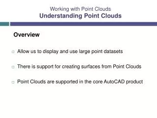
Working with Point Clouds Understanding Point Clouds. Overview Allow us to display and use large point datasets There is support for creating surfaces from Point Clouds Point Clouds are supported in the core AutoCAD product. Working with Point Clouds Understanding Point Clouds.

Working with Point Clouds Understanding Point Clouds
E N D
Presentation Transcript
Working with Point CloudsUnderstanding Point Clouds Overview • Allow us to display and use large point datasets • There is support for creating surfaces from Point Clouds • Point Clouds are supported in the core AutoCAD product
Working with Point CloudsUnderstanding Point Clouds Point Clouds • Scanning is replacing some traditional point by point surveying • Data is richer • Tens of thousands of points collected per second • Detail greater • Some details even difficult for the eye to see • Details that weren’t in the original scope of work may be picked up
Working with Point CloudsUnderstanding Point Clouds LiDAR – Light Detection and Ranging • Aerial –Using Aircraft • Low resolution • Uses Laser scanner • X,Y, Z, intensity • Digital Photography • 100s of millions of points
Working with Point CloudsUnderstanding Point Clouds LiDAR – Light Detection and Ranging • Ground Based – Fixed scanner, typically on a tripod • Higher resolution • Uses Laser scanner • X,Y, Z, intensity • Digital Photography • 10s to 100s of millions of points • Surveyor sets up registration targets
Working with Point CloudsUnderstanding Point Clouds LiDAR – Light Detection and Ranging • Mobile – Moving vehicle • Uses Laser scanner • X,Y, Z, intensity • Digital Photography • Millions to Billions of points
Working with Point CloudsUnderstanding Point Clouds Other forms • Ground Penetrating Radar • Temperature Sensors • Pressure Sensors • Bathymetric Surveys
Working with Point CloudsUnderstanding Point Clouds File formats • LAS (LiDAR standard) • X, Y, Z, intensity, classification • Intensity – materials, reflectiveness • Classification – ground, vegetation, buildings, water • DEM • GeoTIFF • SDTS • ESRI grid files
Working with Point CloudsUnderstanding Point Clouds File formats • ASCII • Comma delimited, csv, etc. • Equipment Specific • Manufactures • Writes data faster
Working with Point CloudsUnderstanding Point Clouds Civil 3D • Database • Indexed • View is driven by Civil 3D styles