Download
1 / 44
440 likes | 624 Vues
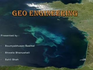
BP Workshop July 17, 2001 GEMINI Geo-Engineering Modeling through INternet Informatics by John Victorine and Lynn Watney Kansas Geological Survey Lawrence, KS. Marty DuBois (petroleum geologist). Data warehouse. POSC-Caesar. Est. 1995. 2001. GEMINI Framework. Significance:

E N D
BP Workshop July 17, 2001 GEMINI Geo-Engineering Modeling through INternet Informatics by John Victorine and Lynn Watney Kansas Geological Survey Lawrence, KS
Data warehouse • POSC-Caesar Est. 1995 2001
GEMINI Framework • Significance: • Technical innovations • Keep Kansas competitive • Web-based business transactions • Incubate entrepreneurial teams • Optimize time and funds • Produce quantitative results • Increase integrated studies • Improve success
Gemini Gemini (Geo-Engineering Modeling through Internet Informatics) is an interactive, integrated Website designed to construct real-time geo-engineering reservoir models. Information assembled form the Website or uploaded by the client (one person or a team) will be analyzed with an extensive suite of web-accessed analytical software using intelligent interfaces and tutorial support to accomplish project development. Project can range from regional to local and span problems from complex to simple. User/Project Work Area Database & Electronic Files Field Level Analysis Well Level Analysis
GeminiWeb Programming • Java Applets • Graphical User Interfaces • Java Servlets • Bridge between Applets and Database & Files • ORACLE Database & Electronic Files • Well Header & Core Library Database Tables • Digital LAS Files
GeminiUser/Project Area Java Applet • Gemini User Creates Personal Work Area on Kansas Geological Survey’s Database. • Gemini User Identifies Region of Interest, i.e. Oil & Gas Well Location and Formation • Gemini User Selects Oil & Gas Wells. • Gemini User Saves their Data and Work in Kansas Geological Survey’s Database.
Well Level Analysis PfEFFER DST Production Well Rock-Petrophysics Profile Field Level Analysis Mapping Cross Section Volumetrics Material Balance GeminiGeo-Engineering Java Applets • Rock Catalog • Fluid Catalog • LAS Plotting
GeminiJava Servlets User Database Tables & Electronic Files
GeminiExamples • User/Project Applet • LAS Plot Applet • PfEFFER Applet • Rock Catalog Applet
GeminiUser/Project Applet - User Login Panelhttp://www.kgs.ukans.edu/Gemini/jrv_test/Gemini.html
Select map variable, select area or zoom into well, select well(s) for analysis
Multi-well Analysis - VolumetricsSelect Regions (Zone) and wells of interest
Volumetrics - supply grid cell and Bodisplays and calculate OOIP Toggle between calculated values Using current default gridding algorithm Tab for each zone
Petrophysics Option Plot/Print LAS File
LAS -- select track, LAS file, curves, and database for annotation
GR Res Ten/Rxo/RT DB Info/Tops
PfEFFER Analysis Select PfEFFER Select PfEFFER icon -- Plot log curves to help identify zones and calculate parameters
Digital Rock Catalog Dynamic comparison of rock properties and correlation to other well data and to other wells Core description - photography - petrography Sedimentology Core analysis - special core analysis
Rock Catalog Database Query and Display Multiple criteria selected
Example: Select well Define data to plot and images to view
GeminiLAS Plot Applet - LAS Plot Annotated with tops and core analysis locations
Reservoir Parameters in Simulation assembled in GEMINI
Opportunities created by GEMINI through Internet access for • geo-engineering modeling • New insights, expand knowledge • Change the way business is conducted • Make the domestic petroleum business enterprise more competitive • Minimize assumptions and interpolations in geo-engineering • Allow client to efficiently assemble project and knowledge base • Respond to client needs as system as system is used