Download
1 / 23
230 likes | 240 Vues
Extract hydraulic geometry from a LiDAR DEM, import into HecRAS, perform 1D flow calculations for arbitrary discharges, and bring variables computed in HecRAS back into the GIS environment.

E N D
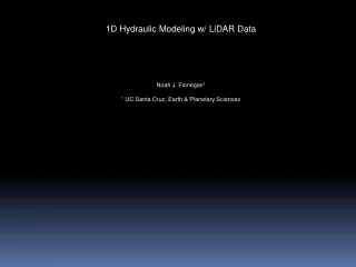
1D Hydraulic Modeling w/ LiDAR Data Noah J. Finnegan1 1 UC Santa Cruz, Earth & Planetary Sciences
Workshop Goal: • Extract hydraulic geometry from a LiDAR DEM • Import this into HecRAS • Perform a 1D flow calculation for an arbitrary discharge or discharges • Take variables computed in HecRAS (for instance, flooded area, mean shear stress, mean velocity) and bring these back into the GIS environment.
Motivation • Using river bed slope to estimate, for example, spatial patterns in rates of river incision or sediment transport implicitly assumes uniform flow, i.e. spatial accelerations in the flow are not allowed.
Motivation • Using river bed slope to estimate, for example, spatial patterns in rates of river incision or sediment transport implicitly assume uniform flow, i.e. spatial accelerations in the flow are not allowed.
Motivation • Using river bed slope to estimate, for example, spatial patterns in rates of river incision or sediment transport implicitly assume uniform flow, i.e. spatial accelerations in the flow are not allowed.
Motivation • Using river bed slope to estimate, for example, spatial patterns in rates of river incision or sediment transport implicitly assume uniform flow, i.e. spatial accelerations in the flow are not allowed.
Motivation • Using river bed slope to estimate, for example, spatial patterns in rates of river incision or sediment transport implicitly assume uniform flow, i.e. spatial accelerations in the flow are not allowed.
Mass Conservation Manning’s Equation
Mass Conservation Manning’s Equation
Mass Conservation Manning’s Equation
Depth to centroid of area L = Reach length So = Bed Slope sin q ~ tan q = So
Depth to centroid of area L = Reach length So = Bed Slope sin q ~ tan q = So
Depth to centroid of area L = Reach length So = Bed Slope sin q ~ tan q = So
![Data Modeling [Comparison of data modeling techniques ]](https://cdn0.slideserve.com/205866/data-modeling-comparison-of-data-modeling-techniques-dt.jpg)