Kansas LiDAR Data Acquisition
Kansas LiDAR Data Acquisition. Data Access & Support Center (DASC). Established by the GIS Policy Board in 1991 Central repository of GIS databases of statewide/regional importance Designated as an National Spatial Data Infrastructure (NSDI) clearinghouse node in 1997


Kansas LiDAR Data Acquisition
E N D
Presentation Transcript
Data Access & Support Center (DASC) • Established by the GIS Policy Board in 1991 • Central repository of GIS databases of statewide/regional importance • Designated as an National Spatial Data Infrastructure (NSDI) clearinghouse node in 1997 • Located at the Kansas Geological Survey at the University of Kansas • Web site – http://www.kansasgis.org
DASC Services • Database archival and distribution • Database development & integration • GIS web application development and hosting • State & Local Government Coordination • Support the Esri Enterprise License Agreement (ELA) for state governement • Technical assistance • Geospatial metadata development assistance • Cartographic development • Promotion of the Kansas GIS Initiative • Development and maintenance of the DASC web site – www.kansasgis.org
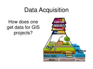
DASC Web Site – http://www.kansasgis.org • Online resource for GIS data, documentation, standards, and web services • Provides access to a variety of web-based mapping applications • Serves as the central hub for the Kansas GIS community
Kansas LiDAR Specifications • Data points are 1.4 meter nominal point spacing • .6 meter horizontal accuracy of bare earth points • 24.5 cm (12.5 cm RMSE) vertical accuracy of bare earth points • Data supports 2 foot contour generation • 1 ft contours with added breaklines
Kansas standard LiDAR data products • Classified Point Cloud in .LAS format • 1-m Bare-Earth DEM in .IMG format • 1-m First-Return DEM in .IMG format • Hydro Polygons in Geodatabase format • Greyscale LIDAR Intensity Return Image in GeoTIFF format • All products in UTM, NAD 83, NAVD 88
File sizes • 2009 - 2010 - 2011 - 2012 LiDAR Project • 5000 x 5000 meter Tiles…aka 5K tiles: • Classified Point Cloud (LAS) – 515 MB • 1-m Bare Earth DEM – 100 MB • 1- m First Return DEM – 90 MB • Hydro Polygons Geodatabase for block – 5 MB • Intensity Images – 10 MB
File sizes • 2006 Kansas LiDAR Project- UTM/StatePlane • 1000 x 1000 meter Tiles…aka 1K tiles: • 2-m Bare Earth DEM(XYZ) – 7.2MB • 2-m All Returns(LAS) – 12MB • Intensity Images(TIFF) – 2.8MB • 2-m County HillShade – 353MB
LiDAR Development in Kansas • Project availability: • 2006 – available online • 2009 – available online • 2010 – available online • 2011 – available online • 2012 – coming soon • 2013 – under development
2012 LiDAR Partners • Natural Resources Conservation Service (NRCS) • Kansas Dept of Agriculture • US Army Corps of Engineers • US Geological Survey • Kansas GIS Policy Board • Kansas Dept of Transportation • Bourbon County • Crawford County • Wyandotte County • Groundwater Management District 3
How to acquire LiDAR data from DASC DASC Data Catalog: http://www.kansasgis.org/catalog Select Elevation category Select project year and navigate on interactive map to area of interest Note: data download requires user to setup a free user account
How to acquire LiDAR data from DASC Go into the GIS Resources section of the web site and select the Elevation & LiDAR Resource Center In the resource center, you can view Terms & Definitions, information about current and upcoming projects, and view the interactive map with download links
How to acquire LiDAR data from DASC • Coming soon…LiDAR-based map services available via DASC data catalog • Similar to accessing DASC’s collection of aerial imagery map services, you will be able to view elevation and hillshademap services within Esri Desktop software, or integrate these services into web-based applications • Map services will allow you to view and query spot elevations in a seamless format, without downloading the individual 5K tiles
How to acquire LiDAR data from DASC LiDAR Mosaic Dataset in Projection WebMercator in Feet
How to acquire LiDAR data from DASC LiDAR Mosaic Dataset Hillshade
Questions? • Brent Miller • DASC GIS Specialist • 785-864-2130 • bmiller@kgs.ku.edu • Ken Nelson • KGS GIS Services/DASC Manager • 785-864-2164 • nelson@kgs.ku.edu • Ivan Weichert • Geographic Information Officer • 785-296-0257 • Ivan.weichert@ks.gov