Download
1 / 73
780 likes | 1.15k Vues
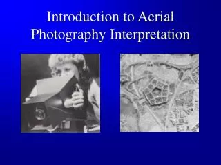
Lecture 4 Photographic Systems, Aerial Photography, and Image Interpretation 11 September 2008. Reading Assignment. Campbell, Chapters 3 (3.1-3.8) and 5 (5.1 to 5.11) Unless otherwise noted, all images in this lecture are from

E N D
Lecture 4Photographic Systems, Aerial Photography, and Image Interpretation11 September 2008
Reading Assignment • Campbell, Chapters 3 (3.1-3.8) and 5 (5.1 to 5.11) Unless otherwise noted, all images in this lecture are from • Jensen, J.R., Remote Sensing of the Environment - An Earth Resource Perspective, 544 pp., Prentice Hall, Upper Saddle River, NJ, 2000.
Lecture 4 Outline and Key Points • Components of a camera system • Collection of aerial photographs • Categories of aerial photographs • Photogrammetry • Definition of image interpretation • Reasons for using image interpretation • Key elements of image interpretation
Early pioneers in photography Joseph Niepce – 1826 • Created first photographic image in France • Used a camera obscura, exposed the scene for 8 hours • Photographic plate was made of pewter and was coated by bitumen suspended in lavender oil • Bitumen is a tar like substance found in crude oil – today it is used in roofing tar and asphalt pavement • When exposed to light, bitumen/oil hardened and adhered to the pewter plate • Non-hardened areas washed away
Figure 5 Emulsion layer Base layer Anti-halation layer
Film Layers • Emulsion layers – contain light sensitive particles (silver-halide crystals) suspended in gelatin • Base or support material (polyester or cellulose acetate) • Anti-halation layer – absorbs all light that gets through first two layers to prevent reflection back into the emulsion
Additive Color Theory • Based on three primary colors (red, green, blue) • When added together, these three primary colors produce white light • ACT is the basis for human vision and photographic systems
Photographic films Color films have 3 emulsion layers – filters are used to expose the emulsion layers to different regions of the EM spectrum 0.4 to 0.5 m: blue region of the EM spectrum 0.5 to 0.6 m: green region of the EM spectrum 0.6 to 0.7 m: red region of the EM spectrum 0.7 to 1.1 m: near infrared region of the EM spectrum
Lecture 4 Outline and Key Points • Components of a camera system • Collection of aerial photographs • Categories of aerial photographs • Photogrammetry • Definition of image interpretation • Reasons for using image interpretation • Key elements of image interpretation
Figure 6 Aerial metric camera
Invention of Digital Cameras • Throughout most of the 20th century, aerial camera systems used film to record information • Aerial cameras used black and white, color and color-IR film to record data • This changed in 1986, when Kodak invented the first charged couple device that was capable of sensing and recording an entire photographic image • The first digital camera recorded 1.4 million picture elements (pixels) in a 5 by 7 inch format • Now, digital aerial camera systems are quite common
Figure 7 Digital Aerial Camera System from Vexcel Corp.
Figure 9 One can alter the focal length of the lenses used in a camera system to vary the area of coverage of the system
Focal Length • Focal length (f) – is the distance, when the lens is focused on infinity from the center of the lens to the film or focal plane where the image is in focus • Wide angle lenses, have short focal lengths • Telescopic lenses have longer focal lengths • Area of coverage ~ 1 / f
Relationship between aircraft altitude and ground coverage – two ways to change FOV • Changing the focal length of the camera lens will alter the angular coverage of the system – as the focal length gets smaller, the angular coverage increases • As the angular cover increases (focal length decreases), the FOV increases Figure 23
Relationship between aircraft altitude and ground coverage – two ways to change FOV Changing the aircraft altitude will alter the ground coverage of the system
Lecture 4 Outline and Key Points • Components of a camera system • Collection of aerial photographs • Categories of aerial photographs • Photogrammetry • Definition of image interpretation • Reasons for using image interpretation • Key elements of image interpretation
Categories of Aerial Photographs • Vertical Photograph • Camera optical axis < 3° off vertical • Low-Oblique • Camera optical axis > 3° off vertical • Horizon not in image • High Oblique • Camera optical axis > 3° off vertical • Horizon in image
Lecture 4 Outline and Key Points • Components of a camera system • Collection of aerial photographs • Categories of aerial photographs • Photogrammetry • Definition of image interpretation • Reasons for using image interpretation • Key elements of image interpretation
What is Photogrammetry? • The science of making accurate measurements by means of aerial photography • Requires development of specific skills • Photomensuration • Techniques used by interpreters to obtain quantitative information from aerial photographs
What is Photogrammetry? • Analogue photogrammetry • Visual interpretation using hard copy (photographs or transparencies) • Digital or analytical photogrammetry • Computer analysis on digitized photography
For More Background • Collection of aerial photography – Section 3.9 to 3.14 • Photogrammetry – Sections 5.12 to 5.14
Lecture 4 Outline and Key Points • Components of a camera system • Collection of aerial photographs • Categories of aerial photographs • Photogrammetry • Definition of image interpretation • Reasons for using image interpretation • Key elements of image interpretation
Image/Photo Interpretation • The examination and analysis of images for the purpose of identifying objects and features and judging their importance
Lecture 4 Outline and Key Points • Components of a camera system • Collection of aerial photographs • Categories of aerial photographs • Photogrammetry • Definition of image interpretation • Reasons for using image interpretation • Key elements of image interpretation
Why is image interpretation such an important tool? • Represents the fundamental process for human (visual) analysis of remote sensing imagery • Provides a unique spatial observation perspective • Provides information that cannot easily be obtained in other ways • Provides ability to do accurate mapping, including 3-D information • Can provide information beyond our visual perception range • Allows for change detection analyses of specific regions where satellite data are not available
AVHRR Image of land and sea surface temperature from thermal IR radiance measurements Red – warmest Orange Yellow Green Blue Purple - coldest Image from -http://rs.gso.uri.edu/amy/avhrr.html
Why is image interpretation such an important tool? • Represents the fundamental process for human (visual) analysis of remote sensing imagery • Provides a unique spatial observation perspective • Provides information that cannot easily be obtained in other ways • Provides ability to do accurate mapping, including 3-D information • Can provide information beyond our visual perception range • Allows for change detection analyses of specific regions where satellite data are not available
Unique perspective of aerial imagery – the aerial/regional perspective • While human vision provides a unique perspective, it is a limited perspective • Humans primarily observe the world from a limited, ground-level view –vertical perspective • Aerial platforms allow the viewing of an area from a more synoptic, horizontal perspective
Why is image interpretation such an important tool? • Represents the fundamental process for human (visual) analysis of remote sensing imagery • Provides a unique spatial observation perspective • Provides information that cannot easily be obtained in other ways • Provides ability to do accurate mapping, including 3-D information • Can provide information beyond our visual perception range • Allows for change detection analyses of specific regions where satellite data are not available
Lillesand and Kiefer 2000 Figure 4.32
Why is image interpretation such an important tool? • Represents the fundamental process for human (visual) analysis of remote sensing imagery • Provides a unique spatial observation perspective • Provides information that cannot easily be obtained in other ways • Provides ability to do accurate mapping, including 3-D information • Can provide information beyond our visual perception range • Allows for change detection analyses of specific regions where satellite data are not available
Stereoscopic viewing • Can create a 3-D view using aerial photographs collected from slightly different vantage points • Using a stereoscope, allows an interpreter to view the earth’s surface in three dimensions • Extremely valuable for interpreting landforms and other 3-D features • Stereoscopic imagery can be processed to generate accurate 3-d maps (e.g., accurate in the x,y,z dimensions) of the earth’s surface
Why is image interpretation such an important tool? • Represents the fundamental process for human (visual) analysis of remote sensing imagery • Provides a unique spatial observation perspective • Provides information that cannot easily be obtained in other ways • Provides ability to do accurate mapping, including 3-D information • Can provide information beyond our visual perception range • Allows for change detection analyses of specific regions where satellite data are not available
Why is image interpretation such an important tool? • Represents the fundamental process for human (visual) analysis of remote sensing imagery • Provides a unique spatial observation perspective • Provides information that cannot easily be obtained in other ways • Provides ability to do accurate mapping, including 3-D information • Can provide information beyond our visual perception range • Allows for change detection analyses of specific regions where satellite data are not available