Tapping into New Technology
This presentation by Janet Hatfield, Program Assistant for the Inyo-Mono Region, explores the integration of technology in sharing vital geographical data. It discusses lessons learned regarding effective data communication to target audiences and highlights the utility of ArcGIS Online in mapping water resources. By examining strengths, such as user-friendly interfaces and ease of access, alongside limitations, such as feature limits and subscription costs, this session provides a balanced view on leveraging ArcGIS for environmental data sharing and decision-making.
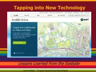

Tapping into New Technology
E N D
Presentation Transcript
Tapping into New Technology Lessons Learned from the Eastside Janet Hatfield - Program Assistant Inyo-Mono Region
If the results are not communicated to their intended audience? How useful are these analyses?
Nuts & Bolts behind the Map Data from a simple Excel file...made this map!
A Closer Look at Priority Watersheds as determined by the USFS Watershed Condition Framework Read more about the Watershed Condition Framework @ www.inyomonowater.org/library
Projects like Forest to Faucets provide us with a multitude of useful indices!
http://www.fs.fed.us/ecosystemservices/FS_Efforts/forests2faucets.shtmlhttp://www.fs.fed.us/ecosystemservices/FS_Efforts/forests2faucets.shtml
ArcGIS Online......Strengths • Accommodates multiple input data types • Easy to configure pop-up functionality • Rich selection of Basemaps • Basic interactive web tools provided • Measure • Print • Query • Find • Limited Editing
ArcGIS Online......Strengths • No programming skills needed • Intuitive functionality • Temporal mapping capabilities • Put tools in the hands of Non-GIS users • Multiple Map Viewing Options (fully integrated) • ArcGIS Explorer, Desktop, Online • Makes sharing spatial information extraordinarily easy!
Other ArcGIS Online Water Data Annual Minimum Depth to Water Table: ESRI/NRCS/SSURGO
Other ArcGIS Online Water Data Dominant Soil Hydrologic Group - NRCS
Other ArcGIS Online Water Data NHD- Surface Water & NHD(plus) Catchment Data- EPA
Other ArcGIS Online Water Data Annual Evapotranspiration Rates - University of MT/ESRI
ArcGIS Online......Limitations • Not an analysis tool • 1,000 feature limit • Some data only displays at limited scales • Limited space for personal accounts • Expensive Subscription Fees
ArcGIS online makes life Easy! Easy to learn! Easy to understand! Easy to use! Easy to share! Easy to configure! Easy to teach! Cost effective! Time efficient!
Get Started Now: Free Help Available Making a Map • Adding Features from a File • Displaying Pop-ups • Editing Features layers in a Map • Embedding Maps to your website • Using custom templates • Creating time enabled maps http://help.arcgis.com/en/arcgisonline/help/#/Videos/010q00000003000000/
Thank You! Janet Hatfield Inyo-Mono Program Assistant janet@inyomonowater.org www.inyomonowater.org