Map Projections and Coordinate Systems
Map Projections and Coordinate Systems. Gerry Daumiller Montana State Library Natural Resource Information System. Map Projections. Why are they important?.

Map Projections and Coordinate Systems
E N D
Presentation Transcript
Map Projections and Coordinate Systems Gerry Daumiller Montana State Library Natural Resource Information System
Map Projections Why are they important? An important thing to remember about map projections is that you can not generally measure distances and areas accurately from projected data. The next slides show some examples of this.
Oblique Mercator Projection -- 10,473 Miles Mercator Projection -- 31,216 Miles Length Distortion on World Maps Robinson Projection -- 16,930 Miles Length of the Arctic Coastline of Russia
Area Distortion on World Maps Mollweide Projection (equal-area) Mercator Projection Lower 48 States -- 30,730,000 Sq Miles Lower 48 States -- 52,362,000 Sq Miles Columbia -- 4,456,000 Sq Miles Columbia -- 4,471,000 Sq Miles
Linear Distortion on National Maps Albers Equal Area Projection -- 2564.3 Miles Oblique Mercator Projection -- 2583.9 Miles Difference = 19.6 Miles One part in 132 0.76 Percent
Area Distortion on National Maps Lambert Conformal Projection -- 147,657 Square Miles Albers Equal Area Projection -- 148,993 Square Miles Difference = 1336 Square Miles One part in 111 0.90 Percent
Linear Distortion on Local Maps Montana State Plane Coordinates – 39,189.6 feet Oblique Mercator Projection – 38,212.1 feet Difference = 27.5 feet One part in 1742 0.0574 Percent
Area Distortion on Local Maps Montana State Plane Coordinates -- 122,314.3 Acres Albers Equal Area Projection -- 122,425.2 Acres Difference = 110.9 Acres One part in 1104 0.091 Percent
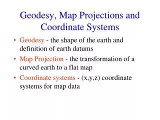
Coordinate Systems vs.Map Projections • A map projection is a method or a type of equation used to transform three-dimensional coordinates on the earth to two-dimensional coordinates on the map. • A coordinate system usually includes the specification of a map projection, plus the three dimensional model of the Earth to be used, the distance units to be used on the map, and information about the relative positions of the two dimensional map and the model of the Earth.
Latitude-Longitude • Not uniform units of measure • Meridians converge at the Poles 1° longitude at Equator = 111 km at 60° lat. = 55.8 km at 90° lat. = 0 km 1° latitude at Equator = 111 km at 90° lat. = 112 km
Using Geographic Coordinates as Plane Coordinates Geographic Coordinates Projected Coordinates
Spheroids • Set of parameters that represent a model of the earth’s size and shape • Based on an ellipse with 2 radii • Semimajor axis (longer) and the semiminor (shorter)
Spheroids • The Earth is not a perfect spheroid. Different spheroids are used in different parts of the world to create the best possible model of the Earth’s curvature in each location.
Datums • A Datum is a spheroid, plus the definition of the relationship between the Earth and the coordinates on the spheroid.
Datums • There are four datums commonly used in Montana: NAD27, WGS84, NAD83, and NAD83 HARN. The latitude and longitude of a point on the ground is different in each datum.
Datums • Difference (meters) between NAD27 and NAD83
Datums • Difference (meters) between NAD83 and NAD83 HARN
Projected Coordinate Systems • Define locations on a 2-D surface • Traditional planar coordinates • Can allow easy measurement, calculation, and/or visual interpretation of distances and areas
Visualize a light shining through the Earth onto a surface ESRI
Cylindrical Equal-Area Projection Mollweide Projection (equal-area, psuedo-cylindrical)
Conic Projections Lambert Conformal Albers Equal Area
Standardized Coordinate Systems There are an infinite number of coordinate systems possible, which can be created by choosing a projection and then tailoring its parameters to fit any region on the globe. Standardized coordinate systems have been developed to simplify the process of choosing a system. The two most common standard systems used in the United States are the State Plane Coordinate system and the Universal Transverse Mercator system.
Choosing a Projection: Checking Accuracy To find the true area of polygons, project them to an equal-area projection and recalculate their areas. To find the true distance between two points: http://www.ngs.noaa.gov/cgi-bin/Inv_Fwd/inverse.prl
Accuracy of Projections -- Statistics Maximum error in Montana for each coordinate system: LENGTH AREA Percent Ratio Percent Ratio UTM Zone 12 0.334 299 0.554 180 State Plane 1983 0.075 1333 0.114 877 State Plane North 0.269 372 0.420 238 (within zone) 0.008 12500 0.013 7962 State Plane Central 0.142 704 0.198 505 (within zone) 0.008 12500 0.039 2564 State Plane South 0.167 599 0.236 424 (within zone) 0.013 7692 0.021 4761
Projections and True North http://nris.mt.gov/gis/gerry/true_north.txt