Download

1 / 51
630 likes | 1.83k Vues
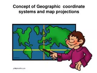
Geodesy, Map Projections and Coordinate Systems. Geodesy - the shape of the earth and definition of earth datums Map Projection - the transformation of a curved earth to a flat map Coordinate systems - (x,y) coordinate systems for map data. Types of Coordinate Systems.

E N D
Geodesy, Map Projections and Coordinate Systems • Geodesy - the shape of the earth and definition of earth datums • Map Projection - the transformation of a curved earth to a flat map • Coordinate systems - (x,y) coordinate systems for map data
Types of Coordinate Systems • (1) Global Cartesian coordinates (x,y,z) for the whole earth • (2) Geographic coordinates (f, l, z) • (3) Projected coordinates (x, y, z) on a local area of the earth’s surface • The z-coordinate in (1) and (3) is defined geometrically; in (2) the z-coordinate is defined gravitationally
Z Greenwich Meridian O • Y X Equator Global Cartesian Coordinates (x,y,z)
Global Positioning System (GPS) • 24 satellites in orbit around the earth • Each satellite is continuously radiating a signal at speed of light, c • GPS receiver measures time lapse, Dt, since signal left the satellite, Dr = cDt • Position obtained by intersection of radial distances, Dr, from each satellite • Differential correction improves accuracy
Global Positioning using Satellites Dr2 Dr3 Number of Satellites 1 2 3 4 Object Defined Sphere Circle Two Points Single Point Dr4 Dr1
Geographic Coordinates (f, l, z) • Latitude (f) and Longitude (l) defined using an ellipsoid, an ellipse rotated about an axis • Elevation (z) defined using geoid, a surface of constant gravitational potential • Earth datums define standard values of the ellipsoid and geoid
Shape of the Earth It is actually a spheroid, slightly larger in radius at the equator than at the poles We think of the earth as a sphere
Ellipse An ellipse is defined by: Focal length = Distance (F1, P, F2) is constant for all points on ellipse When = 0, ellipse = circle Z b O a X F1 F2 For the earth: Major axis, a = 6378 km Minor axis, b = 6357 km Flattening ratio, f = (a-b)/a ~ 1/300 P
Ellipsoid or SpheroidRotate an ellipse around an axis Z b a O Y a X Rotational axis
Standard Ellipsoids Ref: Snyder, Map Projections, A working manual, USGS Professional Paper 1395, p.12
Horizontal Earth Datums • An earth datum is defined by an ellipse and an axis of rotation • NAD27 (North American Datum of 1927) uses the Clarke (1866) ellipsoid on a non geocentric axis of rotation • NAD83 (NAD,1983) uses the GRS80 ellipsoid on a geocentric axis of rotation • WGS84 (World Geodetic System of 1984) uses GRS80, almost the same as NAD83
Definition of Latitude, f m p S n O f q r (1) Take a point S on the surface of the ellipsoid and define there the tangent plane, mn (2) Define the line pq through S and normal to the tangent plane (3) Angle pqr which this line makes with the equatorial plane is the latitude f, of point S
P Prime Meridian Equator Meridian plane Cutting Plane of a Meridian
Definition of Longitude, l l = the angle between a cutting plane on the prime meridian and the cutting plane on the meridian through the point, P 180°E, W -150° 150° -120° 120° 90°W (-90 °) 90°E (+90 °) P -60° l -60° -30° 30° 0°E, W
=0-180°W =0-90°S Latitude and Longitude on a Sphere Meridian of longitude Z Greenwich meridian N Parallel of latitude =0° P • =0-90°N - Geographic longitude - Geographic latitude E W O • Y R R - Mean earth radius • =0° Equator • O - Geocenter =0-180°E X
Length on Meridians and Parallels (Lat, Long) = (f, l) Length on a Meridian: AB = ReDf (same for all latitudes) R Dl D R 30 N C B Re Df 0 N Re Length on a Parallel: CD = R Dl = ReDl Cos f (varies with latitude) A
Example: What is the length of a 1º increment along • on a meridian and on a parallel at 30N, 90W? • Radius of the earth = 6370 km. • Solution: • A 1º angle has first to be converted to radians • p radians = 180 º, so 1º = p/180 = 3.1416/180 = 0.0175 radians • For the meridian, DL = ReDf = 6370 * 0.0175 = 111 km • For the parallel, DL = ReDl Cos f • = 6370 * 0.0175 * Cos 30 • = 96.5 km • Parallels converge as poles are approached
Sea surface Ellipsoid Earth surface Geoid Representations of the Earth Mean Sea Level is a surface of constant gravitational potential called the Geoid
Geoid and Ellipsoid Earth surface Ellipsoid Ocean Geoid Gravity Anomaly Gravity anomaly is the elevation difference between a standard shape of the earth (ellipsoid) and a surface of constant gravitational potential (geoid)
Definition of Elevation Elevation Z P z = zp • Land Surface z = 0 Mean Sea level = Geoid Elevation is measured from the Geoid
Vertical Earth Datums • A vertical datum defines elevation, z • NGVD29 (National Geodetic Vertical Datum of 1929) • NAVD88 (North American Vertical Datum of 1988) • takes into account a map of gravity anomalies between the ellipsoid and the geoid
Converting Vertical Datums • Corps program Corpscon (not in ArcInfo) • http://crunch.tec.army.mil/software/corpscon/corpscon.html Point file attributed with the elevation difference between NGVD 29 and NAVD 88 NGVD 29 terrain + adjustment = NAVD 88 terrain elevation
Geodesy and Map Projections • Geodesy - the shape of the earth and definition of earth datums • Map Projection - the transformation of a curved earth to a flat map • Coordinate systems - (x,y) coordinate systems for map data
Representative Fraction Globe distanceEarth distance = Earth to Globe to Map Map Projection: Map Scale: Scale Factor Map distanceGlobe distance = (e.g. 0.9996) (e.g. 1:24,000)
Geographic and Projected Coordinates (f, l) (x, y) Map Projection
Types of Projections • Conic (Albers Equal Area, Lambert Conformal Conic) - good for East-West land areas • Cylindrical (Transverse Mercator) - good for North-South land areas • Azimuthal (Lambert Azimuthal Equal Area) - good for global views
Cylindrical Projections(Mercator) Transverse Oblique
Projections Preserve Some Earth Properties • Area - correct earth surface area (Albers Equal Area) important for mass balances • Shape - local angles are shown correctly (Lambert Conformal Conic) • Direction - all directions are shown correctly relative to the center (Lambert Azimuthal Equal Area) • Distance - preserved along particular lines • Some projections preserve two properties
Geodesy and Map Projections • Geodesy - the shape of the earth and definition of earth datums • Map Projection - the transformation of a curved earth to a flat map • Coordinate systems - (x,y) coordinate systems for map data
Coordinate Systems • Universal Transverse Mercator (UTM) - a global system developed by the US Military Services • State Plane Coordinate System - civilian system for defining legal boundaries • Texas State Mapping System - a statewide coordinate system for Texas
Coordinate System A planar coordinate system is defined by a pair of orthogonal (x,y) axes drawn through an origin Y X Origin (xo,yo) (fo,lo)
Universal Transverse Mercator • Uses the Transverse Mercator projection • Each zone has a Central Meridian(lo), zones are 6° wide, and go from pole to pole • 60 zones cover the earth from East to West • Reference Latitude (fo), is the equator • (Xshift, Yshift) = (xo,yo) = (500000, 0) in the Northern Hemisphere, units are meters
UTM Zone 14 -99° -102° -96° 6° Origin Equator -90 ° -120° -60 °
State Plane Coordinate System • Defined for each State in the United States • East-West States (e.g. Texas) use Lambert Conformal Conic, North-South States (e.g. California) use Transverse Mercator • Texas has five zones (North, North Central, Central, South Central, South) to give accurate representation • Greatest accuracy for local measurements
Texas Centric Mapping System • Designed to give State-wide coverage of Texas without gaps • Lambert Conformal Conic projection with standard parallels 1/6 from the top and 1/6 from bottom of the State • Adapted to Albers equal area projection for working in hydrology
Standard Hydrologic Grid (SHG) • Developed by Hydrologic Engineering Center, US Army Corps of Engineers • Uses USGS National Albers Projection Parameters • Used for defining a grid over the US with cells of equal area and correct earth surface area everywhere in the country
Defined for a feature dataset in ArcCatalog Coordinate System Projected Geographic X/Y Domain Z Domain M Domain ArcGIS Reference Frames
Geographic coordinates (decimal degrees) Projected coordinates (length units, ft or meters) Coordinate Systems
X/Y Domain (Max X, Max Y) Long integer max value of 231 = 2,147,483,645 (Min X, Min Y) Maximum resolution of a point = Map Units / Precision e.g. map units = meters, precision = 1000, then maximum resolution = 1 meter/1000 = 1 mm on the ground
Summary Concepts • Two basic locational systems: geometric or Cartesian (x, y, z) and geographic or gravitational (f, l, z) • Mean sea level surface or geoid is approximated by an ellipsoid to define an earth datum which gives (f, l) and distance above geoid gives (z)
Summary Concepts (Cont.) • To prepare a map, the earth is first reduced to a globe and then projected onto a flat surface • Three basic types of map projections: conic, cylindrical and azimuthal • A particular projection is defined by a datum, a projection type and a set of projection parameters