Download
1 / 16
170 likes | 344 Vues
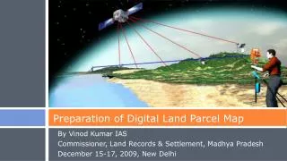
Preparation of Digital Land Parcel Map. By Vinod Kumar IAS Commissioner, Land Records & Settlement, Madhya Pradesh December 15-17, 2009, New Delhi. MP Land Records: Quick Facts. Area > 3 Lakh sqkms Fifty Districts Population > 6Cr Population density 200 people per sqkm

E N D
Preparation of Digital Land Parcel Map By Vinod Kumar IAS Commissioner, Land Records & Settlement, Madhya Pradesh December 15-17, 2009, New Delhi
MP Land Records: Quick Facts • Area > 3 Lakh sqkms • Fifty Districts • Population > 6Cr • Population density 200 people per sqkm • No of parcels > 3.7 Cr
MP Land Records: Quick Facts • Broad Landuse
Objective of the Project • Prepare most up to date GIS compatible Land Parcel Map for entire Madhya Pradesh using latest techniques, accurate enough for different types of areas for example, agricultural land, village abadi land and city area while being cost effective.
Steps Involved in Vendor(s) Selection Select the Vendor based on Quality and Cost Details in following slides
Step 1: Invitation for EOI • Invitation to propose appropriate methods for different areas:
Step 1 EOI: Approach for choosing method • Hybrid approach of latest methods (Any combination of the below) • Aerial Photography • Create Vector Data From Satellite Images • DGPS/GPS • Electronic Total Station
Step 1 EOI: Technical Analysis • Analyze different options • Methods of Survey • Practically Achievable Accuracy Levels • Availability of execution capacity of each method in the commercial market • Indicative cost effectiveness • Driving factors
Step 1 EOI: Evaluation of Vendors • Bidder’s Competence • Financial Stability • Experience • Certifications • Quality of Solution • Smartness in choosing method • Accuracy levels • Availability of Resources • Human Resources • Survey Equipments • Short listed vendors shall be eligible for commercial bid
Steps 2&3: Method Spec Tender • After technical evaluation, analysis of the EOIs from vendors and technical discussions with vendors the following shall be done: • Methodology shall be frozen • Specifications shall be prepared • Tender shall be published inviting commercial bids • Most responsive vendor shall be recommended for executing the work
Prepare Draft Map and Publish • Prepare New Draft Map • Use the survey method frozen • Have New Numbering Scheme • Display Old and New Parcel Numbers • Display measurements • Mention Projected and Surface Areas • Compare with existing data • Use existing digitized data • Use GIS overlay techniques • Derive old parcel number • Derive area difference • Derive owner details from old data • Publish new draft map and ownership table
Public Interaction Sessions • Distribute new map and derived ownership details • Public interaction sessions on pre-published date • Hear and record objections • Resolve issues through discussions • Perform resurvey, if required, in presence of owners / neighbours • Collect additional data • Digital photo of owners • Digital finger prints • Details regarding land like land use, crop, irrigation status etc.
Prepare Final Data and Further use • Prepare final GIS data • Incorporate adjustifications and corrections • Incorporate attribute data collected • Final data in GIS format • Authorize final data • Publish final data • Further use • Upcoming Web based Enterprise GIS Solution • Use the new data for day to day activities of the department • Updates to the database • Public services
Thanks! • For more information • E-mail : clrgwa@mp.nic.in • Phone : +91 751 2441200 • Web Site: www.landrecords.mp.gov.in