Download
1 / 19
190 likes | 398 Vues
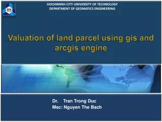
HOCHIMINH CITY UNIVERSITY OF TECHNOLOGY DEPARTMENT OF GEOMATICS ENGINEERING. Valuation of land parcel using gis and arcgis engine. Dr. Tran Trong Duc Msc: Nguyen The Bach. 1. INTRODUCTION. GOVERNMENT REGULATION ON VALUATION OF LAND PARCEL. 2.

E N D
HOCHIMINH CITY UNIVERSITY OF TECHNOLOGY DEPARTMENT OF GEOMATICS ENGINEERING Valuation of land parcel using gis and arcgis engine Dr. Tran Trong Duc Msc: Nguyen The Bach
1 INTRODUCTION GOVERNMENT REGULATION ON VALUATION OF LAND PARCEL 2 A MODEL TO CALCULATE THE POSITIONING LEVEL AND PRICE OF A LAND PARCEL 3 4 APPLICATION DEVELOPMENT AND RESULTS 5 CONCLUSIONS PRESENTATION CONTENT
Need INTRODUCTION Land price forms the basis for calculation of financial charges, fees and any other financial obligations concerning uses of land Importance Limitation Staff have to carry out the calculation of land price manually using printed or digital cadastral maps An application which can automatically determine the price of a particular land parcel A GIS Application Software Develop- ment
Rural Agriculture Land Urban Street Street PL 2 PL1 PL 3 PL 4 PL 1 PL 2 PL 3 PL 4 GOVERNMENT REGULATION ON POSITIONING LEVEL & PRICE POSITION AND PRICE OF LAND PARCEL Non Agriculture Land
1 GOVERNMENT REGULATION ON POSITIONING LEVEL & PRICE POSITIONING LEVEL Applied to land parcels located on the front of a main street
2 GOVERNMENT REGULATION ON POSITIONING LEVEL & PRICE POSITIONING LEVEL • D <= 200m from street • On alley connected to street • 2m <= alley’s width < 4m • D <= 1000m from street • On alley connected to street • Alley’s width >= 4m • D <= 200m from street • On alley not connected to street • Alley’s width >= 4m
3 GOVERNMENT REGULATION ON POSITIONING LEVEL & PRICE POSITIONING LEVEL • D <= 200m from street • On alley connected to street • Alley’s width < 2m • D > 200m D<=100m from street • On alley connected to street • 2m <=Alley’s width >= 4m • D > 1000m from street • On alley connected to street • Alley’s width >= 4m • D > 200m D <= 1000m • On alley not connected to street • Alley’s width >= 4m • D <= 500m • On alley not connected to street • 2m <= Alley’s width < 4m
4 GOVERNMENT REGULATION ON POSITIONING LEVEL & PRICE POSITIONING LEVEL all land parcels not belonging to any of the above cases
GOVERNMENT REGULATION ON POSITIONING LEVEL & PRICE SUMMARY All levels of the location of the land parcel in relation to street and alley
GOVERNMENT REGULATION ON POSITIONING LEVEL & PRICE POSITIONING LEVELS
MODEL TO CALCULATE THE POSITIONING LEVEL AND PRICE OF A LAND PARCEL STEP 1 • Arrange Streets in price order • For every street find connected alley & calculate: • + Alley level • + Street code • + Structure Grade • + width level
MODEL TO CALCULATE THE POSITIONING LEVEL AND PRICE OF A LAND PARCEL STEP 2 • Arrange Streets in price order • For every street find connected parcel & assign: • + Street code • + Structure Grade • Arrange alleys in price order • For every alley find connected parcel & assign: • + Street code • + Structure Grade • + Width level
MODEL TO CALCULATE THE POSITIONING LEVEL AND PRICE OF A LAND PARCEL STEP 3 • Arrange Streets in price order • For every street find connected parcel & assign: • + Positioning level 1 • + Related price • Create buffer zones 200m, 500m, 1000m • Respectively for each zone find intersected parcels and combined with information on parcel’s alley level and width level to assign positioning level 2, 3 or 4 and corresponding price.
APPLICATION DEVELOPMENT Database Design Database is built based on ESRI Geodatabase model.
APPLICATION DEVELOPMENT • Module for building • - Alley & Parcel Information SOFTWARE 2. Module for calculating - Positioning level and price 3. Map module - Map interaction, attribute information viewing 4. Utility module - Create thematic maps, and access necessary data 5. Management Module - Manage, update base information The software is built based on VB.Net and ArcGIS Engine.
APPLICATION RESULTS • Study area: 74 streets, 1143 alleys, and 32683 land parcels. • Time spent: 11 minutes • Accuracy: Calculation results are consistent and free of errors • Flexibility: Adaptable to changes in state regulations by allowing changes of parameters
CONCLUSIONS • To implement the land pricing task: • Spatial relations between street, alley and parcel can be determined accurately and quickly by using appropriate sequence of GIS spatial functions like intersection, buffer, distance measures … • Integration of these spatial functions into a software developed on ArcGIS Engine and programming language VB.NET • The application software tested on a studied area strongly demonstrates efficient execution time and accurate performance