
GEOGRAPHIC INFORMATION SYSTEMS
GEOGRAPHIC INFORMATION SYSTEMS. &. INTELLIGENT TRANSPORTATION SYSTEMS. What are Intelligent Transportation Systems ?. Information technologies applied to transportation systems To manage it in a safe and efficient manner

GEOGRAPHIC INFORMATION SYSTEMS
E N D
Presentation Transcript
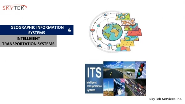
GEOGRAPHIC INFORMATION SYSTEMS & INTELLIGENT TRANSPORTATION SYSTEMS
What are Intelligent Transportation Systems ? Information technologies applied to transportation systems • To manage it in a safe and efficient manner • To monitor traffic conditions (accident, incidents, construction work, major events) • Control traffic flow • To provide information to the motoring public about traffic conditions
ITS Benefits • Improved safety to drivers • Improved traffic efficiency • Reduced traffic congestion • Improved environmental quality and energy efficiency • Improved economic productivity Types of ITS Implemented • Advanced Traffic Management Systems • Advanced Traveler Information Systems • Advanced Vehicle Control Systems • Electronic Toll Collection Systems • Advanced Public Transportation Systems • Commercial Vehicles Operations
What are Advanced Traveler Information Systems (ATIS)? • ATIS are type of ITS implementation, using emerging sensor, computer, communication, and information technologies in order to provide • Provides safety advisory and warning messages to the driver • Provides the information about the traffic regulation, guidance, and hazardous situations ATIS Benefits • Reduction of travel time • Reduction of stress level • Reduction of traffic congestion • Avoidance of unsafe driving conditions
Functional Capabilities in ITS • Urban Traffic Control system (UTC) renewal • Urban Traffic Management & Control (UTMC) common database • Automatic Vehicle Location (AVL) / Real Time Passenger Information (RTPI) • Automatic Number Plate Recognition (ANPR) • Variable Message Signs (VMS) • Car Park Guidance Signs (CPGS) • Closed Circuit Television (CCTV) • Integrate new and existing Network Management Systems in Hertfordshire • Future proof technology • Actively manage HCC Network • Integrate HCC, HA & neighbouring LA strategies • Build Integrated Traffic Control Centre
UTMC Common Database (CDB) CDB is the UTMC central hub, enabling • A coordinated, centralised approach to monitoring and managing traffic • A traffic and travel website • Distribution of transport information via the media (radio/TV/Smart phones) • A consolidated, single user interface • Close co-ordination with adjoining Local Authorities and the Highways Agency
Automatic Vehicle Location – Real-Time Passenger Information • Provide reliable real-time information to passengers through a variety of systems and communications media • Provide a voice and data communications platform • Enable bus priority at traffic signals • Provide a vehicle location and control system • Be compatible with AVL/RTPI systems operating in other counties and with other transport providers • Enhance passenger security • Provide information to drivers to aid timekeeping
Automatic Number Plate Recognition (ANPR)Journey Time Monitoring System (JTMS) • Provides traffic data by identifying the same vehicle at two or more points in a road network from the recognition of the vehicle's number plate. • Cameras are strategically deployed to capture number plates providing real time monitoring. ANPR/JTMS - Benefits • Live monitoring of the effectiveness of traffic management schemes • Early warning of traffic incidents • Improve journey time reliability • Reduce disruption caused by major incidents • Provide alternative route advice to minimise the effect of congestion and incidents • Minimise delays due to road works • Influence road users' decisions before they set out on a journey about route, time and means of travel • Reduce the effects of congestion
Variable Message Signs (VMS) • Provision of information in a timely manner • Local incident management • Reduction in delay • Supporting diversion routes and controlling traffic on these routes Car Park Guidance Signs • Excess queues at car parks; • Congestion on the surrounding road network; • Poor air quality Provides greatest benefit when demand for off-street parking is approximately equal to supply
CCTV • Incident detection and management • Provide traffic information through various media services • Manage traffic in urban areas through the use of an UTMC system • Monitor weather conditions of highway Five Primary Functional Areas of ITS • Advanced Traffic Management Systems (ATMS) • Advanced Traveler Information Systems (ATIS) • Commercial Vehicle Operations (CVO) • Advanced Public Transportation Systems (APTS) • Advanced Vehicle Control Systems (AVCS)
Commercial Vehicle Operations • Apply, pay for and receive permits, registrations, and licenses electronically • Share of common trucking data across agencies • Exchange information electronically with roadside enforcement personnel • Electronic “screening” of trucks for safety or other regulatory violations • Share information across state lines and with Federal information systems
Advanced Vehicle Control Systems Intelligent Cruise Control (ICC) System
Advanced Public Transportation Systems • Web-based computer reservation systems • Smartphone apps • Smart cards • Electronic ticketing systems • Departure control systems • Inter-modal booking systems • Reservation systems • Vehicle inventory control • Car and bicycle sharing systems • Ride-sharing systems
Expressway Monitoring and Advisory System (EMAS) • Intelligent incident management tool that manages traffic along Expressways • Detects accidents, vehicle breakdowns and other incidents promptly, ensuring fast response to restore normal traffic flow • Recovery crew arrives within 15 minutes • Provides real-time information of travelling time from the entry point of Expressway to selected exits Industry Insight: ITS • tunnel management systems • incident detection and weather sensors • lane and speed control signs • connected vehicles and car-sharing systems • automated payment mechanisms • intelligent parking management
Software and IT Solutions App empowering commuters, motorists and cyclists to make informed decisions and better plan their journeys Features include: • Public transport journey planner • Search nearby bus stops and arrival times • Search nearby taxi stands and book taxis • Report road defects via crowdsourcing • Get real-time parking lots availability • Traffic news • Explore cycling towns, routes, and parking facilities
Information Transfer in ITS 1 2 In-vehicle systems Vehicle-to-vehicle systems Vehicle-to-infrastructure systems 3
Technical Issues: Potential Game Changers • Research Questions: • What are the infrastructure requirements for V2V data security? • Is DSRC required to connect vehicles to infrastructure for data security functionality? • Are other communication technologies adequate? • How much and what type of infrastructure is needed for data security? • Is positioning technology adequate? • V2V requires relative positioning; V2I requires absolute positioning • Potential issues between differing GPS manufacturers • Will IntelliDriveSM scale to accommodate all vehicles? • Will DSRC radio channel switching (for safety & non-safety applications) work? Or, will a separate safety radio be required? • Security messages may use significant communication overhead
Identifying Accident Prone Locations Big Events Management
Solutions to Traffic problems • Construct new roads • Covered in geometric design • Not likely to happen on a large scale • Reduce Traffic • Travel demand management • Alternative transportation • Increase existing infrastructure capacity • Uses intelligent transportation systems (ITS)
Option 2: Alternative Transport • But significant new rail capacity will face the same hurdles as new highway capacity.
Real-time Information Green Vehicles Smart Agent Vision 2030 Autonomous Vehicles Interactivity Satellite tracking Shared Vehicles
Real-time information of everything Includes: • Travel times • Crowdedness in buses / trains • Arrival times of buses, trains, and taxis • Queue lengths at junctions and stations • Parking availability • Achieved by embedded sensors, satellite trackers, HD cameras, and crowd sourcing
Smart Agent • A mobile App or a device able to: • Interact with various modes of transport for locating shared vehicles, booking taxis, etc.. • Provide smarter information of journey planning with combination of choices • Take care of logistics e.g. making payments
Interactivity V2V • Communication between nearby vehicles wirelessly, sharing useful information on surroundings
Interactivity V2I • Communication with infrastructure on signals, traffic availability, and road conditions
Satellite-based tracking & ERP • GNSS technology to provide next generation Electronic Road Pricing (ERP) • overcomes the constraints of physical gantries • allows more flexible distance-based congestion charging
Autonomous Vehicles • Driverless cars to maintain a safe distance from other vehicles and comply with speed limits automatically, hence eliminating human errors • Driverless vehicles can move in platoon formation in compact and systematic manner to optimise road capacity
GIS With ITS For • CCTV Monitoring System • Automatic Incident Detection System • Variable Message Sign System • Automatic Vehicle Location System • Communications System • ATM’s Operations • Call Centre Operations • Media Relations • Network Operations • Traffic Engineering/ Transport Planning/ R&D • Building Systems


