Download
1 / 18
180 likes | 199 Vues
Report on effective use of earth observations for disaster reduction, outlining grand challenges and sub-challenges for improving hazard information and understanding natural processes.

E N D
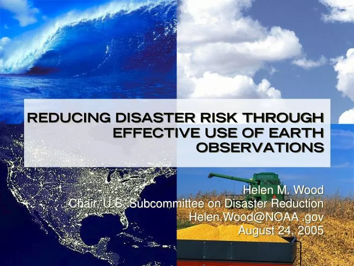
REDUCING DISASTER RISK THROUGH EFFECTIVE USE OF EARTH OBSERVATIONSHelen M. WoodChair, U.S. Subcommittee on Disaster ReductionHelen.Wood@NOAA .govAugust 24, 2005
U.S. SUBCOMMITTEE ON DISASTER REDUCTION • Reports to the Committee on Environment and Natural Resources, An element of the President’s National Science and Technology Council • Promotes coordination across U.S. Government • Supports international cooperation • Supports development of US National Plan for IEOS • Supports US participation in GEOSS • Includes 23 member agencies
Framing the Grand Challengesfor Disaster Reduction • Objective: To enhance disaster resilience by composing a ten-year agenda for science and technology activities that will produce a dramatic reduction in the loss of life and property from natural and technological disasters.
Grand Challenges • Provide hazard and disaster information where and when it is needed. • Understand the natural processes that produce hazards. • Develop hazard mitigation strategies and technologies. • Recognize and reduce vulnerability of interdependent critical infrastructure. • Assess disaster resilience using standard methods. • Promote risk-wise behavior.
The Grand Challenge #1: Grand Challenge for Earth Observations • Provide hazard and disaster information where and when it is needed. To identify and anticipate the hazards that threaten communities, a mechanism for real-time data collection and interpretation must be readily available to and usable by scientists, emergency managers, first responders, citizens, and policy makers. Developing and improving observation tools is essential to provide pertinent, comprehensive, and timely information for planning and response. • Sub-Challenges: • Improve data collection to increase understanding of the ways in which hazards evolve. • Create standards for sharing, storing and analyzing data.
The Grand Challenge #2: Grand Challenge for Earth Observations • Understand the natural processes that produce hazards.. To improve forecasting and predictions, scientists and engineers must continue to pursue basic research on the natural processes that produce hazards and understand how and when natural processes become hazardous. New data must be collected and incorporated into advanced and validated models that support an improved understanding of underlying natural system processes and enhance assessment of the impacts. • Sub-Challenge: • Improve models and visualization techniques.
Observations to Information: Disaster Reduction • Key areas in disaster management cycle: • Mitigation and research • Preparedness and prediction • Assessment of hazards and damage • Response and recovery • Earth observations critical to work of disaster community: • Previous experience provides opportunity for integrated global system
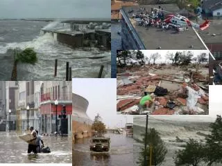
Observations to Information: Disaster Reduction • Statement of Need: • Disasters killed 500,000 people and caused $750 billion in damage from 1990-1999 (UN International Strategy for Disaster Reduction, “Living at Risk”) • The December 26, 2004 Tsunami in the Indian Ocean killed 150,000 people and cost over $2 billion in international donations (preliminary statistic) • Loss of life and property, effect on key natural resources • Increased risk due to population growth and complexity of our infrastructure
Observations to Information: Disaster Reduction • Challenges: • Integration of diverse data streams • Improved predictive modeling • Dissemination of timely and accurate information to decision makers and the public • Improved understanding of the underlying natural and human systems
Some GEOSS Implications • GEOSS: Global Earth Observation System of Systems • International agreement on backbone of critical measurements • Requirement for continuity of critical observations (including weather, climate, disasters, etc.) • Improved systems coordination • Smoother transition from research to operations
Scenarios—Earthquake Trigger: Seismic event. Background: Location and depth of the event; magnitude (e.g., Richter and Modified Mercalli Intensity); date and time of the event; responsible relief agencies; proximity of population centers and structures; vulnerability assessment (e.g., whether buildings are earthquake resistant); and availability of base maps for logistics and communication.
Scenarios—Earthquake Current Situation: Location, nature, and extent of damage, casualties, and secondary hazards (e.g., fires, floods, gas leaks, chemical spills); assessment of utilities, including those of potential use and those posing high risk (e.g., above-ground and underground telephony and power lines, nuclear power plants, dams, and reservoirs); changes to transportation routes (e.g., roads, bridges, rail lines).
Scenarios—Earthquake Satellite Data Requirement: ERS-1/2; ENVISAT; RADARSAT; InSAR; PSInSAR; CRInSAR.
Scenarios—Earthquake Combined InSAR and SCIGN/GPS demonstrates the power of geodetic imaging.
The Way Forward • Collaboration among key international organizations. • Address in-situ and remotely sensed observations as part of an integrated Earth observation system. • Expand and refine a standard set of observation requirements for specific hazards. • Actively involve all sectors (public, private, and academia) throughout the process.
The Earth Observation Summit • The U.S. National Plan for coordinated Earth observations • Grand Challenges for Disaster Reduction.
MORE INFORMATION • http://earthobservations.org http://www.sdr.gov