
Chesapeake Bay Watershed TMDL: Nutrients & Sediment Restoration Process
Explore the Chesapeake Bay TMDL process, stakeholders, goals, and progress tracking for restoring water quality in the watershed through implemented best management practices. The journey from past to future efforts is assessed through modeling tools and data analysis.

Chesapeake Bay Watershed TMDL: Nutrients & Sediment Restoration Process
E N D
Presentation Transcript
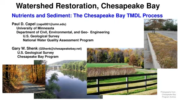
Watershed Restoration, Chesapeake Bay Nutrients and Sediment: The Chesapeake Bay TMDL Process Paul D. Capel (capel001@umn.edu) University of Minnesota Department of Civil, Environmental, and Geo- Engineering U.S. Geological Survey National Water Quality Assessment Program Gary W. Shenk (GShenk@chesapeakebay.net) U.S. Geological Survey Chesapeake Bay Program Photographs from: Chesapeake Bay Program Archive
Comparison of Minnesota and the Chesapeake Bay Watershed NY, PA, MD, DE, WV, VA, and DC
Differences in Minnesota and Chesapeake Bay Watershed Land of Chesapeake Bay Land of 10,000 Lakes (and a Few Reservoirs) - Receiving waters - Lakes - Wetlands
Less of this… Less of This
More of this… More of This
Chesapeake Bay Watershed TMDL for Nutrients and Sediment • Timeline • 1999 – Lawsuit by American Canoe Association • and American Littoral Society • 2010 – TMDL put in place • Reduction in annual loads to Chesapeake Bay: • 25% for N, 24% for P, 20% for Sediment • 2017 – Mid-Point Assessment • 60% of the management practices implemented • 2025 – TMDL Goal Date • 100% of the management practices implemented • Minnesota Clean Water, Land and Legacy Amendment: 2008 2034
Chesapeake Bay Watershed TMDL Stakeholders • Non-profit organizations • Chesapeake Bay Foundation • Center for Watershed Protection • Ducks Unlimited • National Fish and Wildlife Foundation • And more • Academic institutions • Land grant universities • Cooperative Extension programs • Sea Grant programs • Research centers and consortiums • And more • Federal agencies • Environmental Protection Agency (EPA) • US Department of Agriculture (USDA) • US Forest Service (USFS) • US Geological Survey (USGS) • US Fish and Wildlife Service (USFWS) • And more • State agencies • Natural Resources/Environmental departments • Agricultural departments • Parks and Recreation groups • Fish and Wildlife agencies • Local Governments Chesapeake Bay Program www.chesapeakebay.net
1 Areas that contribute the most to the problem must do the most to resolve the problem. All reductions in loads are credited toward achieving final assigned loads. Sum of allocated loads must result in attainment of water quality standards Chesapeake Bay TMDL Philosophy for Planning Urban BMPs Ag BMPs Effort WWTPs Effectiveness
2 Goals Established by State and Watershed Basin allocations for Nitrogen and Phosphorus (Million pounds per year)
3 Track Progress toward TMDL Goals Allocated loads must result in achievement of the Bay water quality standards Fewer Violations Reduced Loads
4 Planning and Tracking Progress accomplished through Models CB: large-scale (Phase 6) small-scale (CAST) MN: large-scale (HSPF-SAM) small-scale (N-BMP, P-BMP, PTMApp)
4 Planning and Tracking Progress accomplished through Models Optimization engine Best Management Practices (BMPs) Less nutrients Less sediment Modeling Tools Optimization engine Achieve target Load Reduction Minimize Total Cost ($)
Implementation of BMPs for Reduction of Nitrogen, 1985-2014 Agricultural BMPs Urban BMPs Sekellick, A.J., Devereux, O.H., Keisman, J.L.D., Sweeney, J.S., and Blomquist, J.D., 2019, Spatial and temporal patterns of Best Management Practice implementation in the Chesapeake Bay watershed, 1985–2014: U.S. Geological Survey Scientific Investigations Report 2018–5171, 25 p., https://doi.org/10.3133/sir20185171.
Nitrogen Conceptual Model fertilizer & manure land BMPs Rivers To Bay water water groundwater The watershed is conceptualized as a series of filters.
Phosphorus and Sediment Conceptual Models For phosphorus and sediment, storage is important. Storage Phosphorus channels, other Fertilizer & manure land BMPs water BMPs Reservoirs water water water To Bay Storage Sediment channels, other land BMPs water BMPs Reservoirs water water To Bay water
Every location on the landscape is connected to a stream … either directly or indirectly via groundwater and lakes
1. All parts of the landscape do not contribute N, P, and sediment equally. land Critical Contributing Areas
2. Groundwater contributions of water and nitrogen to streams (and lakes) can be very important and delayed.
Looking forward and back … Nitrogen in the Chesapeake Watershed: A Century of Change, 1950-2050
Looking forward and back … MN WQ Model to 2034 and beyond Putting past and future into context from our present understanding Current WQ is the result of past activities Future WQ will be the result of the current conditions and future decisions / activities. Help quantify what has be done to improve / maintain WQ. Provide decision making tool (“what if” scenarios). In 2034 with a forecasting model, can we should be able to say … How WQ has improved in __ Lake or __ River due to the Legacy Amendment efforts. (Improvement) What the WQ would have been in __ Lake or __ River, if Legacy Amendment efforts were not done. (Protection)
Summary 1. Chesapeake Bay established a TMDL philosophy for planning purposes. Areas that contribute the most to the problem must do the most to resolve the problem. 2. N, P, and sediment goals were established by state and watershed. 3. Progress was tracked toward the TMDL goals (BMP implementations, …). 4. Planning and tracking progress was accomplished through models (with iteration for optimization) Every location on the landscape is connected to a stream … either directly or indirectly via groundwater and lakes. All parts of the landscape do not contribute N, P, and sediment equally. Groundwater contributions of water and nitrogen to streams (and lakes) can be very important and delayed. There may be value in using MN models to forecast WQ protection/improvements.


