Analyse spatiale de l’évolution urbaine et géoprospective
160 likes | 446 Vues
Analyse spatiale de l’évolution urbaine et géoprospective. Yuji KATO Projet CARIBSAT – Action 8. Sommaire. Contexte Méthodologie Résultats Perspective. I. Contexte. Action 8 : Phénomènes liés au développement de l’urbanisation

Analyse spatiale de l’évolution urbaine et géoprospective
E N D
Presentation Transcript
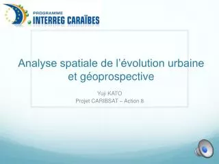
Analyse spatiale de l’évolution urbaine et géoprospective Yuji KATO Projet CARIBSAT – Action 8
Sommaire • Contexte • Méthodologie • Résultats • Perspective Y. KATO - CARIBSAT A8
I. Contexte • Action 8 : Phénomènes liés au développement de l’urbanisation • Objectif de la mission : mieux comprendre les processus d’urbanisation en Martinique et dans les petites Antilles • Collaborations : • Christian de Vassoigne (UAG) • Vincent de Reynal (UAG) • Jean Doucet (DEAL) • David Flamanc (DEAL) • CeniaBorerro (ADUAM) Y. KATO - CARIBSAT A8
II. Méthodologie Y. KATO - CARIBSAT A8
II. Méthodologie Délimitation de l’urbanisation Bâtiments Rastérisation Bâtiments 1m Superposition Réseau routier Rastérisation Réseau routier 1m Elément urbain 1m Elément urbain 10m Agrégation Analyse de voisinage Urbain 15% Classifications voisinage urbain 10m Urbain 30% … Y. KATO - CARIBSAT A8
II. Méthodologie Y. KATO - CARIBSAT A8
II. Méthodologie Analyse diachronique Analyse de changement Zones urbaines T0 Evolution des zones urbaines Zones urbaines T1 Y. KATO - CARIBSAT A8
II. Méthodologie Y. KATO - CARIBSAT A8
II. Méthodologie Géoprospective - Démarche 0 : Critère défavorable 10 : critère Favorable Y. KATO - CARIBSAT A8
II. Méthodologie Géoprospective - Démarche Structures urbaines Effet limitant Proximité des zones urbaines Proximité des routes Effet positif Zones protégées Pentes Croissance urbaine Vue sur mer Exposition aux risques naturels Topographie Règlementation Croissance de la population Démographie Y. KATO - CARIBSAT A8
II. Méthodologie Y. KATO - CARIBSAT A8
II. Méthodologie Analyse de l’habitat dispersé • Analyse multicritère par le biais de l’outil Maxent Y. KATO - CARIBSAT A8
III. Résultats Zones urbaines 2004 Urbain diffus Urbain dense • Délimitation de l’urbanisation Y. KATO - CARIBSAT A8
III. Résultats Evolution 1994 - 2004 Expansion Densification • Analyse diachronique Y. KATO - CARIBSAT A8
III. Résultats Eléments prospectifs Population +20% Nouveau noyau urbain • Géoprospective Barrière écologique Y. KATO - CARIBSAT A8
IV. Perspectives Perspectives • Gestion du territoire • Création d’une application • Comparaison avec d’autres îles des petites Antilles • Recherche • Photographies aériennes anciennes • Litto 3D • Publication scientifique Y. KATO - CARIBSAT A8