Download
1 / 29
290 likes | 413 Vues
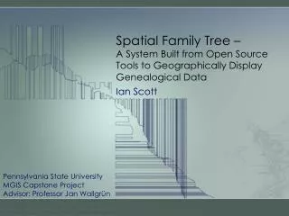
Spatial Family Tree – A System Built from Open Source Tools to Geographically Display Genealogical Data. Ian Scott. Pennsylvania State University MGIS Capstone Project Advisor: Professor Jan Wallgrün. Inspiration. Inspiration.

E N D
Spatial Family Tree – A System Built from Open Source Tools to Geographically Display Genealogical Data Ian Scott Pennsylvania State University MGIS Capstone Project Advisor: Professor Jan Wallgrün
Inspiration GEOG 897C Final Project (http://ianscottgeog897cfinal.weebly.com/) • I noticed my ancestors tended to move often and I could not find a satisfactory system to visualize that • Used ArcGIS tools hosted on Amazon Cloud to display spatial family tree • The desire for this project is to automate the process and crowd source more data
Project Goal The goal of this project is to create a system from open source tools to process, store, and spatially visualize family tree data.
Existing Systems Ancestral Atlas (http://www.ancestralatlas.com) • Closest existing system to project goal • Uses Google maps as a plugin • Slow • Best features are behind a pay wall
Existing Systems Map Your Ancestors (www.mapyourancestors.com) • Uses Google maps as a plugin • Provides simple “Ancestry Map” and “Life Map” • Appears to be abandoned
Existing Systems Non-Geographic Focus • Ancestry.com/Family Tree Maker • Gramps
Existing Solutions Existing Data Models • GEDCOM (Genealogical Data Communications) • Serial file format designed in 1980’s for genealogical data exchange • De facto genealogical data file • Version 5.5.1 (Oct 99) last update
Existing Solutions • GENTECH Genealogical Data Model • Model based on genealogical research process • Not generally used as basis for software • Version 1.1 (May 2000) last update
Existing Solutions • STEMMA(Source Text for Event and Ménage MApping) • Personal project of Tony Proctor • Designed to be more general • Most modern • Actively Maintained
Existing Solutions Web Application Components Figure from: http://securesoftwaredev.com/tag/java/
Existing Solutions • Web Application Frameworks • Provide building blocks for web applications • Examples: • Django • Rails • Play • GIS Web Frameworks • Provide GIS specific functionality • Can be used with a more general Web Framework • Examples: • GeoMajas • MapFish • OpenLayers
Existing Solutions Databases • GEDCOM flat file • Read from GEDCOM file • Inefficient and not scalable • SQL RDBMS (Oracle, PostGres, etc…) • Relational table structure • High data integrity • NoSQL(MongoDB, CouchDB, etc…) • Non-Relational • Several different approaches • More flexible • Less data integrity
Requirements Focus on 3 Data Elements • Family connection • Location data • Time More Flexible Model Than Existing • Care more about spatial data and visualization than data integrity and genealogical research. • Handle multiple relationship types • Simple privacy handling Design for Everyone on Earth • Thousands of concurrent users • Billions of records • Flexible family definitions to handle cultural differences
Requirements Data Entry • User Entry • File Import • GEDCOM Data Processing • Creating Data From Input • Life Lines (Spatial Objects) • Family Connections • Finding Ambiguities • Duplicate entries • Multiple parents • Time line errors (parents and children do not overlapped)
Requirements GIS Specific Tasks • Geocoding • User’s enter placenames/addresses • Files contain non-standard placenames • Global placenames • Limited by access to placename web services • Google – 2500 per day (must use Google Maps) • Yahoo – No free usage • Open Street Map (Nominatim)– Politely asked to keep small • Geonames – 30,000 per day • Creating Spatial Objects • Spatial Query • Spatial Display
Requirements Spatial Focused Display • Open Source Geospatial Tools • Display, Query, and Navigate • Spatially • Temporally • Genealogically
Project Proposal Theme: “Build for Performance and Scalability!” Data Model • Use STEMMA data model • Most modern • Most flexible • Can be implemented with JSON which directly lines up with DB and Web tools
Project Proposal Database • Use NoSQL Document Style DB • Provides the most flexibility • Easiest to achieve expected performance • JSON focused storage • Choice:
Project Proposal Web Application Components • Typesafe Stack • Scala • Play • Akka • Javascript Libraries • OpenLayers • Bootstrap
Proposed System Diagram External Systems Map Tiles Client Layer JSON Middle Tier Placename Service JSON Data Layer
Validation • Test Data • Use my own data for design and build • Ultimate goal would be to go live and crowd source data • Generate random test data if needed • Load Testing • http://www.neotys.com/ or similar free tool • Validation Criteria • Data in excess of one million records • No mapping performance lags with 1,000 concurrent users
Schedule Schedule Start Implementation Finish Data Layer Finish Client Layer 1/1/2014 2/21/2014 4/6/2014 Nov Dec Jan 2014 Feb Mar Apr 2013 2014 11/13 - 1/14 Learn/Configure Chosen Tech 1/14 - 1/14 Establish Data Model in MongoDB 1/14 - 2/14 Develop GEDCOM data import 1/14 - 3/14 Develop Middle Tier 2/14 - 4/14 Develop Client Layer
Potential Conferences • AAG Annual Meeting, Tampa FL, 8-12 Apr (http://www.aag.org/annualmeeting) • PA GIS Conference, State College PA, 5-7 May (http://www.pagisconference.org/Pages/default.aspx) • OGRS Symposium, Finland, 10-13 Jun (http://2014.ogrs-community.org/) • FOSS4G 2014, Portland OR, 8-13 Sep (http://2014.foss4g.org/) • Open to Suggestions! …
References Inspiration • Scott, I. (2012, September 17). GEOG 897C Final Project - Ian Scott. Retrieved October 25, 2013, from http://ianscottgeog897cfinal.weebly.com Existing Systems • Strahan, A., Cullingford, R., & Francis, N. (2006). Ancestral Atlas. Retrieved October 25, 2013, from http://www.ancestralatlas.com • Map Your Ancestors. (2005). Retrieved October 25, 2013, from http://www.mapyourancestors.com Data Models • Family History Department The Church of Jesus Christ of Latter-day Saints. (1999, October). The GEDCOM Standard Draft Release 5.5.1 [PDF]. Retrieved from https://devnet.familysearch.org/docs/ gedcom/ged551.pdf • Anderson, R. C., Barkley, P., Booth, R., Holsclaw, B., Velke, R., & Wylie, J. V. (2000, May). Genealogical Data Model Phase 1 [Microsoft Word]. Retrieved from http://members.ngsgenealogy.org/GENTECH_Data_Model/Description_GENTECH_Data_Model_1.1.doc • Proctor, T. (2013, June). STEMMA® Data Model [PDF]. Retrieved from http://stemma.parallaxview.co/ downloads Chosen Technology • The Open Source Geospatial Foundation. (n.d.). OpenLayers: Free Maps for the Web. Retrieved October 25, 2013, from http://openlayers.org/ • Bootstrap. (n.d.). Retrieved October 25, 2013, from http://getbootstrap.com/ • Typesafe Reactive. (n.d.). Retrieved October 25, 2013, from http://typesafe.com/platform • MongoDB. (n.d.). Retrieved October 25, 2013, from http://www.mongodb.org/