Download

1 / 10
170 likes | 489 Vues
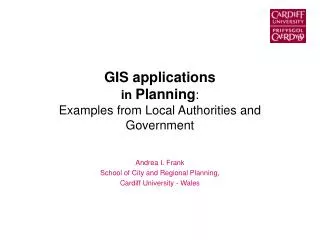
GIS applications in Planning : Examples from Local Authorities and Government. Andrea I. Frank School of City and Regional Planning, Cardiff University - Wales. Definitions. Planning has different flavours Economic, urban, rural, land use planning Spatial, urban and regional planning

E N D
GIS applicationsin Planning:Examples from Local Authorities and Government Andrea I. Frank School of City and Regional Planning, Cardiff University - Wales
Definitions • Planning has different flavours Economic, urban, rural, land use planning • Spatial, urban and regional planning “Critical thinking about space and place as a basis for action or intervention” (RTPI 2003) “…methods used by the public sector to influence the future distribution of activities in space with the aim of creating more rational territorial organisation of land uses and linkages to balance demands…” (EC 1997) • Urban management Day-to-day operation tasks and administration, i.e. construction and street building, parcel and property management, tax collection
Goal: Inform Education in Planning/GIS Early ideas: support & improve rational planning • Driven by research • Webster (1995), Wegener (1998); Masser, et al (1996) • Impact of changes in planning, GIS technology Today: Use of GIS in local & regional government • For what/why use GIS? • Is it used for spatial planning, economic planning, urban management? • How is it used, set up and applications? By whom? Teaching • Building of a GIS • Mastering Software • Basic: introductory analysis, mapping • Advanced: modelling Implications for GIS education ???
Case study 1: Bristol 1. Informing the public ….
2. Visualisation of data Mapping of liveability scores per neighbourhood based on a quality of life survey….. To provide clear, timely and location specific evidence for monitoring and review 3. Emergency planning(GIS is used to access vital information on vulnerable populations and traffic patterns to assist emergency services to operate efficiently) Case Study 1: Bristol Source: http://www.creatingexcellence.org.uk/regeneration-renewal-article191-p1.html
Other Examples • Edinburgh: Integrated City & Area Planning (Datashare) for community planning • Participatory GIS • Work at CASA for design visualisation etc….
Case 3 : Wales • Welsh Spatial Plan • Information and mapping • Schematic level illustrations
Managerial administrative GIS Improve how city operates integrated database Highly accurate locational information, frequent updating Process modeling Access & use from many if not all agency departments Project-oriented GIS Facilitate a project using analysis/mapping functions Database with selected data relevant to project Low to medium spatial accuracy Use by single department Spectrum of GIS setups
Summary • GIS for planning support but to what degree varies • High percentage of GIS use in planning is related to thematic maps (description) and simple analyses (prediction) • Some use for public participation & special projects • GIS benefits for planning are not easily quantified (but if, mostly linked to administrative tasks in cities with a managerial setup for GIS) • GIS growth areas: • Emergency services and planning, e-government • Internet map servers/Public participation/visualisation