Download
1 / 12
120 likes | 272 Vues
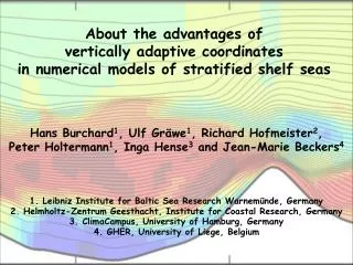
Reduction of numerical mixing by means of vertically adaptive coordinates in ocean models . Hans Burchard 1 , Ulf Gräwe 1 , Richard Hofmeister 2 , Knut Klingbeil 1 , Inga Hense 3 and Jean-Marie Beckers 4 1. Leibniz Institute for Baltic Sea Research Warnemünde , Germany

E N D
Reduction of numerical mixing by means of vertically adaptive coordinates in ocean models Hans Burchard1, Ulf Gräwe1, Richard Hofmeister2, Knut Klingbeil1, Inga Hense3 and Jean-Marie Beckers4 1. Leibniz Institute for Baltic Sea Research Warnemünde, Germany 2. Helmholtz-ZentrumGeesthacht, Institute for Coastal Research, Germany 3. ClimaCampus, University of Hamburg, Germany 4. GHER, University of Liege, Belgium
Whatismixing ? Reynolds-averagedsalinityequationwithdowngradient turbulent transport(nohorizontal turbulent transport): Salinityvarianceequation: ? Mixing isdissipationoftracervariance. Numericalmixing due totraceradvectioncanbecalculated. Burchard andRennau (2008)
2 approachestoquantifynumericalmixing A: Comparesquareofadvectedtracerwithadvectedtracersquare (Burchard & Rennau 2008) B: Reconstructtracertransportsthrough individual layerinterfaces andquantifythemixing (Maqueda Morales & Holloway 2006; Klingbeil et al. in prep.)
„Baltic Slice“ simulation Burchard andRennau (2008)
salinity velocity numericalmixing physicalmixing Burchard andRennau (2008)
Adaptive vertical gridsin GETM Horizontal direction z hor. filteringof layer heights Vertical zooming of layer interfaces towards: a) Stratification b) Shear c) surface/ bottom hor. filteringof vertical position Lagrangiantendency Vertical direction isopycnaltendency Solution of a verticaldiffusionequation forthecoordinateposition bottom Burchard & Beckers (2004); Hofmeister, Burchard & Beckers (2010a)
Example for grid adaptation for wind entrainment experiment Burchard & Beckers (2004);
Baltic slice with adaptive verticalcoordinates Fixed coordinates Adaptive coordinates Numericalmixing Physicalmixing Numericalmixing Physicalmixing Hofmeister, Burchard & Beckers (2010)
Salinitymixinganalysis in Western Baltic Sea (adaptive coordinates) Klingbeil et al. (almostsubmitted)
Grid adaptation in Northern North Sea (additional adaptation to biogeochemistry) Temperature transect [°C] phys & bio adaptive with 50 layers phys & bio adaptive with 30 layers phys adaptive with 30 layers non-adaptive with 30 layers Gräwe et al. (in prep.)
Grid adaptation in Northern North Sea (additional adaptation to biogeochemistry) [mmol N/m3] Nutrient transect phys & bio adaptive with 50 layers phys & bio adaptive with 30 layers phys adaptive with 30 layers non-adaptive with 30 layers Gräwe et al. (in prep.)
Conclusions In stratifiedflowsimulations, thenumericallyinducedmixingmay beofthe same order orevenmuch larger thanthephysicalmixing. Vertical coordinate adaptation leads to optimised model resolution in a way that its additional computational effort is strongly overcompensated by the gain in accuracy. Vertical coordinate adaptation can also be applied to biogeochemical properties or other tracers (in addition to u & T & S). Advantages of vertically adaptive coordinates are substantial for shelf sea simulations, but also large scale simulations should profit from this concept.