Download
1 / 23
240 likes | 420 Vues
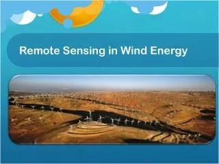
Remote Sensing in Wind Energy. General. Used for wind farms In-flow angle Turbulence Wind speeds and directions Result: Optimal location and design for wind farms Turbines at maximum efficiency. Meteorological Towers. Why Remote Sensing?. Cheaper Low power requirements

E N D
General • Used for wind farms • In-flow angle • Turbulence • Wind speeds and directions • Result: • Optimal location and design for wind farms • Turbines at maximum efficiency
Why Remote Sensing? • Cheaper • Low power requirements • Allows for solar energy • Less maintenance time
SODAR • Measures by reflected self-emitted pulses • Detects • Pitch • Frequency • Sound reflected from turbulence
LiDAR • Records data based on laser reflection • 3D Coherent Doppler LiDAR • Flexible • Different type of measurements • Conical • Vertical Slice • Fixed beam
LiDAR • Can measure wind speeds with much higher accuracy than a MET tower • Linear regression coefficients are as high as 0.99
Work Cited • http://www.ophir.com/overview--atmospheric-remote-sensing/ • http://asprs.org/a/publications/pers/2003journal/june/2003_jun_695-704.pdf • http://en.wikipedia.org/wiki/Precision_agriculture • http://www.asdi.com/applications/remote-sensing/airborne-remote-sensing • http://www.spectir.com/applications/geologic-airborne-hyperspectral/ • http://www.ars.usda.gov/is/AR/archive/mar05/remote0305.htm
How? Why? Climate in the Atmosphere Climate uses both geostationary and polar orbiting satellites Affords us a view that we would otherwise be incapable of reaching without physically being at the given location. Evelyn Myers
“We highlight some important discoveries about the climate system that have not been detected by climate models and conventional observations; for example, the spatial pattern of sea-level rise and the cooling effects of increased stratospheric aerosols”
Some Satellites METSAT India GOES Geostationary USA Evelyn Myers
Evelyn Myers Evelyn Myers Evelyn Myers
Time lapse of climate occurrence Evelyn Myers
http://www.eo-miners.eu/earth_observation/eo_eof_msa_remote_sensing_apps.htmhttp://www.eo-miners.eu/earth_observation/eo_eof_msa_remote_sensing_apps.htm Referances http://www.nersc.no/ http://www.eurac.edu/en/research/institutes/remotesensing/default.html http://0-onlinelibrary.wiley.com.opac.library.csupomona.edu/doi/10.1002/met.288/pdf https://www.google.com/search?q=remote+sensing+and+climate+change&source=lnms&sa=X&ei=8OwUU_vtGcryoASB2IK4CA&ved=0CAgQ_AUoAA&biw=1920&bih=1105&dpr=1 http://www.srh.noaa.gov/jetstream/remote/satellite.htm http://0-onlinelibrary.wiley.com.opac.library.csupomona.edu/doi/10.1002/met.288/pdf http://noaasis.noaa.gov/NOAASIS/ml/genlsatl.html http://www.goes.noaa.gov/ http://www.srh.noaa.gov/jetstream/remote/satellite.htm