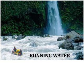
Running Water
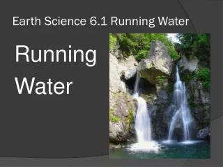
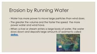
Running Water. Running water is the most important geologic agent in eroding, transporting and depositing sediment Nearly every landscape on Earth shows the results of stream erosion or deposition. Hydrologic Cycle.

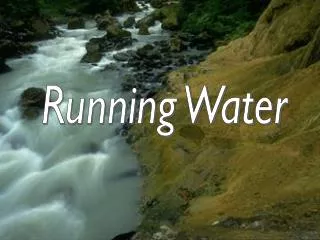
Running Water
E N D
Presentation Transcript
Running Water • Running wateris the most important geologic agent in eroding, transporting and depositing sediment • Nearly every landscape on Earth shows the results of stream erosion or deposition
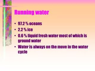
Hydrologic Cycle • Hydrologic cycle- the movement and interchange of water between the sea, air, and land • Evaporation • Solar radiation provides energy • Precipitation • Rain or snow • Transpiration • Evaporation from plants • Runoff • Water flowing over land surface • Infiltration • Water soaking into the ground
Running Water • Stream - a body of running water, confined to a channel, that runs downhill under the influence of gravity • Headwaters - upper part of stream near its source in the mountains • Mouth - place where a stream enters sea, lake or larger stream • Channel - a long, narrow depression eroded by a stream into rock or sediment • Stream banks - sides of channel • Streambed - bottom of the channel • Floodplain - flat valley floor composed of sediment deposited by the stream Insert revised Fig. 10.2
Drainage Basins • Drainage basin- the total area drained by a stream and its tributaries • Tributary - a small stream flowing into • a larger one • Divide- ridge or high ground that divides one drainage basin from another • Continental Divide separates the streams that flow into the Pacific from those that flow into the Atlantic and Gulf of Mexico
Drainage Patterns • Drainage pattern - the arrangement, in map view, of a stream and its tributaries • Most tributaries join the main stream at an acute angle, forming a V or Y pointing downstream • Dendritic - drainage pattern resembling the branches of a tree • Radial pattern - streams diverge outward like the spokes of a wheel • Typically form on conical mountains (volcanoes) • Rectangular pattern - tributaries have frequent 90° bends and join other streams at right angles • Trellis pattern - parallel streams with short tributaries meeting at right angles
Sediment Deposition • Meandering streams flow faster along the outside of bends and more slowly along the inside, depositing point bars on the insides of the meanders • Meander cutoffs may form when a new, shorter channel is cut through the narrow neck of a meander (as during a flood) Insert Fig. 10.20
Deposition of sand bars, formation of cross bedding and Ox-bows (not related)
Stream Erosion • Stream erosion (and deposition) controlled by flow velocityand discharge • Stream velocity controlled by stream gradient (slope), channel shape and channel roughness • Maximum velocity near center of channel • Floods involve increased velocity and discharge (volume of water passing a particular point in a stream over time) • Higher stream velocities promote erosion and transport of coarser sediments • Erosion of very small particles difficult due to molecular binding forces
Stream Erosion • Streamgradient is the downhill slope of the streambed • Typically measured in feet per mile in the U.S., and in meters per kilometer elsewhere • Usually decreases downstream • Channel shape and roughness • Both effect stream velocity due to drag • Narrower, deeper channels allow faster flow • Smoother channels allow faster flow • Wider, shallower channels decrease flow speed • Rougher channels decrease flow speed • Stream discharge is the volume of water flowing past a given point in a unit of time
Stream Erosion • Streams cut their own valleys, deepening and widening them over time and carrying away the sediment • Stream erosion occurs by three mechanisms: hydraulic action, solution, and abrasion • Hydraulic action - ability of flowing water to pick up and move rock and sediment • Solution - dissolving of rocks (e.g., limestone) • Abrasion - grinding away of stream channel by the friction and impact of the sediment load • Potholes are eroded into streambed by the abrasive action of the sediment load in the stream
Sediment Transportation • Sediment load transported by a stream can be subdivided intobed load, suspended load, and dissolved load • Bed load - large or heavy particles that travel on the streambed • Traction load - large particles that travel along the streambed by rolling, sliding or dragging • Saltation load - medium particles (typically sand-sized) that travel downstream by bouncing along - sometimes in contact with the streambed and sometimes suspended in the flowing water • Suspended load - sediment that is small/light enough to remain above the stream bottom by turbulent flow for an indefinite period of time • Dissolved load - dissolved ions produced by chemical weathering of soluble minerals upstream
Sediment Deposition • Sediments are temporarily deposited along stream course as bars and floodplain deposits, and at/near its end as deltas or alluvial fans • Bars - ridges of sediment (usually sand or gravel) deposited in the middle or along the sides of a stream • Braided streams contain sediment deposited as numerous bars around which water flows in highly interconnected rivulets
A Braided River: typical of rivers just disgorging from mountainous areas. A rapid drop in current velocity and too much stuff to carry
Sediment Deposition • Floodplains are broad strips of land built up by sedimentation on either side of a stream channel • Floodplain sediments are left behind as flood waters slow and recede at the end of flood events • Main channel has slightly raised banks with respect to the floodplain known as natural levees
Sediment Deposition • Delta - body of sediment deposited at the mouth of a river when flow velocity decreases • Surface marked by shifting distributary channels • Shape of a delta depends on whether its wave-dominated, tide-dominated, or stream-dominated
Sediment Deposition • Alluvial fan- large, fan- or cone-shaped pile of sediment that forms where stream velocity decreases as it emerges from a narrow mountain canyon onto a flat plain • Well-developed in desert regions, such as the southwestern U.S. • Larger fans show grading from large sediments nearest the mountains to finer sediments farther away
Flooding • When water levels rise and overtop the banks of a river, flooding occurs • Natural process on all rivers • Described by recurrence intervals • A 100-year flood is, on average, the size of the largest flood within a 100-year period of time • Can cause great damage in heavily populated areas • High velocity and large volume of water causes flood erosion • Slowing of waters as flood ends causes flood deposits (usually of silt or clay-sized particles) to be deposited in the floodplain
Flooding • Urban flooding • Paved areas and storm sewers increase runoff by inhibiting infiltration • Rapid delivery of water to streams increases peak discharge and hastens occurrence of flood • Flash floods • Local, sudden floods of large volume and short duration • Typically triggered by heavy thunderstorms
Flooding • Flood control • Dams designed to trap flood waters in reservoirs upstream and release it gradually over time • Artificial levees designed to increase capacity of river channel • Works well until stream overtops artificially raised levees, leading to extremely rapid flooding and erosion • Wise land-use planning, including prevention of building within 100-year floodplains, is most effective
Stream Valley Development • Downcutting • Process of deepening a valley by erosion of the streambed • V-shaped valleystypically form from downcutting combined with mass wasting and sheet erosion • Streams cannot erode below their base level • Basel level can be sea level, a lake, or the bottom of a closed basin (e.g., Death Valley, CA) • Downcutting rate can be rapid if a stream is well above base level (e.g., Grand Canyon, AZ)
Stream Valley Development • Graded streams • Characteristic concave-up longitudinal profile • Rapids and waterfalls have been smoothed out by extensive erosion over a long period of time • Delicate balance between available sediment load and transport capacity • Lateral erosion widens stream valleys by undercutting of stream banks and valley walls as stream swings from side to side across the valley floor • Headward erosion is the slow uphill growth of a valley above its original source by gullying, mass wasting, and sheet erosion
Stream Valley Development • Stream terraces • Step-like landforms found above a stream and its floodplain • Occurs when river rapidly cuts downward into its own floodplain • Represents relatively sudden change in rate of erosion • Can be caused byrapid uplift, drops in base level, changes in underlying lithology orclimate changes
Stream Valley Development • Incised meanders • Retain sinuous pattern as they cut vertically downward • May be produced by profound base level changes, as when rapid tectonic uplift occurs
Stream Valleys on Mars • Evidence of different climate in past • Liquid water not stable on surface of Mars under present conditions • Too cold • Atmospheric pressure too low • Stream channels and terraces suggest long-term erosion by flowing water • Lack of smaller tributaries is puzzling, but these do exist for channels networks in more ancient terrains on Mars • Requires warmer, wetter Mars • NASA missions targeting such locations
Lecture OutlinesPhysical Geology, 11/e Plummer, McGeary & Carlson
Mass Wasting • Mass wastingis downhill movement of masses of bedrock, rock debris or soil, driven by the pull of gravity • Landslides have been far more costly in the U.S., in terms of both lives and dollars, than all other geologic and weather hazards combined • Mass wasting is, with proper planning, perhaps the most easily avoidable of all major geologic hazards
Classification of Mass Wasting • Types of mass wasting are classified based on: • Rate of movement • Wide range from < 1cm/year to >100 km/hour • Type of material • Did moving mass start out as solid bedrock or as debris (unconsolidated material at Earth’s surface) • Type of movement • Flow, slide, or fall
Classification of Mass Wasting • Types of movement • Flow • Descending mass moves downhill as a viscous fluid • Slide • Descending mass remains relatively intact, and descends along well-defined surfaces • Translational slide - movement along plane parallel to motion • Rotational slide (slump) - movement along a curved surface • Fall • Material free-falls or bounces down a cliff
Factors Controlling Mass Wasting • Factors making mass wasting likely: • Steep slopes • Shear forces maximized by gravity • Large relief • (large elevation change from top of • mountains/hills to valley floor) • Thick layer(s) of loose rock, • debris, soil • Presence of water • Lubricates moving rocks/debris/soil • Lack of vegetation • No roots to hold rock/soil in place • Seismic (earthquake) activity
Common Types of Mass Wasting • Creep (or soil creep) • Very slow downslope movement of soil • Major contributing factors include water in soil and daily freeze-thaw cycles • Can be costly to maintain homes, etc., on creeping ground as foundations, walls, pipes and driveways crack and shift downslope over time
Common Types of Mass Wasting • Debris flow - mass wasting in which motion takes place throughout the moving mass (flow) • Earthflow - debris moves downslope, slowly or rapidly, as a viscous fluid • Commonly occurs on steep hills, with thick debris cover, after heavy rains • Solifluction is an example • Mudflow - flowing mixture of debris and water, usually down a channel • Most likely to occur on steep unvegetated slopes with thick debris cover • Heavy rains on the slopes of stratocone volcanoes with fresh ash layers often triggers • Debris avalanches are very rapid and turbulent • Can reach speeds of several hundred km/hr
Types of Mass Wasting • Rockfall - when a block of bedrock breaks free and falls or bounces down a cliff • Commonly an apron of fallen rock fragments (talus) accumulates at cliff base • Rockslide - the rapid sliding of a mass of bedrock along an inclined surface of weakness • Rock avalanche - a very rapidly moving, turbulent mass of broken-up bedrock • Debris slide - a coherent mass of debris moving along a well-defined surface • Debris fall - a free-falling mass of debris
Preventing Landslides • Preventing mass wasting of debris • Construct retaining wall with drains • Don’t oversteepen slopes during construction • Preventing rockfalls and rockslides on highways • Remove all rock that is prone to sliding • “Stitch” together outcrop • Important to know the susceptibility of land to mass wasting before building any road or structure!