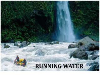
RUNNING WATER
RUNNING WATER. The Hydrologic Cycle. Water is everywhere on Earth – in the oceans, glaciers, rivers, lakes, air, soil, and in living tissue! All of these reservoirs constitute Earth’s hydrosphere . In all, the water content of the hydrosphere is about 326 million cubic miles! .

RUNNING WATER
E N D
Presentation Transcript
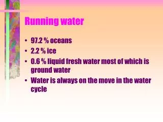
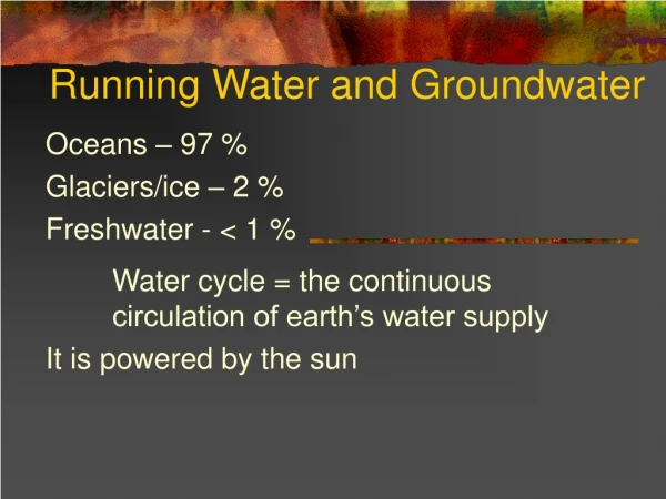
The Hydrologic Cycle Water is everywhere on Earth – in the oceans, glaciers, rivers, lakes, air, soil, and in living tissue! All of these reservoirs constitute Earth’s hydrosphere. In all, the water content of the hydrosphere is about 326 million cubic miles! The vast bulk of it, about 97.2 percent, is stored in oceans. Ice sheets and glaciers account for about 2.15 percent, leaving only 0.65 percent to be divided amount lakes, streams, subsurface water, and the atmosphere.
The Hydrologic Cycle Water does not remain in one place for long. It can change from one state of matter (solid, liquid, or gas) to another at the temperatures and pressures that occur at Earth’s surface. Therefore, water is constantly moving among the hydrosphere, the atmosphere, the geosphere, and the biosphere. This unending circulation of Earth’s water supply is called the hydrologic cycle. The hydrologic cycle is a gigantic worldwide system powered by energy from the sun in which the atmosphere provides the vital link between the oceans and continents. Water evaporates into the atmosphere from the ocean and to a much lesser extent from the continents. Winds transport this moisture-laden air often great distances until conditions cause the moisture to condense into clouds and precipitation to fall. The precipitation falls into the ocean, completing the cycle and beginning another.
Earth’s Water Balance What happens to precipitation once it has fallen on land? A portion of the water soaks into the ground (called infiltration), slowly moving downward, then laterally, finally seeping into lakes, streams, or directly into the ocean. When the rate of rainfall exceeds Earth’s ability to absorb it, the surplus water flows over the surface into lakes and streams, a process called runoff. Much of the water that infiltrates or runs off eventually returns to the atmosphere because of evaporation from the soil, lakes, and streams. Also, some of the water that infiltrates the ground surface is absorbed by plants, which then release it into the atmosphere. This process is called transpiration. Because we can’t be for sure the exact evaporation and transpiration rates, the term evapotranspiration is often used for the combined effect.
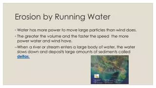
Earth’s Water Balance Over the continents, precipitation exceeds evaporation. Over the oceans, evaporation exceeds precipitation. This keeps the water cycle in balance. All the water that runs off from the land to the ocean causes enormous erosion. This immense volume of moving water is the single most important agent sculpturing Earth’s land surface.
Running Water Although we have always depended on running water, its source eluded us for centuries. Not until the 1500s did we realize that streams were supplied by surface runoff and the migration of underground water. Runoff initially flows in broad, thin sheets across the ground, appropriately termed sheet flow. The water that runs off in sheets instead of sinking into the ground depends upon the infiltration capacity of the soil. Infiltration capacity is controlled by many factors, including (1) the intensity and duration of rainfall; (2) the prior wetted condition of the soil; (3) the soil texture; (4) the slope of the land; and (5) the nature of the vegetative cover.
Running Water When soil becomes saturated, sheet flow begins as a layer only a few millimeters thick. After flowing as a thin, unconfined sheet for only a short distance, threads of current typically develop and tiny channels called rills begin to form and carry the water to a stream. At first the streams are small, but as one intersects another, larger and larger ones form. Eventually rivers develop that carry water from a broad region to the ocean. The land area that contributes water to a river system is called a drainage basin. The drainage basin of one stream is separated fro the drainage basin of another by an imaginary line called a divide. Divides range in scale from a ridge separating two small gullies on a hillside to a continental divide which splits whole continents into enormous drainage basins.
The drainage basin of the Yellowstone River is one of the many that contribute water to the Missouri River which, in turn, is one of the many that make up the drainage basin of the Mississippi River (the largest drainage basin in North America). Extending between the Rockies in the West and the Appalachians in the East, the Mississippi and its tributaries collect water from more than 1.2 million square miles of the continent.
River Systems Rivers and streams can be simply defined as water flowing in a channel. They have three important roles in the formation of a landscape: They erode the channels in which they flow, they transport sediments provided by weathering and slope processes, and they produce a wide variety of erosional and depositional landforms. Water may flow in one of two ways, either as laminar flow or turbulent flow. The velocity of water in a stream depends on (1) gradient; (2) shape, size, and roughness of a channel; and (3) discharge.
Gradient and Channel Characteristics The slope of a stream channel expressed as the vertical drop of a stream over a specified distance is gradient. The steeper the gradient, the more energy available for streamflow. In addition, the shape, size, and roughness of a channel will affect the amount of friction the water encounters as it travels.
Stream Discharge The discharge of a stream is the volume of water flowing past a certain point in a given amount of time. The discharges of most rivers are far from constant. This is because of variables like rainfall and snowmelt. Streams that exhibit flow only during “wet” periods and referred to as intermittent streams. In arid climates streams that carry water only occasionally are called ephemeral streams.
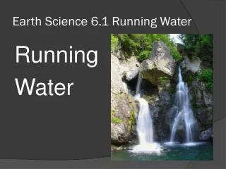
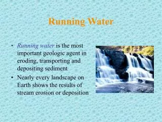
The Work of Running Water Streams are Earth’s most important erosional agent. In addition to sculpting the landscape, streams also have the ability to transport enormous quantities of sediment, which travels downstream and creates a variety of depositional features. Erosion can occur in many ways, through sheet flow, increased water volume, and even by the size of sand and gravel particles carried the stream. These potholes (right) were created in the bed of a small stream in Cataract Falls State Park, Indiana.
The Work of Running Water All streams regardless of size transport some rock material. Streams are also able to sort the solid sediment they transport because the finer, lighter material is carried more rapidly than coarser, heavier rock debris. Depending on the nature of the rock material, the stream load consists of material (1) in solution (dissolved load); (2) in suspension (suspended load); and (3) sliding or rolling along the bottom of the stream (bed load). Streams vary in their ability to carry a load. Their ability is determined by two criteria: The competence, or maximum size of particles the stream is capable of handling (this depends a lot on velocity); and the capacity, or the maximum load it can carry (depends upon discharge rates – the greater the volume of water in a stream, the more sediment it can carry).
Stream Channels A basic characteristic of streamflow that distinguishes itself from sheet flow is that it is usually confined to a channel. A stream channel can be thought of as an open conduit that consists of the streambed and banks that confine the flow (except during floods). Many stream channels are composed of loosely consolidated sediment (called alluvium) and therefore can undergo major changes in shape because the sediments are continually being eroded, transported, and redeposited. Two main types of alluvial channels are meandering channels and braided channels. Over time, meandering streams may also form an oxbow lake.
When a stream meanders, its zone of maximum speed shifts toward the outer bank. A point bar is deposited where the water on the inside of a meander slows. Because the outside of a meander is a zone of active erosion, it is often referred to as the cut bank.
Sometimes the downstream migration of a meander is slowed when it reaches a more resistant material. This allows the next meander to “catch up” and overtake it, creating a shorter channel called a cutoff, and eventually an oxbow lake.
Meandering Versus Braided Streams Some streams consist of a complex network on converging and diverging channels that thread their way among numerous islands or gravel bars. Because the channels have an interwoven appearance, these streams are said to be braided. While meandering streams carry suspended loads in solution, braided streams generally carry loads of fine- and coarse-grained particles.
Streams, with the aid of weathering and mass wasting, shape the landscape through which they flow. As a result, streams continuously modify the valleys that they occupy. A stream valley consists not only of the channel but also the surrounding terrain that directly contributes water to the stream. Stream valleys can be divided into two types: Narrow V-shaped valleys and wide valleys with flat floors.
Depositional Landforms Whenever a stream’s velocity slows, it begins to deposit some of the sediment it is carrying. In addition to sand and gravel bars, streams also create other features, including deltas, natural leeves, and alluvial fans. When a stream enters the relatively still waters of an ocean or lake, its velocity drops abruptly, and the resulting deposits form a delta. As the delta grows outward, the stream’s gradient lessens, which chokes the channel with sediment. As the water tries to find another route, it divides the main channel into smaller ones, called distributaries. After numerous shifts of the channel, a delta may grow into a rough triangular shape like the Greek letter delta (Δ), for which it is named. Many large rivers have deltas extending thousands of miles. The delta of the Mississippi River is one example.
During the past 5,000 years, the Mississippi River has built a series of seven coalescing subdeltas. The numbers indicate the order they were deposited.
Natural Levees Some rivers occupy valleys with broad floodplains and build natural levees that parallel their channels on both banks. When a stream overflows its banks, its velocity immediately diminishes, leaving coarse sediment deposited in strips boarding the channel.
Drainage Patterns Drainage systems are networks of streams that together form distinctive patterns. The nature of a drainage pattern can vary greatly from one type of terrain to another, primarily in response to the kinds of rock on which the streams developed. The most commonly encountered drainage pattern is the dendritic pattern. This word means “treelike,” which matches its shape. If streams diverge from a central area like spokes on a wheel, the pattern is said to be radial. This often develops on volcanic cones. Sometimes, if certain types of rock are harder than others, a rectangular pattern is created. When tributary streams are nearly parallel to each other and have the appearance of a garden trellis, a trellis drainage pattern is developed. This is also due to differential weathering of rock types.
Floods Floods are the result of the accumulation of too much water in too little time in a specific area. Regional floods occur seasonally when winter or spring rains coupled with melting snow fill river basins with too much water too quickly. The ground may be frozen, reducing infiltration into the soil and thereby increasing runoff. Regional floods are many times associated with slow-moving, low-pressure or frontal storm systems including decaying hurricanes or tropical storms. Flash floods can occur within several seconds to several hours, with little warning. Flash floods can be deadly because they produce rapid rises in water levels and have devastating flow velocities. Several factors can contribute to flash flooding. Among these are rainfall intensity, rainfall duration, surface conditions, and topography and slope of the receiving basin.