BOLIVIA
BOLIVIA. Presented by Betsy Mosteller & Shelley Stevens. A visual tour of Bolivia…. http://www.youtube.com/watch?v=ufwHS9clcoc. Location. Central South America, Southwest of Brazil Coordinates: 17°S 65°W Border Countries: Brazil, Peru, Chile, Paraguay, Argentina

BOLIVIA
E N D
Presentation Transcript
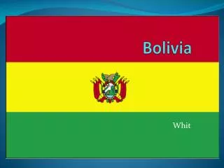
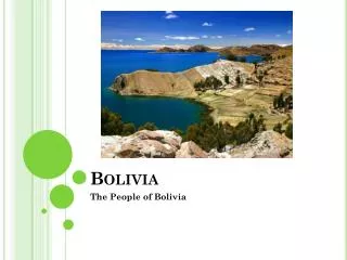
BOLIVIA Presented by Betsy Mosteller & Shelley Stevens
A visual tour of Bolivia… http://www.youtube.com/watch?v=ufwHS9clcoc
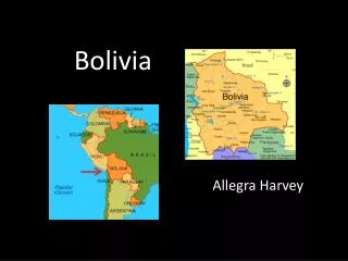
Location • Central South America, Southwest of Brazil • Coordinates: 17°S 65°W • Border Countries: Brazil, Peru, Chile, Paraguay, Argentina • Bolivia is a landlocked country. Does anyone know what this means???
Geography • Total area = • Land area = • Water area = • The terrain of Bolivia is made up of • The climate of Bolivia is
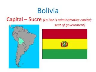
Government • Bolivia has 2 capitals: Sucre and La Paz • Bolivia has a government. This means • To vote in Bolivia, a citizen must be at least 18 years old. How does this compare to the United States?
Bolivia’s History • Bolivia gained her independence from Spain in 1825.
The Bolivian People • Population = • Age structure • Ethnic groups • Religions • Languages
Statistics about Bolivia • Birth rate = • Death rate = • Infant mortality rate = • Fertility rate = • Life expectancy = • Literacy rate =
Bolivian Money • The official currency of Bolivia is the “Boliviano” • The current exchange rate for Bolivia is approximately 8 Bolivianos (B’s) = 1 USD • The poverty rate in Bolivia is
Land Use • % of the land in Bolivia is arable. What does arable mean? • % of the arable land is used for permanent crops. • Current environmental issues include:
Environmental International Agreements • Bolivia has made agreements with other countries and agencies worldwide to promote a better environment. These agencies include:
Transportation • Bolivia has airports. Only of these airports have paved runways. • Railways = • There are km of roadways in Bolivia. However, only km of these roadways are actually paved. Many of the roads are dirt, gravel, cobblestone, etc.
Geographic Regions of Bolivia • Like North Carolina, Bolivia can be divided into three geographical regions, determined by terrain and climate. • What are NC’s three regions? • Bolivia’s three regions include:
Time to show your knowledge… Now that you have learned some important information about Bolivia, it is time for you to show others your knowledge. Your mission is to, with a partner, create a travel brochure for Bolivia. Include geography and climate information, as well as cultural information. Use the handout, the presentation, and the video to assist you in your task. Remember, you want to convince people that Bolivia is a place worth visiting. Good luck!!!