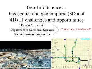
Geospatial and Geotemporal Informatics
Geospatial and Geotemporal Informatics. Monika Sester Institute of Cartography and Geoinformatics Leibniz Universität Hannover. What is solved ?. Topological data structures LBS: “Where is next restaurant ?” Industry has taken over Earth Viewers Industry has taken over .

Geospatial and Geotemporal Informatics
E N D
Presentation Transcript
Geospatial and Geotemporal Informatics Monika Sester Institute of Cartography and Geoinformatics Leibniz Universität Hannover
What is solved ? • Topological data structures • LBS: “Where is next restaurant ?” • Industry has taken over • Earth Viewers • Industry has taken over
What has failed ? • Quality / uncertainty handling: • Beyond Epsilon-band ?? • No solutions for • Mix of nominal and geometric quality measures • Propagation of quality in analysis processes • Communication / visualization of quality parameters • Surprisingly (yet) low success: • Use of AI-techniques • E.g. ML for knowledge acquisition
What is missing ? • Geosensor networks: • Where are the real applications ? • Methods for structure recognition in spatial data sets • Detect higher level structures in geodata • Use of techniques from image analysis, e.g. • Implicit shape models • Symmetry detection • Structural learning
What is next ? Hot Topics • Semantics • Temporal data – moving objects • Spatial data interpretation / data mining • Fusion of geodata, especially image and vector, but also data from different ontologies • Multiscale issues • Ubiquitous computing • Neo-Geography • Geosensor networks • Applications: • Traffic • epidemiology
Hot Topics • Geosensor networks • User-generated geospatial content • New representations: • integrate low and high level data (e.g. raw image data and interpreted GIS-data) • On-the-fly interpretation and integration facilities • Quality management • Storage concepts, aggregation concepts