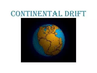
CONTINENTAL DRIFT
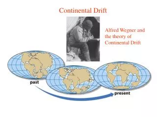
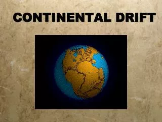
CONTINENTAL DRIFT. http://www.tectonics.caltech.edu/movies/outreach/sumatra/pangaea.mov. Alfred L. Wegener. Geologist Alfred Wegener noticed similar rocks & fossil remains were found on continents which seemed to fit together He called this “ super ” continent called Pangaea

CONTINENTAL DRIFT
E N D
Presentation Transcript
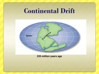
CONTINENTAL DRIFT http://www.tectonics.caltech.edu/movies/outreach/sumatra/pangaea.mov
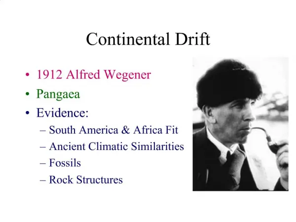
Alfred L. Wegener • Geologist Alfred Wegener noticed similar rocks & fossil remains were found on continents which seemed to fit together • He called this “super” continent called Pangaea • In 1912 Wegener published the first version & died defending his theory
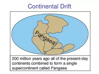
PANGAEA the large landmass that included all of Earth’s present day continents
Support for Continental Drift 1. SHAPE of the continents Continents fit together like puzzle pieces
Support for Continental Drift 1. SHAPE of the continents • Wegener was not the only one to notice the fit of the continents. • 1858: Antonio Pelligrini depicted Africa and South America connected. • He was one of the first scientists to publish maps depicting the apparent fit of the continents.
Support for Continental Drift 2. FOSSIL EVIDENCE SAME FOSSILS: DIFFERENT CONTINENTS Mesosaurus was incapable of swimming across a large ocean.
Support for Continental Drift 3. ROCK EVIDENCE – Mountain ranges • SAME ROCK: DIFFERENT RANGE Existing mountain ranges separated by vast oceans contain rocks of identical mineral content. • A prime example are the Appalachian Mountains in the eastern U.S and the Caledonian Mountains in the British Isles.
SAME SCARS: DIFFERENT CONTINENTS Support for Continental Drift 4. GLACIAL SCARS
5. LOCATION OF Coal Deposits Support for Continental Drift Coal deposits have been found in temperate and polar regions; however, coal is formed in tropical regions.
CONTINENTAL DRIFT IN DOUBT Why didn’t people believe in continental drift? • People couldn’t image how the earth could be millions of years old • People couldn’t image a force great enough to move the continents BUT by the 1960’s evidence would prove continental drift is TRUE and…. The story continues (as does all good science!)
Sea Floor Spreading • American geophysicist Harry Hess helped develop the theory of plate tectonics. • While a Navy officer, Hess helped map the ocean floor.
Undersea mountains discovered • Naval maps showed undersea mountain chains that formed a continuous chain down the centers of the ocean floors. • Hess wondered if new ocean floor was created at these mid-ocean ridges.
The Hypothesis • Hess called his hypothesis sea-floor spreading. • The key was the discovery that there are “magnetic patterns” in the rocks on either side of the mid-ocean ridges. • Matching magnetic patterns and the age of rocks on either side of mid-ocean ridges provided strong evidence for sea-floor spreading.
Magnetic Evidence for Sea Floor Spreading • http://www.youtube.com/watch?v=BCzCmldiaWQ
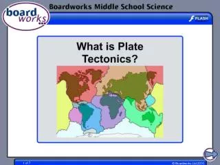
What Exactly is Moving? • Scientists realized that large pieces of Earth’s surface moved about like rafts on a river. • These “rafts” are pieces of lithosphere called lithospheric plates. • Plate tectonics is the study of these lithospheric plates.
The Lithosphere • There are two kinds of lithospheric plates: oceanic platesand continental plates.
What Causes the Motion? • Convection cells in Earth’s lower mantle drive the lithospheric plates on the surface. • Heated lower mantle material rises toward Earth’s surface.
Different Types of Boundaries http://pubs.usgs.gov/gip/dynamic/understanding.html
How Plates Move http://pubs.usgs.gov/gip/dynamic/unanswered.html
LAYERS OF THE EARTH • Crust (brown/tan) • Mantle (light & dark orange) • Core (yellow & white)
LAYERS OF THE EARTH Lithosphere{ Crust and upper mantle make up the LITHOSPHERE • rigid plates (OCEANIC & CONTINENTAL plates) • low temperature & pressure Beneath the lithosphere is the ASTHENOSPHERE • plastic” mantle (flows, moves the plates) • higher temperature & pressure
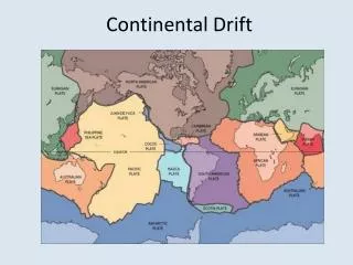
PLATE TECTONICS the surface of the Earth is made of rigid plates • Size and position of plates can change over time • PLATE BOUNDARIES Edges of plates, where two plates “float” side-by-side, is where geologic activity takes place • Plates movement is from convection currents deep in the mantle
EARTH’S MAJOR PLATES: Pacific, N. American, S. American, African, Eurasian, Indian, Antarctic
PLATE BOUNDARIES • Divergent boundaries plates move apart • Convergent boundaries plates move together • Transform boundariesplates slide past
DIVERGENT BOUNDARIESMake new crust When two plates move apart and magma surfaces forming NEW crust (usually oceanic) • continental rift zones (landmass splits into two or more segments) • mid-ocean ridges (sea-floor is elevated)
DIVERGENT BOUNDARIESMake new crust Rift valley continent-continent
DIVERGENT BOUNDARIESMake new crust: Sea Floor Spreading • Youngest rocks form at ridge • Older rocks are further from ridge • Oldest rocks are located at subduction zones
DIVERGENT BOUNDARIESMake new crust: Sea Floor Spreading Every ~20,000 years the polarity of the Earth changes. This is change is reflected in the rocks, whose polarity is fixed once the magma is cooled. • As magma rises and cools, iron and magnesium minerals align themselves to the Earth’s magnetic field • “Magnetic Stripes” are formed • The Earth’s magnetic field reverses polarity • Magnetic stripes are mirrored on each side of the mid-ocean ridge
Divergent Boundary – Iceland http://pubs.usgs.gov/gip/dynamic/understanding.html
Divergent Boundary – Arabian and African Plates Arabian Plate Red Sea African Plate
CONVERGENT BOUNDARIESplates colliding • Destroys old crust and forms new mountains • Three types of convergent boundaries
CONVERGENT BOUNDARIESplates colliding Continent-continent convergence: Folded mountains Ex HimalayasEurasian/Indian plates
Convergent Boundary – Indian and Eurasian Plates Eurasian Plate Indian Plate
Cooling makes the nearby material denser and it sinks deeper into the lower mantle. • This sinking process is called subduction.
CONVERGENT BOUNDARIESplates colliding: Subduction Zones • Subduction Zones: where ocean plates slide under another plate • Creates magma which moves upward, pushing up the land above it. • Magma/lava solidifies into intrusive/extrusive igneous rock • Heat from the magma can change the rock around it. Rock that recrystallizes without melting becomes metamorphic rock.. Denser oceanic plates always subduct beneath less dense continental plates
CONVERGENT BOUNDARIESplates colliding Ocean-continent convergence: Trench & Coastal Volcanoes Andes MountainsNazca & S.American plates
CONVERGENT BOUNDARIESplates colliding Ocean-ocean convergence: Trench & Island arc
TRANSFORM BOUNDARIES When two plates slide past each other • no tearing or crushing - no damage occurs to the lithosphere • Faults –San Andreas Fault • Cause most earthquake damage
Transform Boundaries • Additional Names • Strike-slip fault • Lateral fault • Conservative
Summary of Plate Movements Convection currents
Hot Spots • A single hot rising plume, called a mantle plume, can cause a volcanic eruption in the plate above it. • If the eruption is strong and lasts long enough, the volcanic eruption may form an island on the plate.
After the island forms, the movement of the plate carries it away from the mantle plume. • Scientists determine the direction and speed of plate movement by measuring these island chains.