Download
1 / 15
150 likes | 287 Vues
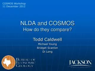
NLDA and COSMOS How do they compare? . Todd Caldwell Michael Young Bridget Scanlon Di Long . Soil Moisture Storage. Soil moisture is a large component of the water balance in Texas (676,000 km 2 ). WY05 +76.7 km 3 +6.2x10 7 ac- ft CY11 Drought -84.6 km 3 -6.8x10 7 ac- ft

E N D
NLDA and COSMOSHow do they compare? Todd Caldwell Michael Young Bridget Scanlon Di Long
Soil Moisture Storage Soil moisture is a large component of the water balance in Texas (676,000 km2) • WY05 • +76.7 km3 • +6.2x10⁷ ac-ft • CY11 Drought • -84.6 km3 • -6.8x10⁷ ac-ft • ±11 cm of water over TX
Soil Moisture Modeling Soil moisture is enigmatic at large scales • Hard to quantify at basin+ scale • We need a means to estimate and predict • The simplification and numerical representation of our world in 1-D columns • North American Land Data Assimilation System (NLDAS) by NASA • A quality-controlled, and spatially and temporally consistent, land-surface multi-model (LSM) output from 1979 to present Loukili et at., doi:10.2136/vzj2007.00810
Soil Representation in NLDAS CONUS-SOIL NLDAS ⅛° grid (~14 km) %Class over each grid Noah, Mosaic, VIC Uniform soil texture from top 5cm layer • STATSGO (1:250,000) • 1 km grid • Dominant soil series • 16 textural classes • 12 are actually soil • 11 layers to 2m depth Mitchel et al., 2004, JGR, D07S90, doi:10.1029 /2003JD003823. Miller and White, 1998, Earth Interactions, Paper 2-002.
Soil Parameterization in NLDAS Mosaic and Noah • Soil hydraulic properties for 12 soil classes • Mosaic PTF (Rawls et al., 1982) • Noah PTF (Crosby et al., 1984) • Flux between layers quasi-Richards’ equation • Uniform soil with depth • Textural class at 5cm extracted for whole soil column
NLDAS-2 Data and Output • GRIB outputs at hourly and monthly values http://disc.sci.gsfc.nasa.gov/hydrology/data-holdings • 52 Fields of parameters • Soil Moisture Storage (4): 0-0.1m, 0.1-0.4m, 0.4-1.0m and 1.0-2.0m Noah Output
Operational Scale of NLDAS-2 4169 nodes in TX 627 nodes in Colorado River Basin NLDAS-2: ⅛° grid (~14 km), 224x464=104k nodes STATE WATERSHED
Operational Scale of NLDAS-2 18 nodes in Travis County COUNTY SSURGO AWC(in) Austin
Current of Soil Moisture and Climate Observatories in the State of Texas • USDA SCAN Sites • 140 nationally • 5 (4%) in Texas, ~9 planned • NOAA USCRN Sites • 144 nationally, 538 planned • 7 (5%) in Texas • NSF COSMOS Sites • 50 nationally, 450 planned • 2 (4%) in Texas • AmeriFlux Sites • 212 nationally • 3 (1%) in Texas, ? Planned • NEON? Freeman Ranch, TX
SCAN Data and NLDAS in Texas • VWC at 0-10 cm ?? Missing storm? Missing data?
SCAN Data and NLDAS in Texas • VWC at 0-10 cm
A snapshot of COSMOS stations • NSF COSMOS Sites • Picked 6 of the oldest, more diverse station • Plus 2 in Texas • Not very scientific at this point • Extracted the daily mean of the Level 3, boxcar filtered hourly data (SM12H) • NLDAS-2 Model Data • Extracted nearest-node • Daily mean 0-10cm Freeman Ranch, TX
So, how do they compare? • Modeler’s viewpoint: • Captures the soil moisture dynamics robustly, good correlation! • There’s a scale issue with the observational data • We need to refine our models and collect more data • Field hydrologist viewpoint: • Absolute values are way off, terrible correlation! • Non-synchronous and erroneous precipitation events • Oversimplified the soil system • We need to collect more data and refine our models • Personal viewpoint: • The models provide more spatiotemporal data then we can monitor • We can use the data to site future key monitoring locations (mean relative differences) • The monitored data shows inadequacies in model structure • We can update and refine the antiquated PTF through parameter optimization • We can develop downscaling algorithms to better assess model performance • We need to collect more data and refine our models • Soil moisture is the “first-in-time, first-in-right”