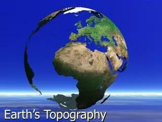
Earth Systems Notes – Oceans Overview (15.1)
540 likes | 788 Vues
Earth Systems Notes – Oceans Overview (15.1). * Oceanography and early data collection - the study of the Earth’s oceans - the Challenger (1872) was the first research ship to use measuring devices to study the ocean floor - oceanographer = scientist that studies oceans.

Earth Systems Notes – Oceans Overview (15.1)
E N D
Presentation Transcript
* Oceanography and early data collection - the study of the Earth’s oceans - the Challenger (1872) was the first research ship to use measuring devices to study the ocean floor - oceanographer = scientist that studies oceans
* Surface and satellite data collection 1. sonar (sound navigation and ranging) - sends a sonar signal to the bottom of the ocean - calculates depth based on the time it takes for the sound wave to hit the bottom of the ocean and return to the surface
To calculate depth: seconds time of echo x 1454 m/s depth = 2 meters
2. side-scan sonar - maps large areas of the ocean floor - sound waves are sent at an angle, which allow topographic elements (hills and mountains) to be mapped
3. floats - used to measure ocean water ~ temperature ~ salinity ~ concentration of dissolved gases ~ current speed
4. satellites - Topex/Poseidon – monitors surface temperatures, currents, and wave conditions
* Subsurface data collection - uses submersibles = underwater devices; are manned or are remotely operated - allows photographs and samples to be collected and brought to surface
- Alvin (1964) ~ the first submersible capable of carrying passengers ~ discovered hydrothermal vents ~ has helped locate and retrieve artifacts (such as bombs and materials from sunken ships, such as Titanic)
* Data analysis - information from satellites and float sensors can be downloaded to computers - information is processed to produce models
* Ocean origins - information from radioactive isotopes and ancient lava flows give evidence about the early existence of water on Earth - early oceans may have originated from: 1. water released from comets and meteorites
2. an intense period of volcanism that may have occurred shortly after the formation of the Earth ~ released large amounts of water vapor, which cooled, condensed, then released precipitation that collected
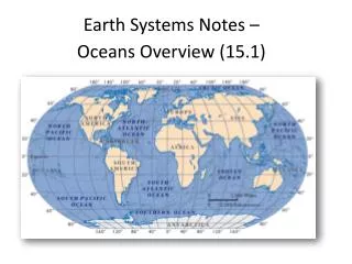
* Distribution of water - 71% of Earth is covered in water = is called the “blue planet” ~ 97% is salt water (found in oceans) ~ remaining 3% = freshwater frozen in ice caps (Greenland and Antarctica), groundwater, rivers, and lakes - average depth of ocean = 3800m (over 2 miles!)
- northern hemisphere = more land masses - southern hemisphere = more ocean
- oceans are one interconnected body (form one global ocean) ~ are divided into certain oceans/seas for geographic and historical purposes
1. Pacific – the largest (15x larger than US); western Americas to Asia
2. Atlantic – 2nd largest; eastern Americas to Africa & Europe
3. Indian – 3rd largest; eastern Africa to Asia & west Australia
* Global sea level - is the level of the oceans’ surfaces - changes due to: 1. additional water during warm periods (melting of glaciers); decreased water during cold periods (expanding of glaciers)
2. rising and sinking of seafloor due to movements in the Earth’s crust (tectonic forces)
*Ocean composition - oceans contain dissolved gases and salts; amounts vary according to depth and location - salinity = the amount of dissolved salt (sodium chloride)in seawater ~ is lower in areas near the equator = due to increased precipitation ~ is lowest at estuaries = large amounts of freshwater empties into the ocean
~ salt sources = volcanic activity and weathering of rocks ~ can be removed from the ocean = 1. by the wind(carried into atmosphere) 2. from absorption by marine organisms (remove the calcium to make shells, bone, and teeth)
* Ocean-atmospheric interactions - oceans help to make life on Earth more habitable; they are a: 1. source of atmospheric oxygen (50% of atmospheric oxygen is produced by phytoplankton)
2. reservoir for carbon dioxide = taken up by phytoplankton and sinks to bottom; reduces amount of CO2 in atmosphere 3. source for heat and moisture = warm air massesrise from them (storms)
*Ocean waves - are energy that is generated by wind moving over the surface of open water (friction between wind and water) ~ waves can occur over open water of any size (lakes, ponds) - are also called wind waves - move faster in deep water than shallow water
- waves cause water to move up and down (does not cause water to flow forward) 15.17 Waves.avi
- parts: 1. crest = highest point on wave 2. trough = lowest point on wave 3. height = the distance between the crest and trough 4. wavelength = distance from the crest of one wave to the crest of another wave ~ as wavelength increases, speed increases 5. wave base = the depth to which the wave disturbs the water ~ is half the wavelength height http://www.forgefx.com/casestudies/prenticehall/ph/waves/waves.htm
- parts: - wave height depends on: 1. fetch = large unobstructed area of water 2. wind duration = how long the wind blows without stopping 3. wind speed ~ as speed increases, wave height increases
~ occurs along shorelines where the water is more shallow(not as deep; friction with ocean bottom slows it) ~ influence the shape of shorelines ~ are created as wave slows in speed and wavelengthdecreases, which causes crests to collapse forward, creating a breaker
* Tides - the periodic rise and fall of sea level (occurs in a 24 hour, dailycycle) ~ is different depending on area’s latitude and topography ~ high tide = the highest regular (daily) water level ~ low tide = the lowest regular (daily) water level
* Tides - are caused by the attraction of the Earth, the Moon, and Sun- spring tides = occur when the Sun, Moon, and Earth are aligned (in a line) ~ produces very strong tides
- neap tides = occur when the Sun, Moon, and Earth form a right angle ~ produces weak tides
* Currents - move ocean water (horizontally or vertically) - distribute heat, salt, and nutrients from one region of the ocean to another
- three types of currents: 1. surface currents – horizontal moving currents produced by wind systems ~ affect the upper portion of the ocean ~ landmasses disrupt current streams, causing gyres – giant circular currents
- five major gyres: • North Pacific • South Pacific • North Atlantic • South Atlantic • Indian Ocean
2. upwellings –upward(vertical) movement of water; are formed in deep waters 3. density currents - deep-ocean currents produced from ocean differences in temperature and salinity
Earth Systems Notes – The Marine Environment (Ch 16)
* The Shore - beach = area in which sediment is deposited along the shore ~ can consist of sand, pebbles, gravel , or cobbles = depends on energy of waves Ireland
* Wave erosion - causes erosion of weaker rocks or rocks at sea level to produce formations such as: 1. sea stack (isolated rock tower) Australia Ireland
2. sea arch 3. sea cave
* Longshore bar - a long bar of sediment (usually sand) that forms parallel to beach
- is created from the buildup of sediment that washes back to the ocean from receding tide waters - are usually located where waves break
- longshore current = movement of water between shoreline and longshore bar http://glencoe.mcgraw-hill.com/sites/0078746361/student_view0/unit4/chapter16/concepts_in_motion.html
- rip tide = current that moves water in longshore current outinto open ocean ~ produced from gaps in longshore bar
* Human impact on coasts - coastal areas (US) = 17% of mainland, but are currently home to over half of our population - increased population has caused a change in our coast 1. pollution 2. shoreline erosion 3. wetland and wildlife-habitat loss
- concrete structures are built to protect homes, buildings, and harbors along the coast 1. seawalls – protect beachfront properties
2. groins – built into water; traps sand 3. jetties – protect harbors
4. breakwaters – to calm waters; allows people to swim and boats to dock safely