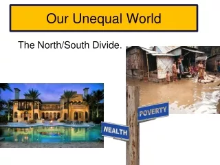
Our World
Our World. Investigating the World Stage 4 Geography . Our World. Recognise continents using different map projections. Use latitude to describe the global pattern of climate including the spatial and seasonal change in insolation Use longitude to explain world time zones.

Our World
E N D
Presentation Transcript
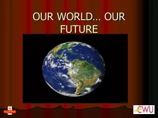
Our World Investigating the World Stage 4 Geography
Our World Recognise continents using different map projections. Use latitude to describe the global pattern of climate including the spatial and seasonal change in insolation Use longitude to explain world time zones. Describe global patterns of physical and human features.
Map Projections • Cartographers are people who make maps. • They have different perspectives on how a world map can be drawn and have invented different ways of showing the curved surface of an almost spherical lump of rock—our planet—on a flat piece of paper. • These different ways of drawing the world are called map projections. • The Earth is a spherical shape, but it bulges at the middle due to the quick rotation around its axis—once every 24 hours it completes a revolution. It is flattened at the Poles and is a rough irregular shape. This makes drawing maps of the world difficult.
Map Projections • Map projections attempt to show correctly: • the shape of continents and oceans • the area or size of continents and oceans • the distance between two points • direction.
How Are Map Projections Made? • Map projections are made by shining a light through part of a transparent globe so that the lines of latitude and longitude and the outlines of continents and oceans make a chart on the screen behind it. • On the drawn map, areas near the centre will be about the right shape, but areas near the Poles will be distorted.
Types of map projections • The main types are constructed in the following ways. • Cylindrical—By projecting the surface of the globe onto a cylinder that just touches the outside edges of the globe • Conical—By projecting the surface of the globe onto a cone that just touches the outside edges • Azimuthal—By projecting the surface of the globe onto a flat surface that just touches the outside edges. Rectangular maps are prone to area and distance stretching, while round ones distort the shape. • Interrupted projections - cut the world map along less important features—like oceans—to show size and shape correctly.
Latitude • Latitude measures how far north or south of the Equator a location is. • The Equator is an imaginary line that runs around the middle of the Earth, separating it into two halves or hemispheres • Latitude and longitude are angles and therefore are measured in degrees (°). The measurement of latitude is between 0 degrees at the Equator and 90 degrees either north (N) or south (S). • The latitude of the South Pole is 90°S and the North Pole is 90°N. • Lines of latitude are called parallels because they never meet each other. They run from east to west on a map.
Latitude Affects Climate • Climate is the usual condition of the atmosphere near the Earth’s surface—the long-term weather of a place. Incoming solar radiation (insolation) is the energy that reaches the Earth from the Sun and it determines our climate. • Insolation is greatest at the Equator because the Sun is directly overhead and the rays hit the Earth’s surface at a direct angle. • Places at the Equator are generally hotter than places near the Poles. At the higher latitudes the rays come in at an angle and the same energy is spread over a larger area.
Other Influences On Climate • Height above sea level—High elevations or altitudes experience colder conditions. • Ocean currents—Warm ocean currents bring wet conditions, while cold currents bring dry conditions. • Being close to the ocean—The ocean heats and cools more slowly than land, causing temperatures to be milder near the sea. • Prevailing or usual wind patterns—Winds that come over water may bring rain, but winds over land may bring dry conditions. • Aspect—North-facing slopes in the Southern Hemisphere will be warmer than south-facing slopes.
The Seasons • The amount of insolation is also affected by the Earth’s orbit around the Sun. • The Earth revolves around the Sun once a year and spins on its axis at a tilt of 23 1⁄2 degrees. As the Earth rotates on its axis and orbits around the Sun different parts of the world receive more or less energy. • This creates the seasons— spring, summer, autumn and winter.
The Seasons • At the Equator there is very little difference between the seasons. The further away from the Equator you are, the greater the difference between the seasons. • Twice a year at the Equator there are equal hours of day and night. At the South Pole there are 24 hours of darkness for six months in winter, and 24 hours of daylight in summer.
Longitude • Lines of longitude run in a north–south direction, or longways, down a map. • They are not parallel to each other so all the lines meet at the North and South Poles. • They are called meridians of longitude. • Longitude measures the distance east or west of the Prime Meridian or 0 degrees. • The Prime Meridian is an imaginary line at 0 degrees that runs from the North Pole to the South Pole passing through Greenwich, a suburb of London. It is also referred to as the Greenwich Meridian. This line separates the Eastern Hemisphere from the Western Hemisphere.
Longitude Affects Time • Day and night occur because the Earth is spinning on an axis. • It takes 24 hours for the Earth to complete one rotation. It makes sense that the Earth is divided into 24 time zones, one for each hour of the day. Some time zones zigzag so that people living in a region can have the same time. • Time changes as you move east or west. Each degree of longitude represents a difference in time of four minutes. • Each time zone of one hour is approximately equal to 15 degrees longitude. If it is 12 noon where you are, 15 degrees to the west it will be 11 a.m. and 15 degrees to the east it will be 1 p.m.
How Does Time Work ? • At the Prime Meridian, Greenwich Mean Time (GMT) is set by the most accurate clock in the world. • All other places in the world set their time according to this clock
Skills Question – Use The World Time Zone Chart To Answer The Following Question • What time is it in Sydney when it is 11 a.m. Monday in London? • What is the time in London when it is 3 p.m. Tuesday in Sydney? • What is the time difference between Sydney and Los Angeles? • Jenny is in Sydney and wants to telephone her sister Anne in Los Angeles at 6 p.m. on Sunday Los Angeles time. What time should she call from Sydney? • Anne wasn’t home when Jenny rang so she left a message. Anne didn’t return Jenny’s call until 8 a.m. Monday, Los Angeles time. At what time did Jenny receive the call in Sydney? • Dave is flying from Sydney to Los Angeles. The flight leaves Sydney at 2 p.m. on Tuesday and takes 14 hours. What is the day and time when the plane arrives in Los Angeles?
Physical Maps - Show Natural Features Of The World Including Continents, Islands, Rivers, Mountains And Elevation, Lakes, Deserts, Oceans, Seas And Sometimes Ocean Currents
Political Maps – The countries are coloured so that they can be distinguished from one another. The continents are not labelled, as the map would become cluttered.