Download
1 / 28
280 likes | 296 Vues
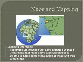
Unlock the world of maps with details on map types, how to read them, and the significance of map elements. Learn about political, physical, topographic, climate, and more types of maps. Understand grid systems for navigation and explore various map scales. Dive into the world of cartography for a deeper appreciation of maps.

E N D
What is a map? • : A representation of the features of an area of the earth • They are a mix of science and art
a) Political Map • It does not show any topographic features. • It instead focuses on the state and national boundaries of a place.
b) Physical Map • One that shows the physical landscape features of a place. • Blue = rivers, lakes • Green = lower elevations • Brown = higher elevations
c) Road maps • Road maps show major—some minor highways—and roads, airports, railroad tracks, cities and other points of interest in an area. • People use road maps to plan trips and for driving directions.
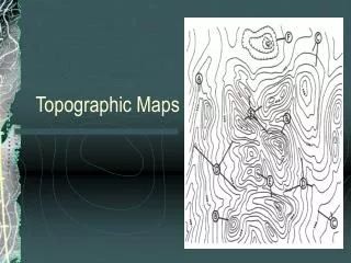
d) Topographic Maps • They include contour lines to show the shape and elevation of an area. • Lines that are close together indicate steep terrain • Lines that are far apart indicate flat terrain
e) Climate map • Climate maps give general information about the climate and precipitation (rain and snow) of a region. • Cartographers, or mapmakers, use colors to show different climate or precipitation zones.
f) Economic or Resource Map • It shows the specific type of economic activity or natural resources in an area through the use of different symbols or colors depending on what is being shown on the map
g) Thematic Maps • They are especially designed to show a particular theme connected with a specific geographic area. https://i.redd.it/wyx2386ibuh01.png
h) Choropleth Map • : A thematic map in which areas are shaded or patterned in proportion to the measurement of the statistic being shown on the map
i) Graduated Circle Map • Another kind of thematic map • A map with symbols that change in size according to the value of the attribute they represent.
j) Dot Map • A dot distribution map (also known as dot density map) is a thematic map type that uses a dot symbol to show the presence of a feature or phenomenon.
k) Flow Map • A type of thematic map used in cartography to show the movement of objects between different areas
How Do We Read Maps? • We can use grid systems to locate places on a map. • The 3 grid systems used today are: 1. Latitude and Longitude 2. Military Grid 3. Alpha-numeric Grid
1) Latitude & Longitude • We will be having an entire lesson on these soon, but for now all you need to know is that they are imaginary lines drawn onto the surface of the Earth that run North-South and East/West • Example of coordinates: 43.6532° N, 79.3832° W
2) Military Grid • The military grid reference system (MGRS) is the coordinate system used by NATO militaries for locating points on the Earth
Why use this military grid system? • It was easier to place a grid system on a map then to use degrees, minutes and seconds from a globe. • With the increasing range in artillery in WWI, latitude and longitude was too cumbersome.
Example: 567893 • 567 – Find the vertical 56 line and then go to the right 7/10 of the space. • 893 – Find the horizontal 89 line and then go up 3/10 of the space. 90 567893 89 88 87 56 57 58 59 60
3) Alphanumeric Maps • a simple coordinate system on a grid in which each box is identified by a combination of a letter and a number • This is mostly used on road maps • Example: A3, K5
Border • Must be around the entire map • All title, legend, & labelling must be within the border
Title • It identifies the main topic of the map
Scale • Small Scale • They show large areas of land on a small space. • 1:50,000,000 • Large Scale • They show small areas of land • 1:5,000 Remember: 1:1 is life size!
Kinds of Scale Three ways to show scale: • Linear or Bar Scale 2) Ratio or Representative Fraction 1:10 000 000 3) Word Scale 1 cm = 250 km