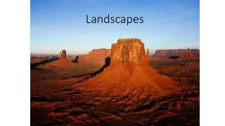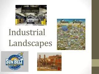
Landscapes
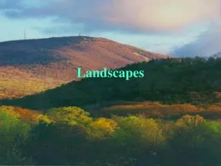
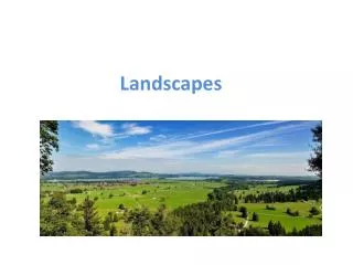
Landscapes. What is a landscape ?. A landscape is part of the Earths surface that can be viewed at one time from one place. let’s identify some landforms. What can you see ?. chain of mountains. mountain peak. lake. clouds. valley. evergreen. river. field. plain. volcano.

Landscapes
E N D
Presentation Transcript
Whatis a landscape? A landscape is part of the Earths surface that can be viewed at one time from one place.
let’sidentify some landforms What can yousee?
chain of mountains mountain peak lake
clouds valley evergreen river field
plain volcano waterfall hills
Bodies of Water ocean river lake stream
a closer look atrivers definition: A river is a natural watercourse, usually freshwater, flowing towards an ocean, a lake, a sea, or another river. In a few cases, a river simply flows into the ground or dries up completely at the end of its course, and does not reach another body of water.
a closer look atrivers The longest rivers in the world are the Nile in Africa and the Amazon in South America A river bank is the "edge" of a river where the land begins. Riversmeander. A river meander is the turns that a river makes when it is flowing Some flow all year round. Others flow seasonally or during wet years.
A brief look atvegetationzones Scientists divide the Earth’s land into what are called vegetation regions or zones. These areas have distinct types of plants, soil(terreno), and weather patterns. Wewill look at the fivemainzones. Whichones do youalreadyknow?
Forests Forests are areas with trees grouped in a way so their leaves, or foliage, shade the ground. Forests can be found just about anywhere trees can grow, from below sea level to high in the mountains. shade = ombra to shade = ombreggiare
Grasslands Grasslands are flat and open areas where grasses are the dominant type of vegetation. Grasslands can be found on every continent except Antarctica. grass = erba
Tundra Tundra is an area where tree growth is difficult because of cold temperatures and short seasons. Vegetation in tundra is limited to a few shrubs, grasses, and mosses shrub = cespuglio moss = muschio
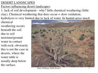
Desert Deserts have almost no precipitation, or rainfall. In fact, deserts are specifically defined as areas with an average annual precipitation of less than 10 inches per year. Desert soil is often sandyor rocky. Plant life is highly specialized to adapt to these coarse, dry conditions. sandy = sabbioso
Icesheet The interesting thing about the ice sheet “vegetation region” is that there really isn’t any vegetation there at all! An ice sheet is a large stretch of glacier ice that covers the land all around it for more than 50,000 square kilometers (20,000 square miles). Currently, the only ice sheets are in Antarctica and Greenland. Don’t confuse the ice sheets, called polar ice caps, with other ice shelves or glaciers; an ice sheet is much, much bigger.
VegetationDistributionWhatis a tree line? The tree line refers to the edge of a habitat at which trees are capable of growing.