Real-Time Satellite Cloud Properties for CALWater-2 Project by NASA LaRC
NASA LaRC is set to develop a comprehensive web page similar to the CALWATER 2011 initiative, providing near-real-time GOES imagery and various retrieved products within 15 to 30 minutes. The site will feature lagged imagery and data products from Aqua, Terra MODIS, SNPP VIIRS, and AVHRR, with overlays of flight tracks for all planes. Key standard cloud parameters will be included, such as cloud masks, optical depth, effective temperature, and additional metrics for multilayer cloud identification and potential icing hazards.

Real-Time Satellite Cloud Properties for CALWater-2 Project by NASA LaRC
E N D
Presentation Transcript
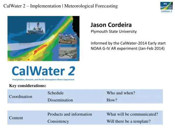
Satellite Cloud Properties for CalWater 2 P. Minnis NASA LaRC
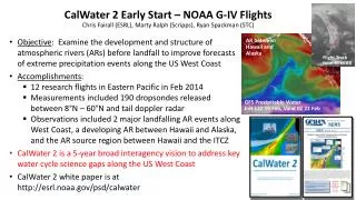
LaRC plans to provide a web page similar to the CALWATER 2011 page shown here • near-real time GOES imagery & retrieved products (15 – 30 min) • lagged imagery & products from Aqua & Terra MODIS, SNPP VIIRS, & AVHRR • flight track overlays & matching for all planes • other? http://cloudsgate2.larc.nasa.gov/cgi-bin/site/showdoc?docid=4&cmd=field-experiment-homepage&exp=calwater
Standard Cloud Parameters Cloud Mask, Phase Optical Depth, IR emissivity Effective Radius/Diameter Liquid/Ice Water Path Cloud Effective Temperature Cloud Top/ Bottom Pressure Cloud Effective Pressure Cloud Effective Height Cloud Top/Base Height Clear-sky, Surface Skin Temperature Overshooting Tops Aircraft Icing Potential
Additional Cloud Parameters MultilayerIdentification Lower layer cloud top *Only for MODIS and SNPP VIRS